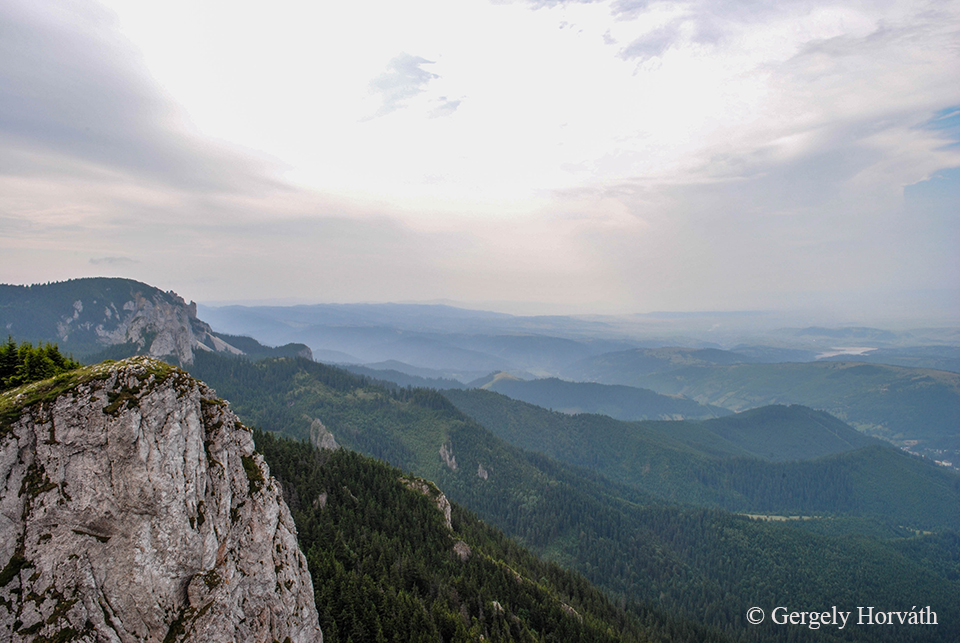
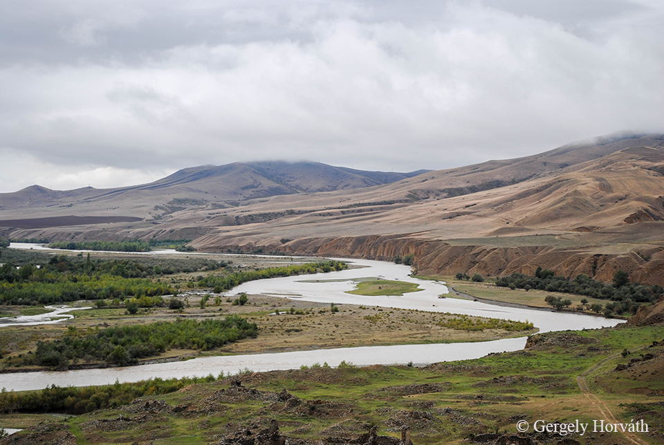
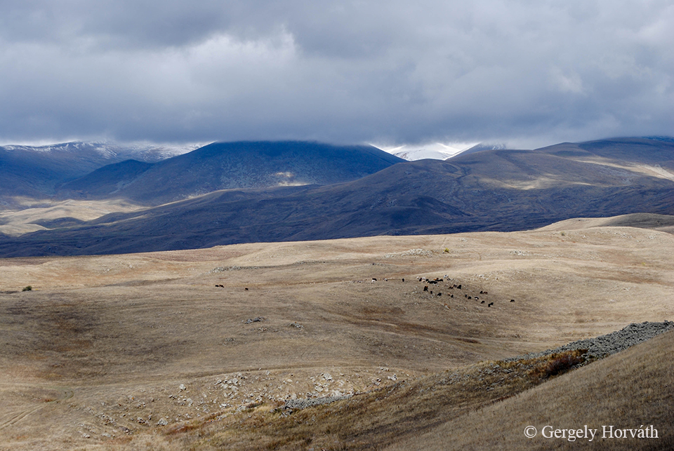
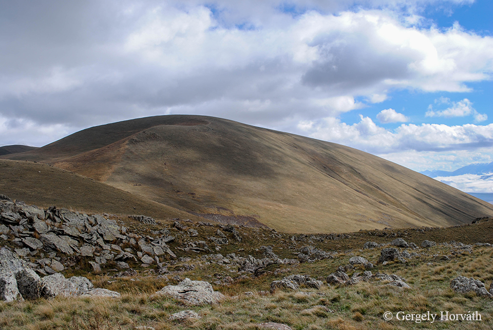
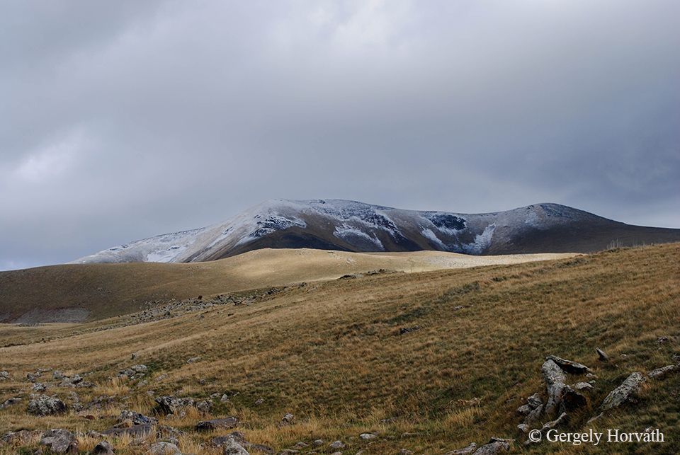
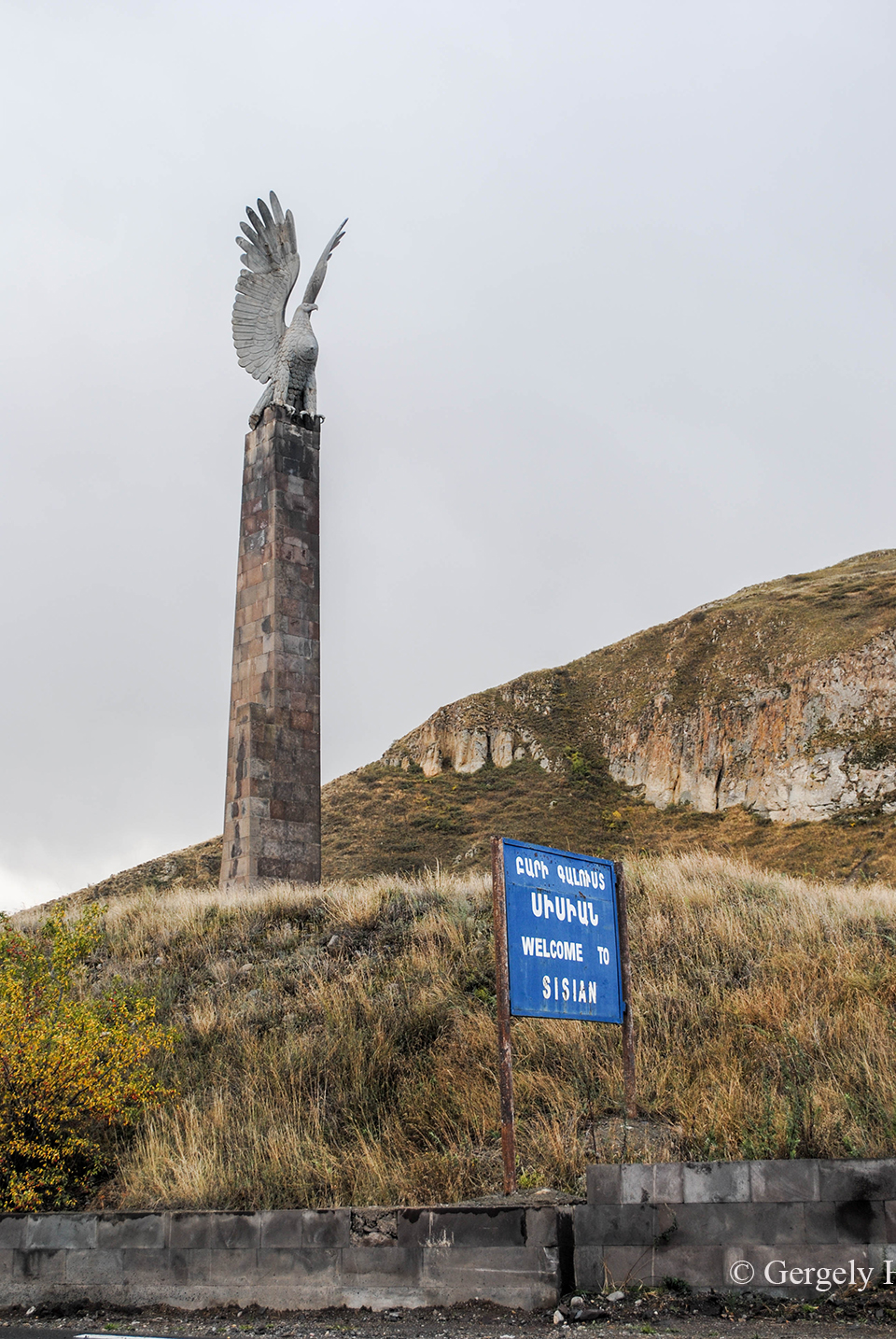
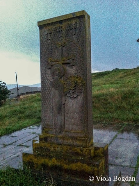
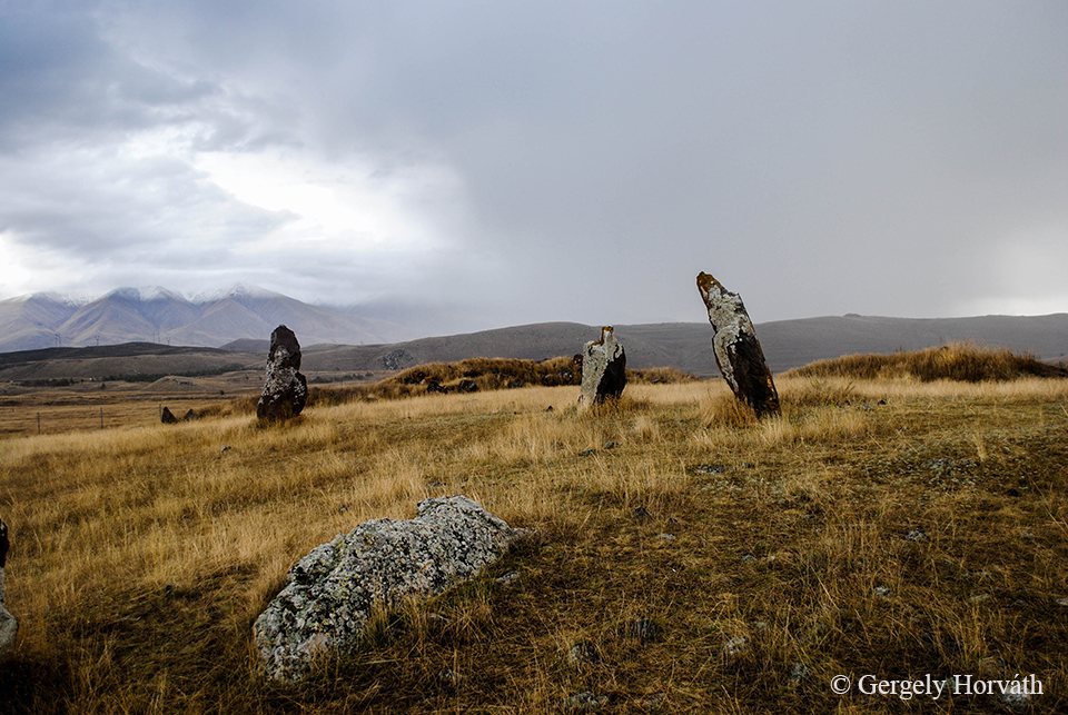
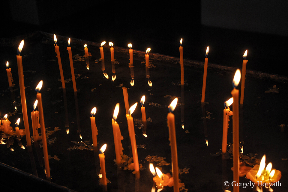
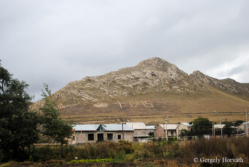
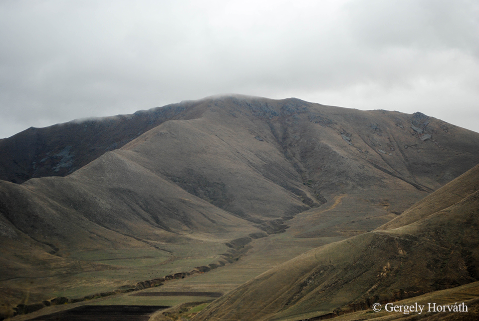
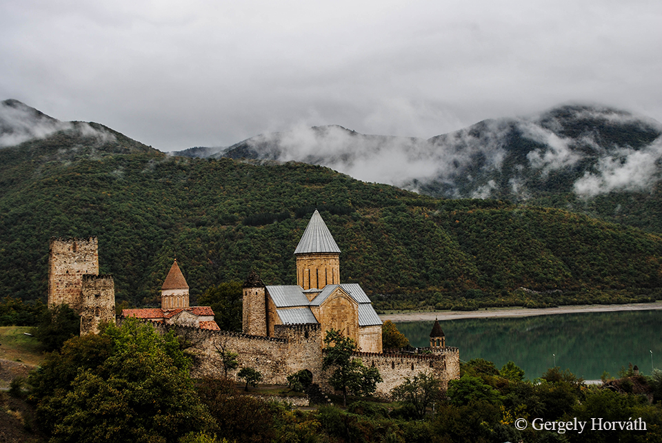
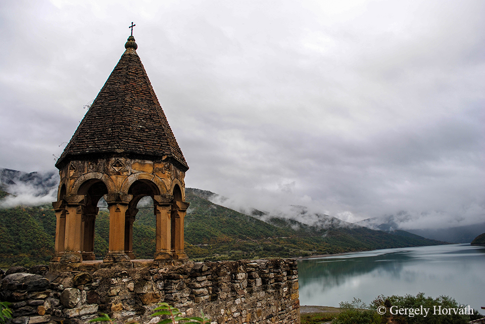
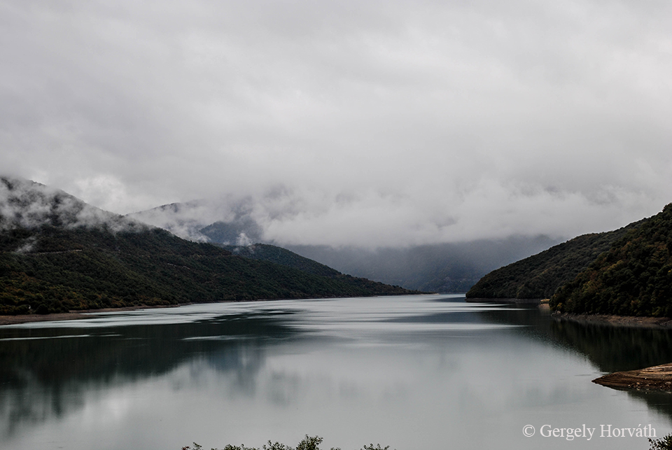
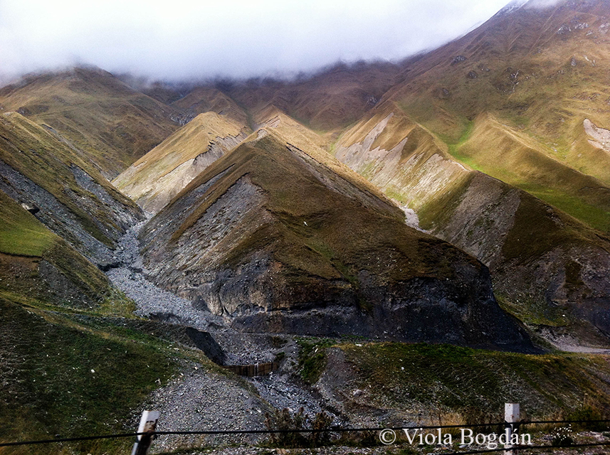
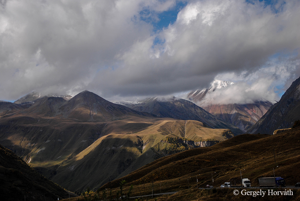
Hagymás-hegység, Keletei-Kárpátok, Hargita megye.
Hăşmaş Mountains, Eastern Carpathians, Harghita county, Romania.
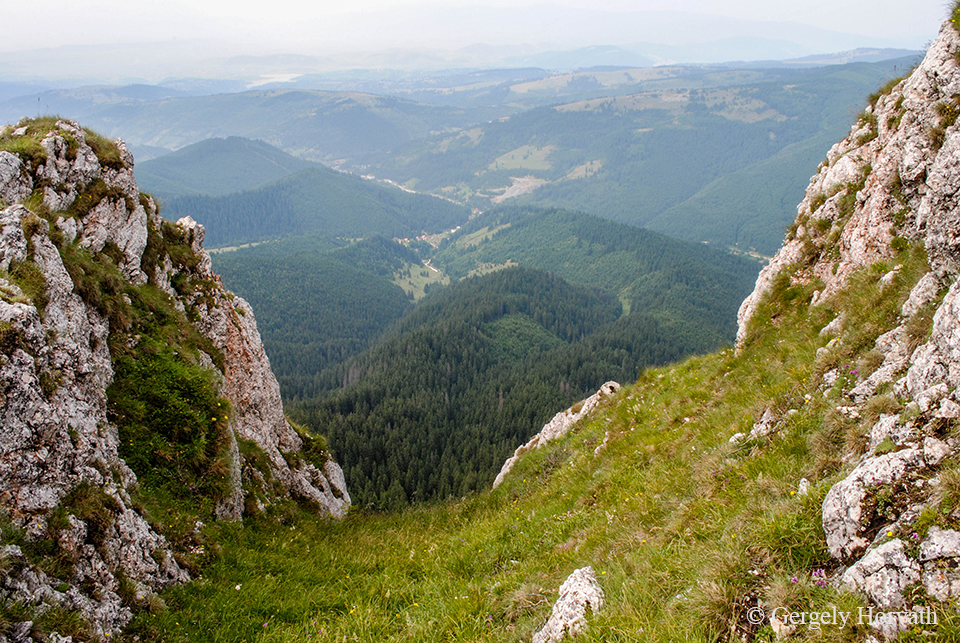
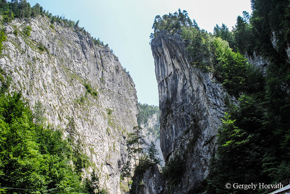
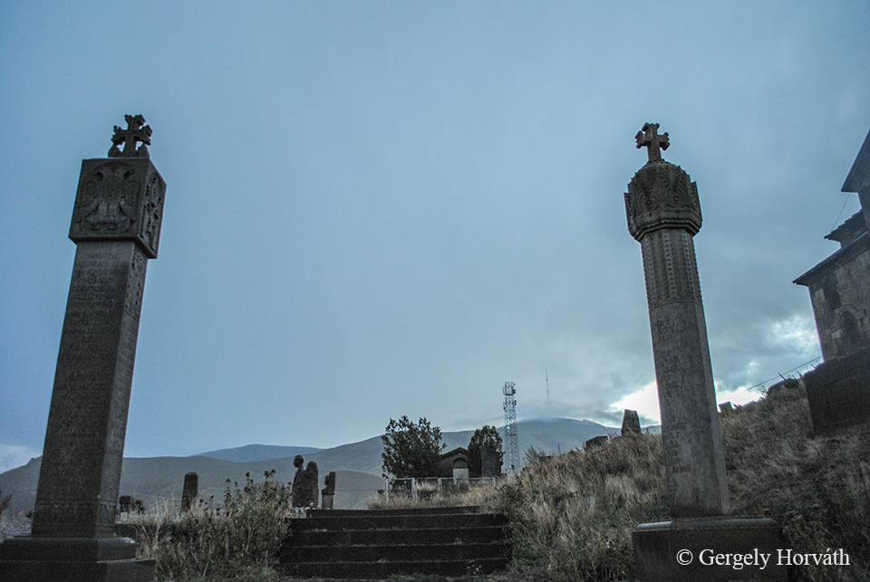
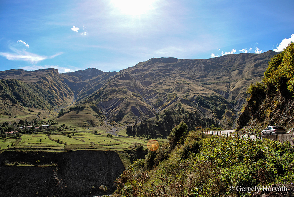
Békás-szoros.
Bicaz Gorge.
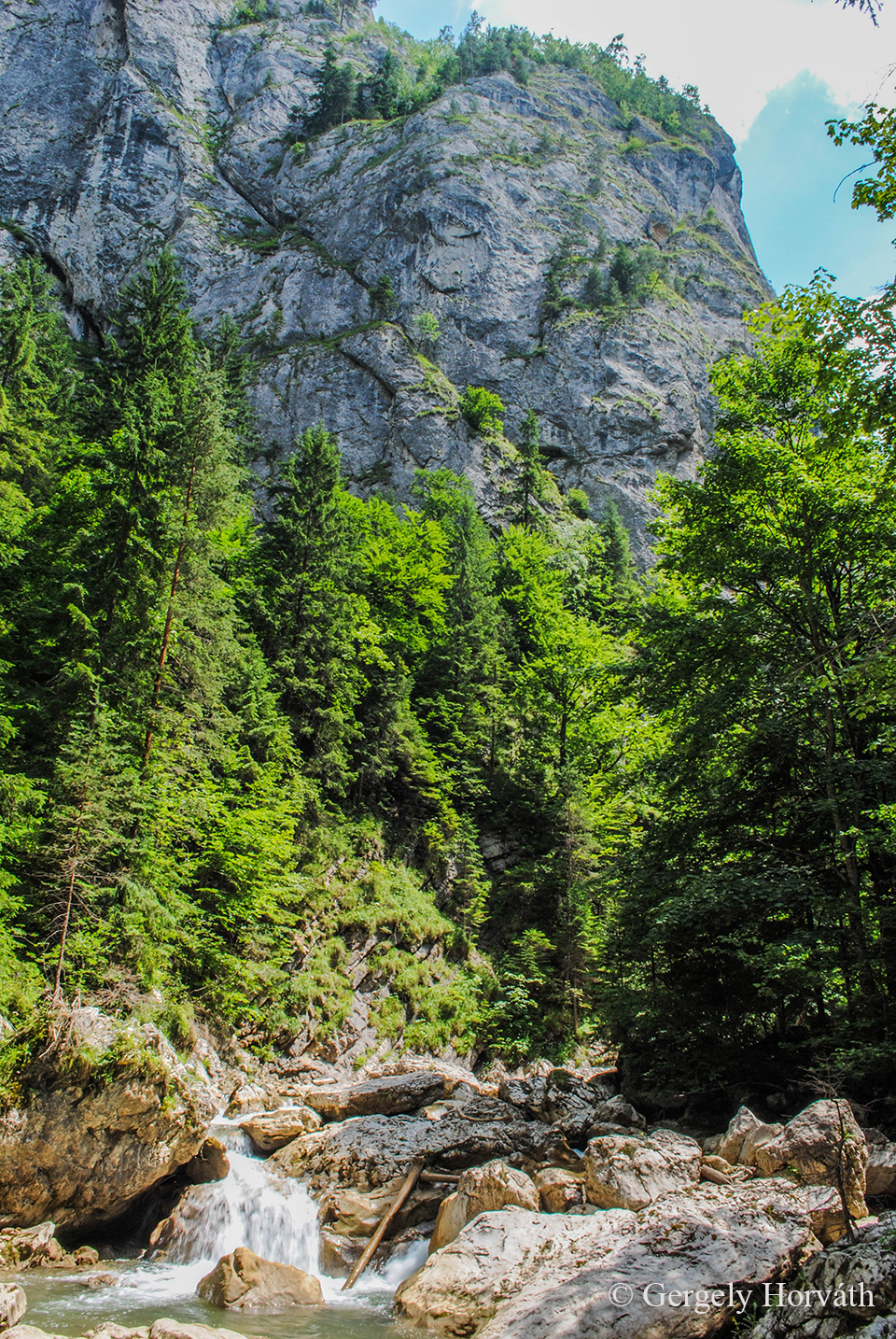
Békás patak.
Bicaz River.
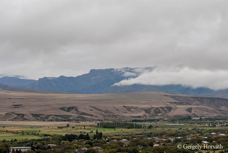
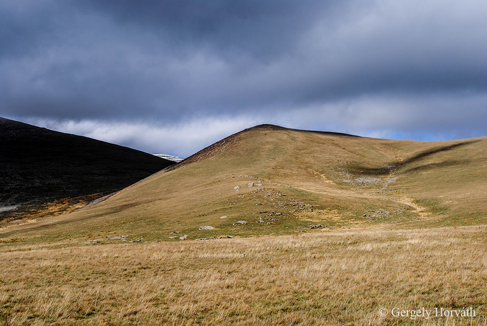
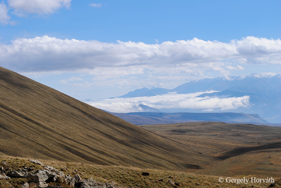
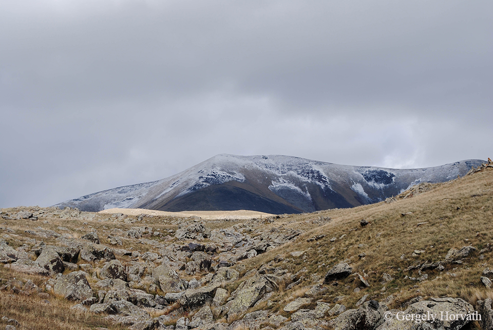
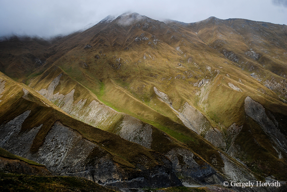
Hagymás-hegység, Keletei-Kárpátok, Hargita megye.
Hăşmaş Mountains, Eastern Carpathians, Harghita county, Romania.
Békás-szoros.
Bicaz Gorge.
Békás patak.
Bicaz River.
Szóval úgy kezdődött, hogy aktuális szállásunkat elfoglalva Goriban, a nagyon kedves házigazda hölgy, Lia szőlővel és teával fogadott minket, és mivel aznap reggel még Jerevánban ébredtünk, az eső pedig egész nap kitartóan esett, örömmel elfogadtuk mindkettőt. Természetesen szóba is elegyedtünk, felvázoltuk másnapi terveinket: körbejárjuk a várost, aztán átruccanunk Upliszcikébe, ha marad még elég időnk, akkor talán még a múzeumba meg a várba is, aztán délután irány Batumi. Így derült ki, hogy a fejemben tökéletesen összeállt, a rendelkezésre álló időt maximálisan kihasználó terv csupán egy ponton hibádzik: Goriból közvetlenül Batumiba csak napi egy busz indul, az is délelőtt fél tízkor. Lia látta tanácstalanságunkat, úgyhogy hamar előállt egy elég használhatónak tűnő, ámbár szokatlan ajánlattal.
The whole story begins at the moment we arrived to our guesthouse in Gori. After we occupied our room, the super nice landlady Lia offered us home raised grapes and hot tea. Since we woke up back in Yerevan and it did not stop raining all day, we gladly accepted both. Of course we started a conversation and we told our plans about looking around in the town tomorrow, then traveling to Uplistsikhe and if we had enough time maybe visiting the Stalin Museum and Goris Tsike. Then on the afternoon we are going to take a minibus to Batumi. As it turned out, my perfect masterplan which fully utilized the available time has only one error: namely that only one marshrutka goes to Batumi per day, at 9.30 am. Lia saw that we became clueless about what to do now, so she quickly offered a quite usable, but also very unusual back-up plan.
„Friends no problem!” Menjünk csak nyugodtan ahova akarunk, járjuk körbe a várost és Upliszcikét se hagyjuk ki semmi pénzért, mert tényleg nagyon szép (az is, mint kiderült). Amikor visszaérünk, ő majd hív nekünk egy taxit, ami kivisz az autópályára (!), a taxisofőrrel pedig megbeszéli, hogy intsen le nekünk egy Tbilisziből Batumiba tartó marshrutkát (!!).Lia arca túl komolynak tűnt ahhoz, hogy csupán helyi tréfának gondoljuk az egészet, na meg nem akartuk, hogy egy egész napunk a levesbe menjen el, úgyhogy hamar ráálltunk. Végül is kaland az élet.
’Friends, no problem!’ she starts. We could go wherever and do whatever we want. Take a look inside the town and we definitely should not miss Uplistsikhe because it’s really amazing (it is, as it turned out). When we finis, all we need to do is coming back and she‘ll order a taxi for us. The driver will take us to the motorway (!) and he will help us to stop marshrutka going from Tbilisi to Batumi (!!). Lia’s face looked way more serious to be joking. In addition, we did not want to waste the whole day on travelling, so we agreed to do the same way she proposed. Life is about adventure after all.
Minden ment is simán, megnéztünk mindent, amit akartunk, visszaérve még ettünk valamit, ittunk egy teát, Lia házi térképén mi is elhelyeztük saját gombostűnket a már meglévő rengetegben és felkészültünk a hadműveletre. A taxis jött is, és Lia, ahogy ígérte, neki is elmondta, hogy mit szeretnénk. Nyilván semmit sem értettünk a beszélgetésükből, de ahogy Lia időnként aggodalmasan ránk pillantott, sejtettük, hogy a taxis nem igazán vevő a pesztrálásunkra, azon kívül, hogy elvisz minket oda, ahova megfizetjük. Megérzésünk be is igazolódott.
Everything went well, we saw all of the must-sees we wanted and when we returned we even had time to eat something and drink a farewell tea. We inserted our pin on Lia’s visitors-map and prepared to the operation. The taxi came and Lia told the guy what we needed. Of course we did not understand a word they said, but the worried look on Lia’s face told me that it won’t be as easy she expected to be. The taxi-driver looked not very open to nursing us besides he drives us wherever we pay him enough for. And as it turned out our intuitions were true.
„Friends, no problem!” Ez nem jelenthet akadályt, hiszen rengeteg kisbusz jár Tbilisziből Batumiba, nekünk csak az a dolgunk, hogy leintsük a megfelelőt, mondta Lia és a kezembe nyomott egy cetlit, amin Batumi neve állt, grúz betűkkel: ბათუმი. Megmondom őszintén, sok akadályon átvergődtünk az idáig vezető időszakban, és mindig optimistán álltunk a dolgok elébe, de ez volt az a pillanat, amikor mindketten kicsit elbizonytalanodtunk a jövőt illetően. Egy idegen kultúrájú ország autópályája szélén, szemerkélésből egyre biztosabb szakadásba kezdő esőben állva az ember elég könnyen el tudja veszteni a jókedvét, de végül is minden kételyünk ellenére jött marshrutka, nem is egy, és volt olyan is, ami ბათუმი-ba ment. Szóval azért kis büszkeséget is érezve írhatom most, hogy ezt is sikerült megoldanunk. A Grúziába utazni vágyóknak mindenképp hasznos információ, hogy itt az autópályán sem lehetetlen stoppolni.
’Friends no problem! This is just a small inconvenience what should not worry us at all! There are many minibuses travelling between Tbilisi and Batumi all we need to do is stop one on its way’ she told and put a paper in my hand with the name of Batumi in Georgian letters on it: ბათუმი. I’ll be honest with you we have been through a lot of unexpected turns during the two weeks and we tried to stay positive the whole time. But this was the exact moment when we both became a bit unsure about the future and this did not really changed standing at the edge of the motorway. In a country with a foreign culture trying to stop a fast moving vehicle while the rain falls harder and harder isn’t the situation what cheers you up. But after all, despite our scepticism one marshrutka really came and we managed to take it to ბათუმი. So after we solved this final task I write now these lines feeling a little pride about what we accomplished. For those who planning to hitchhike in Georgia I can say that it is not impossible even on the motorway.
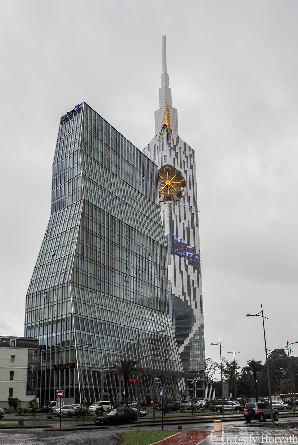
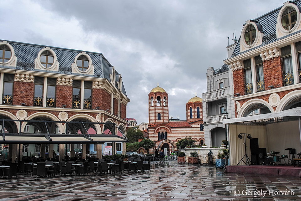
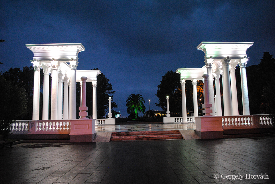
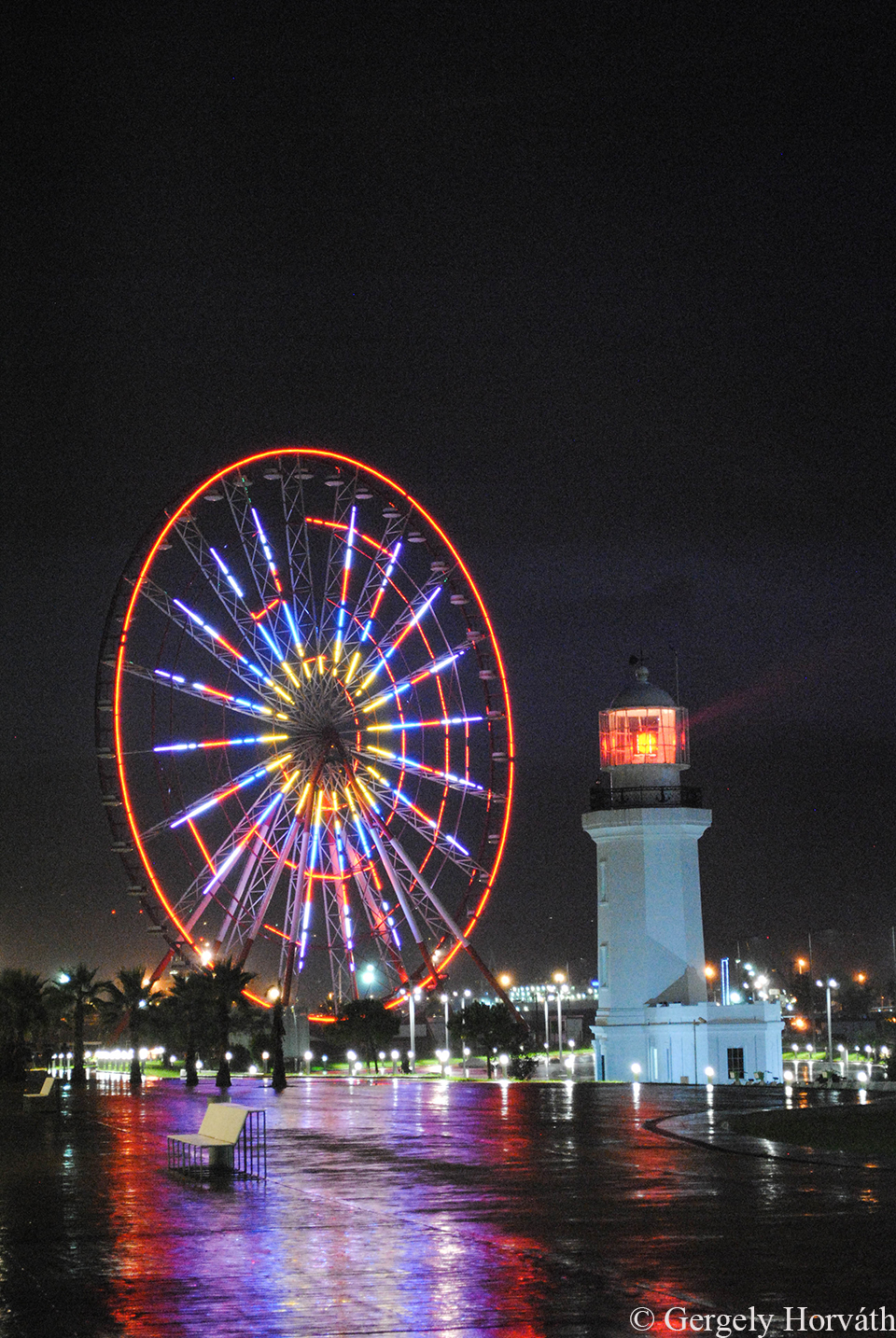
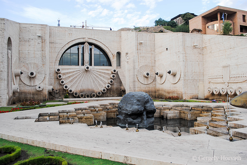
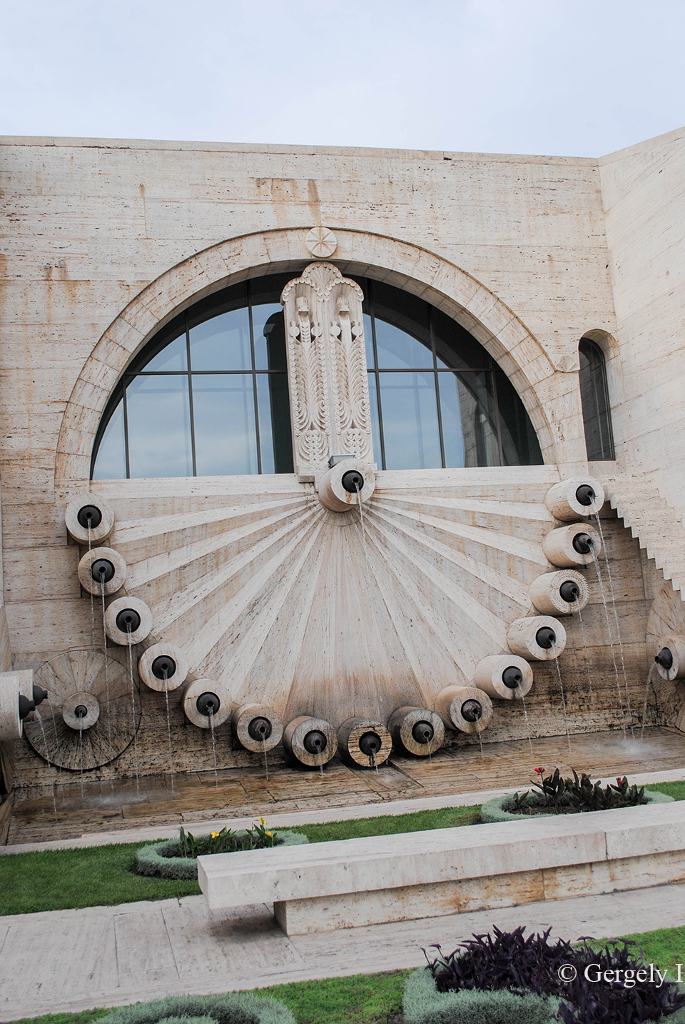
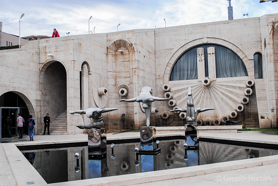
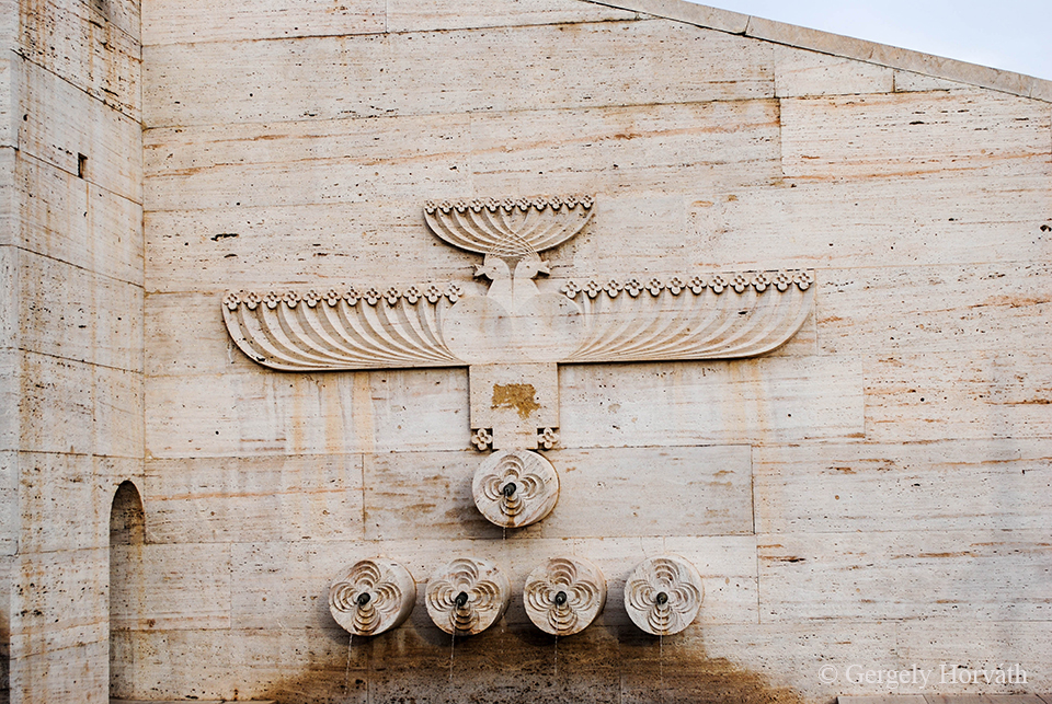
Batumira rátérve: a város elég feltűnő jelenség lenne, akkor is, ha nem Grúziában lenne megtalálható. Az Adzsár Autonóm Tartomány székhelye jelen pillanatban Grúzia legfontosabb kikötője, de az utóbbi évtizedben elég sok pénzt öltek a turizmus fejlesztésébe, ami főleg felhőkarcolók és kaszinók építését takarja. Mindezzel nem is lenne semmi baj, de a Tbilisziben már megismert posztmodern stílus itt aztán végleg elszabadult és eléggé megkérdőjelezhető ízlésvilággal karöltve formálta ki a város „modern” arculatát. Természetesen már csak hozzáértés hiányában sem bocsátkozhatok megfelelő mélységű elemzésbe, a képek úgy is többet mondanak a szavaknál.
About Batumi: The city would be an eye-catcher even if it hasn’t been found in Georgia. At the moment Batumi is the capital of the Ajarian Autonomous Republic and the most important port of Georgia. During the last decade authorities invested lot to increase tourism in the city. This mainly means building of skyscrapers and casinos. This alone would not be wrong but the postmodern style what we already saw in Tbilisi came totally out of control and together with a questionable sense of taste dominates the ‘modern’ image of the city. In the lack of adequate competence I cannot analyse the phenomenon in depths so I let the pictures tell the story.
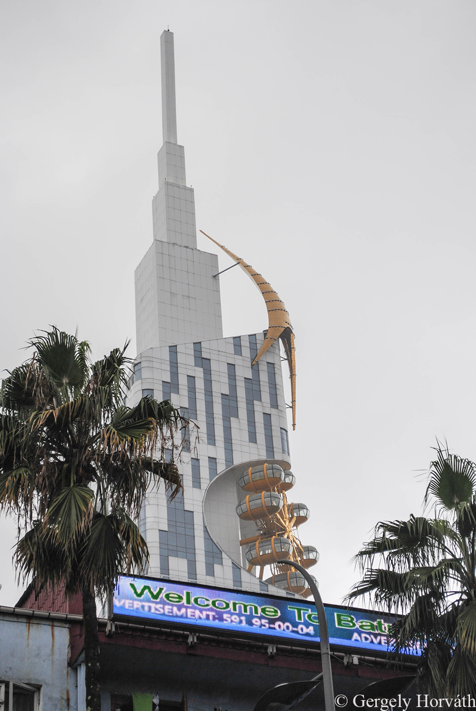
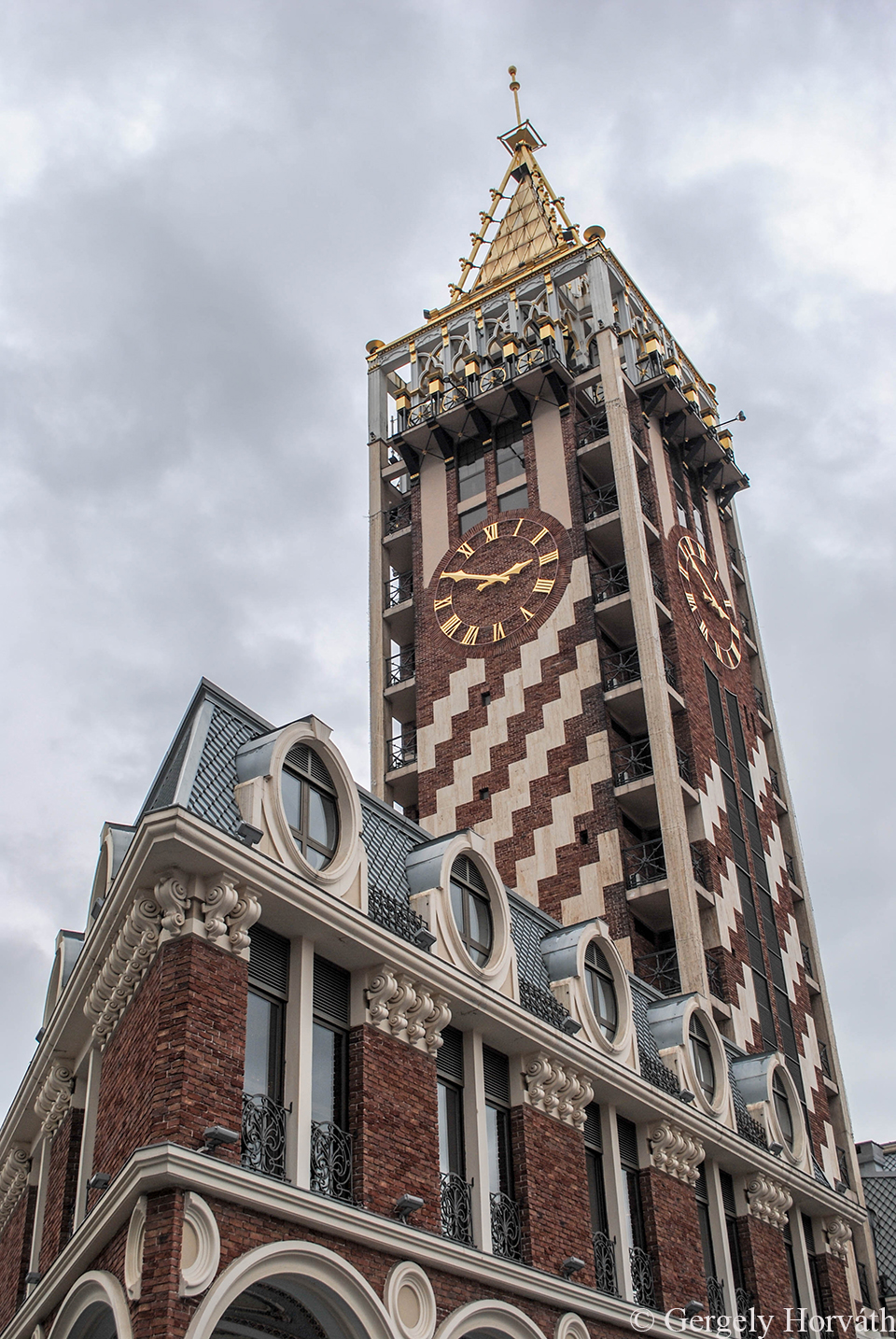
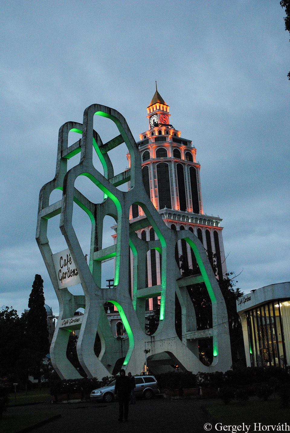
A legnagyobb őrültség, amit egész Grúziában találhat az ember: A Csacsa-torony. Pár évvel ezelőtt a városvezetés véghez vitte azt, amit igazából mindenütt meg kellene valósítani, így minden este hét órától tíz percen keresztül pálinka folyik a torony melletti fém kutakból. Nagy bánatomra ottjártunkkor nem működött, mivel nagy esőzések alatt leállítják.
The craziest thing what you can find in whole Georgia: The Chacha Tower. A few years ago the local government accomplished what every other city administration should do so at every 7 pm for 10 minutes chacha (Georgian booze) flows from the metal fountains of this towers. My greatest sorrow it did not worked for us, 'cause they shut it out during heavy rains.
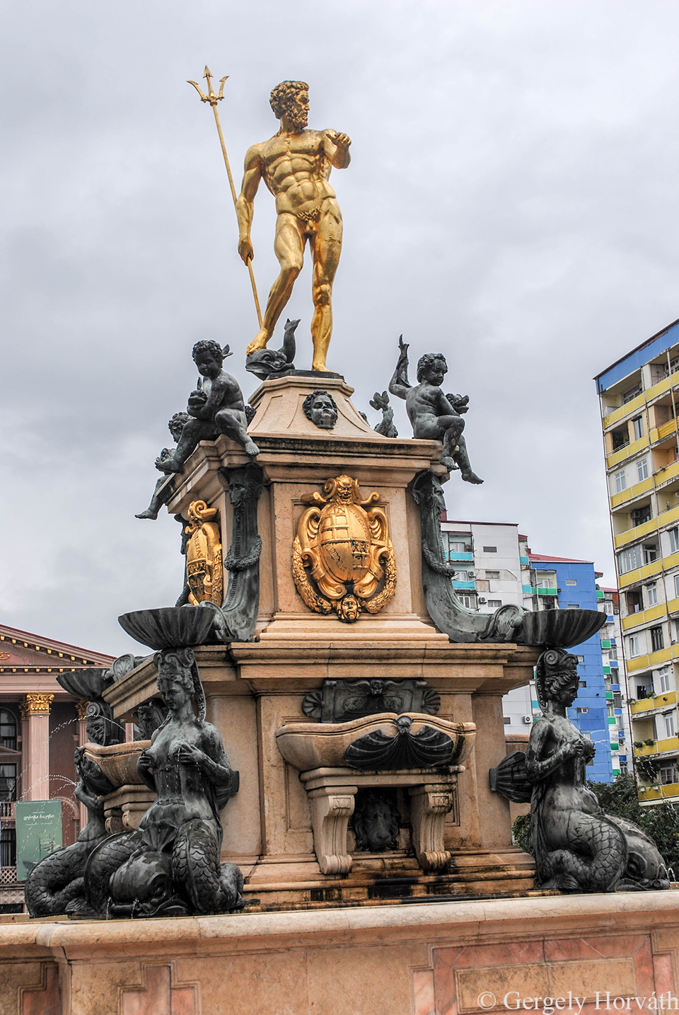
A világ legperverzebb szökőkútja. Nézzétek csak a sziréneket.
The dirtiest fountain of the whole world. Just look at the syrens.
Médeia, kolkhiszi királylány és az aranygyapjú.
Medea princess of Colchis and the Golden Fleece.
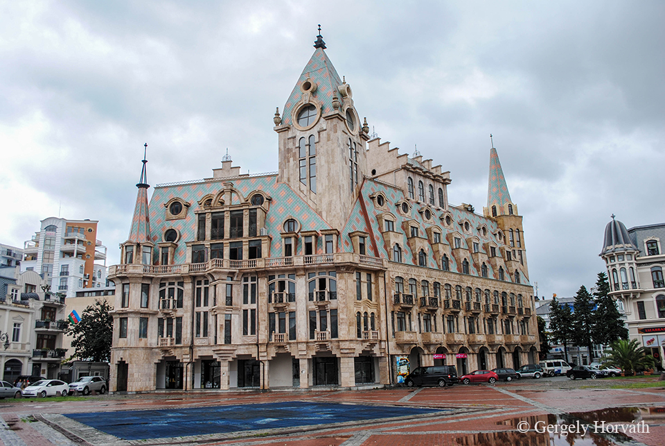
A város vadiúj főtere a "Piazza" a velencei Szent Márk teret "mintázza".
The city's brand new main square the 'Piazza' depicts the St. Mark square of Venice
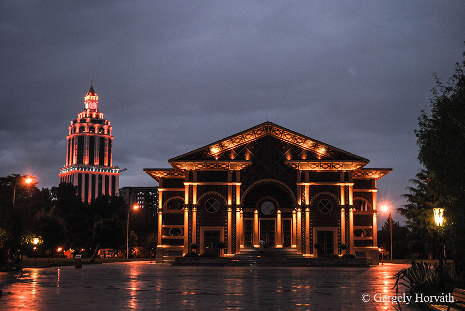
Esténként a belváros neonfénybe öltözik.
Every night the downtown covered in neon-lights.
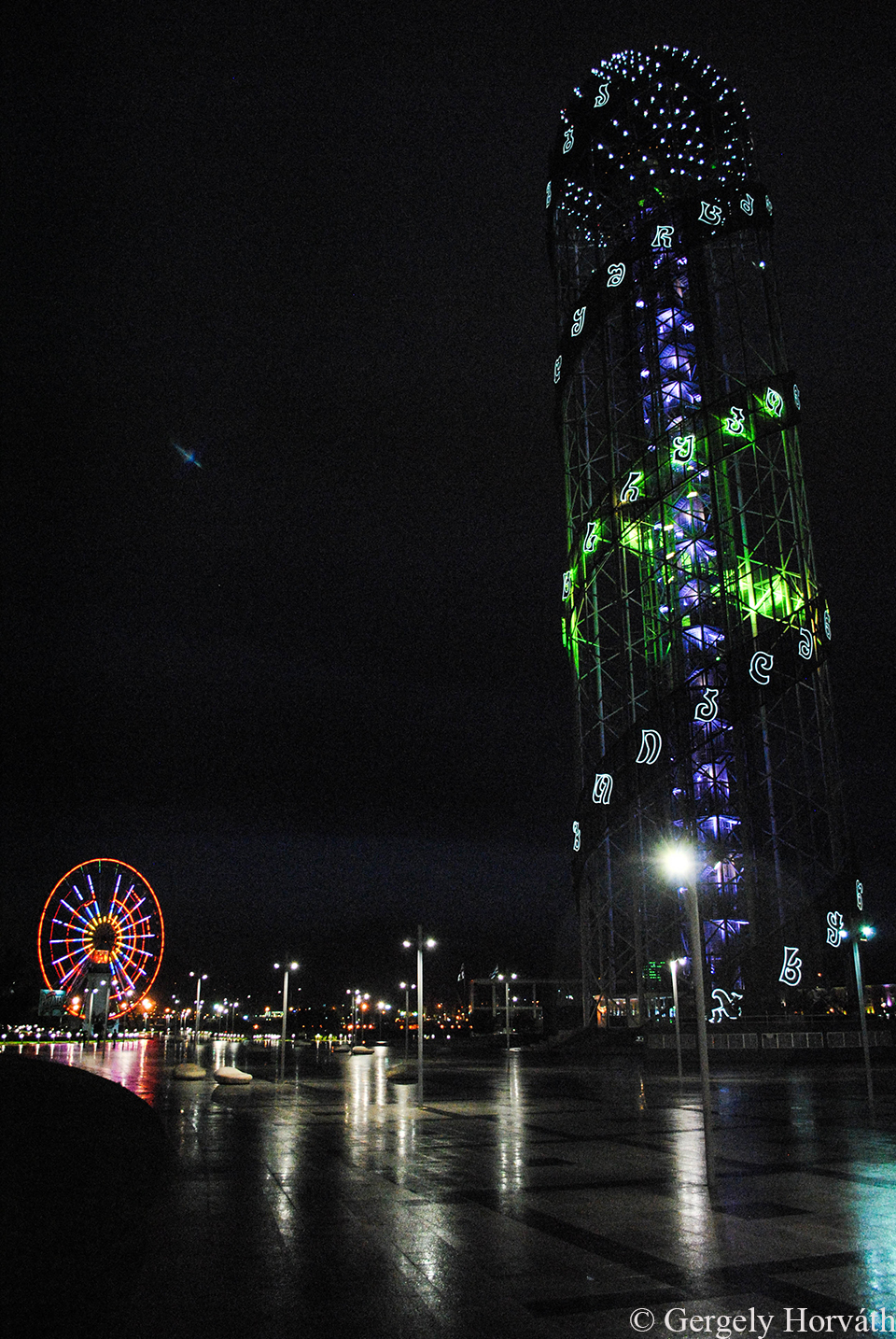
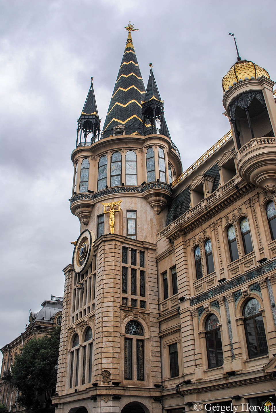
Az "ABC" torony.
The Alphabetic Tower.

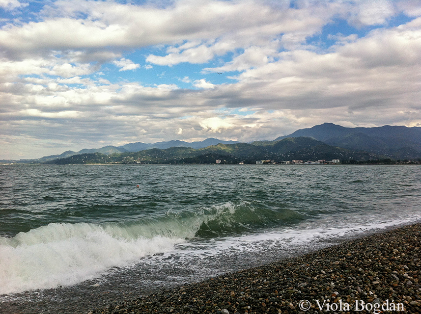
Utunk és beszámolóim is itt végződnek, a Fekete-tenger kavicsos partján. Remélem sikerült sokakban felkeltenem az érdeklődést a Kaukázus és az itt elterülő csodás országok felkeresése iránt. Mi biztosan visszatérünk még.
Our journey and my travelogues ends here at the pebbly beach of the Black Sea. I hope that I could make interest in visiting the Caucasus and the amazing countries of this region in many of you. We will return someday that's for sure.
A Tbiliszitől mintegy órás autóútnyira keletre található Gori első látásra nem tűnik túl jelentős városnak, már csak méretéből adódóan sem, hiszen alig 55 ezer fő lakja. Ám mivel kereskedelmi szempontból fontos útvonal mentén fekszik, történelme mozgalmasabb, mint gondolnánk, mindenképpen érdemes útba ejteni.
Gori lies cca. one-hour drive east from Tbilisi. The medium size town (almost 55.000 inhabitants) looks like a not so important, calm and sleepy place at first, but as it's located along an important trading route its history was far more eventfull than you might think. It's definetely worth to make a short visit here.
A várost a hagyomány szerint Építő Dávid által itt letelepített örmények alapították a 11. században, de a Gori erőd (Gorisz Cike) már jóval korábban (7. sz.) felépült a környék fölé magasodó dombra, mivel a kulcsfontosságú, kelet-nyugat irányú kereskedelmi útvonal (ma autópálya) itt halad keresztül. Ennél a ténynél fogva Gori birtoklása mindig is nagy stratégiai jelentőséggel bírt és a történelem során többször cserélt gazdát. Legutóbb 2008-ban, mikor a orosz-grúz háború során orosz-oszét csapatok egy hétig tartották megszállás alatt.
According to the chronicles, the town was founded during the 11th century by David the Builder wo settled armenians here. However, the Gori Fortress (Goris Tsikhe) dates back to the 7th century. As the East-West trading route (nowadays motorway) passes near the town, possessing Gori always had a considerable strategic potencial and hence changed its masters several times. Last time in 2008 when the town was occupied by russian-ossetian forces for a week during the South Ossetian War.
A 2008-as háború során az orosz légicsapások és tüzérségi támadások jelentős pusztítást okoztak a városban, ám ebből ma már szinte semmit sem érezni. Bár a háború végén kijelölt dél-oszét demarkációs vonal fenyegetően közel található, Gori lakosai élik életüket és természetesen, ahol lehet, szőlőt, bort is termelnek.
The war in 2008 was devastating for Gori as the russian army bombed and shelled the local Georgian military base causing several damages in civilian buildings as well. However, today you can feel almost nothing of this recent events. Although the South-Ossetian demarcation line is threateningly close, local people lives their lives and off course raising grapes and producing wine wherever they can.
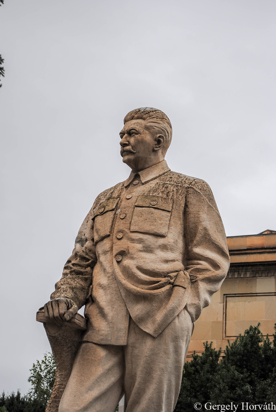
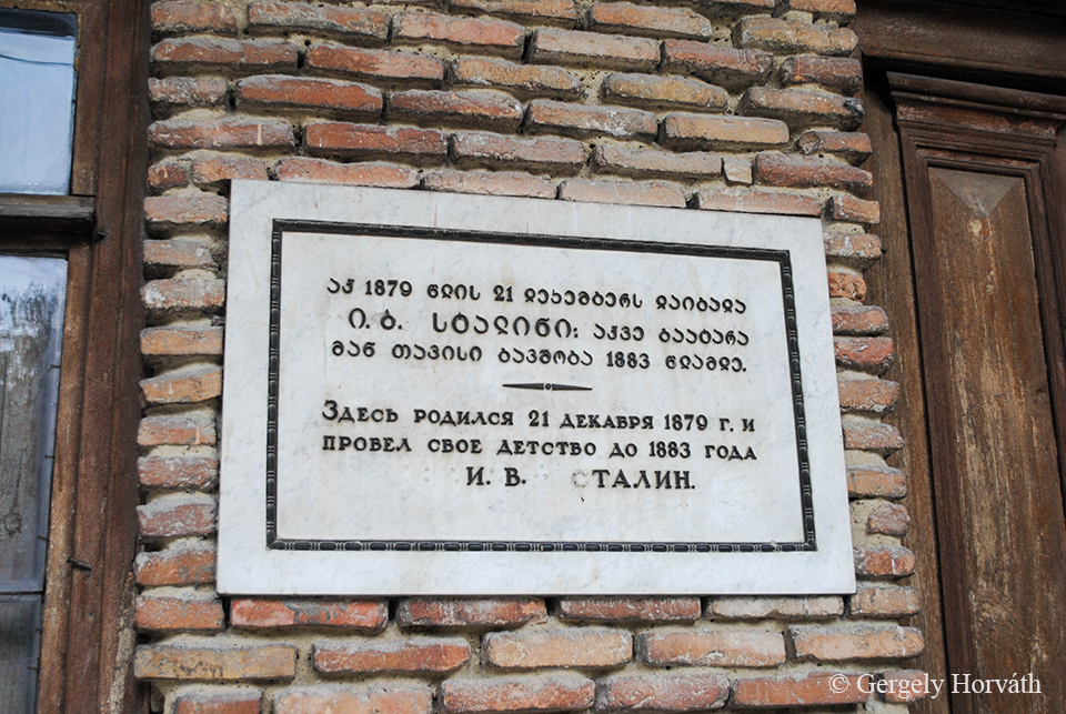
Az orosz-grúz háborús eseményen kívül Gori még egy dologról híres, de arról nagyon és ez elég kétes hírnév. 1878 december 18-án itt látta meg a világot egy Jozeb Beszarionisz dze Dzsugasvili nevezetű grúz fiúcska, aki felnőve egy rövid, a tbiliszi papi szemináriumban eltöltött kitérő után illegális kommunistából a fél világot markában tartó diktátorrá emelkedett, Joszif Sztálin néven. Nehéz lehet megküzdeni a ténnyel, hogy a város (horribile dictu az ország) legismertebb szülötte egyben a világ legnagyobb tömeggyilkosa is, de Goriban minden politikai akarat és szándék ellenére a mai napig Sztálin sugárútnak hívják a város főútját ezen kívül múzeuma is van Joszifnak, és bár hatalmas bronzszobrát a városháza térről már eltávolították (állítólag nemsokára visszahelyezik) emléke a mai napig elevenen él és évente turisták ezreit vonzza a városba.
Besides its short term role during the South-Ossetain War Gori's fame comes from one particualarry dubious person. On the 18th December 1878 a boy named Ioseb Besarionis dze Jughashvili was born here, who, after a short period in Tiflis Spritiual Seminary, from underground communist became the almighty dictator of the half of the globe under the name Joseph Stalin. It should be hard to deal with the fact that the most famous son of the town (horrible dictu the whole country) is the biggest mass-murderer of the world, but despite every political effort the main avenue in Gori is still named after Stalin and there is a musem dedicated to him as well. Although his bronze statue was removed from the city centre (according to various sources they are planning to re-erect it) the memory of the soviet dictator is very vivid in his birthtown attracting annually several thousands of tourists to Gori.
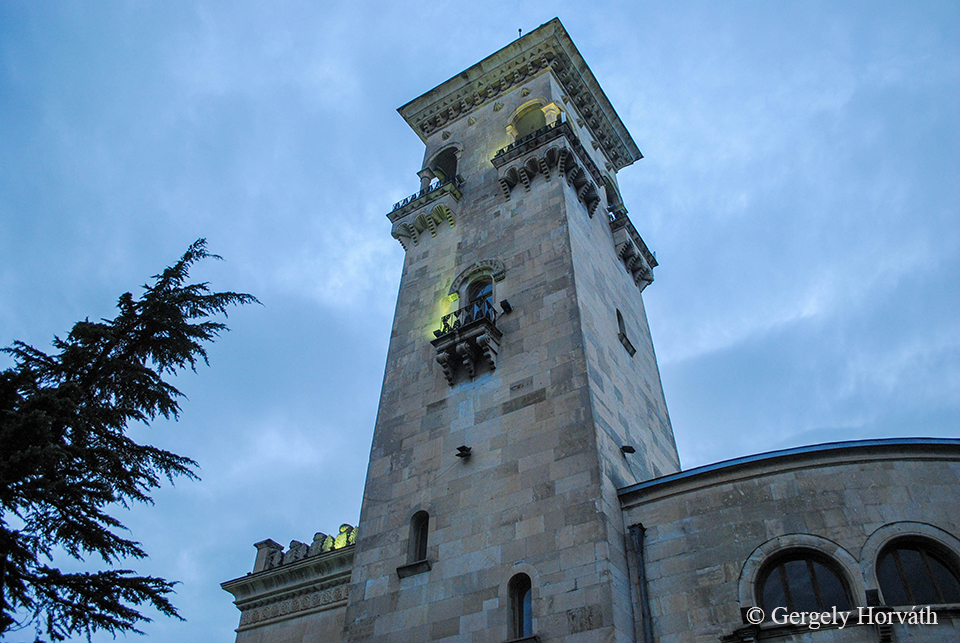
A Sztálin Múzeum épülete.
The Stalin Museum.
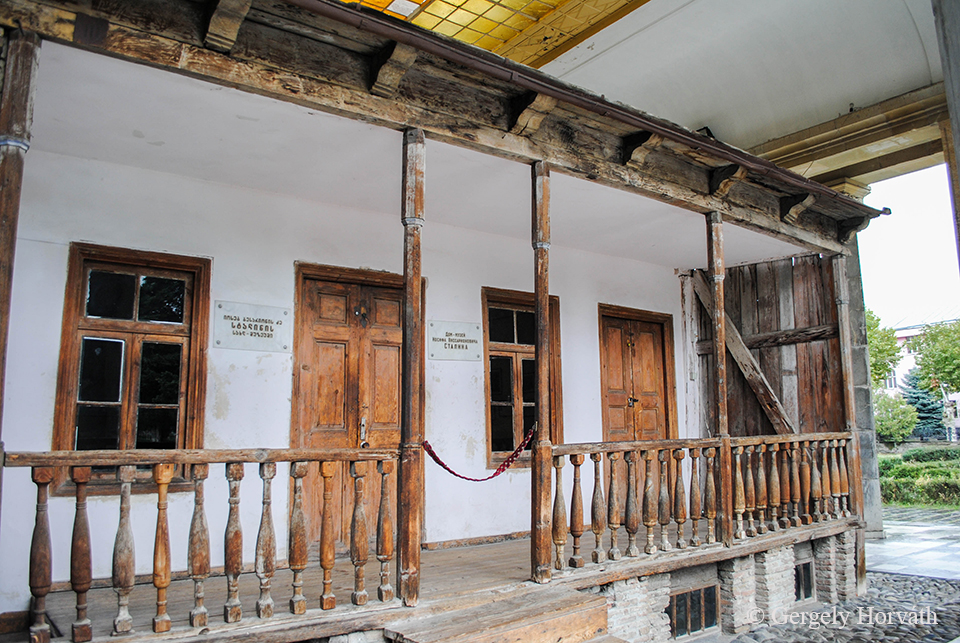
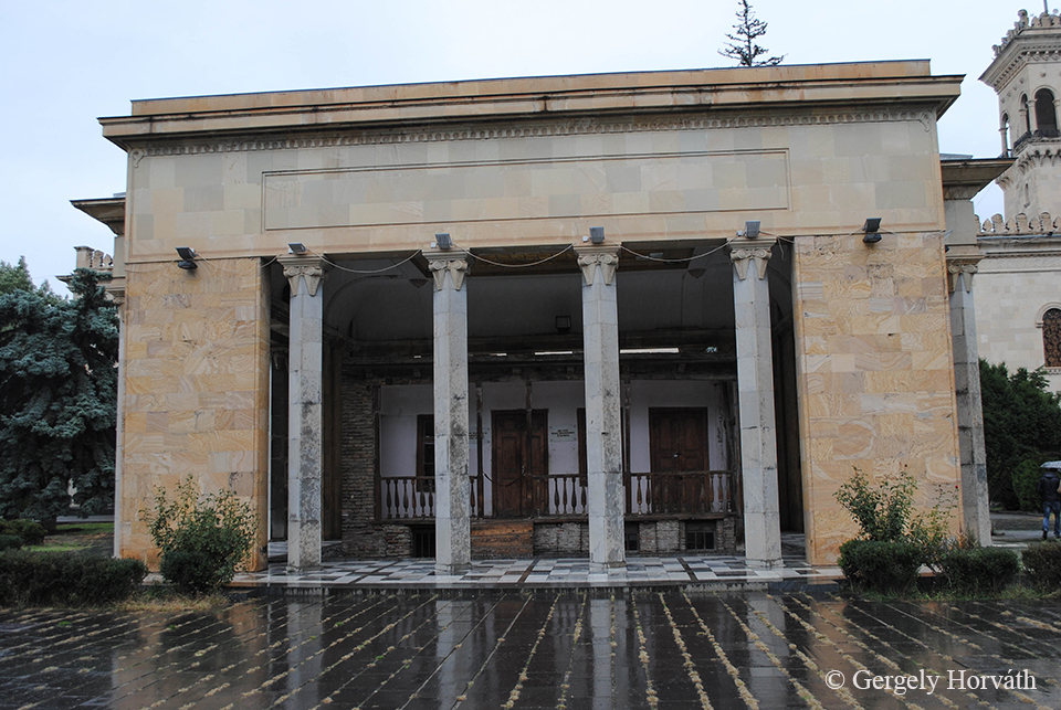
A múzeumhoz tartozik Sztálin (állítólagos) szülői háza is.
Stalin's (alleged) birth-house is part of the museum.
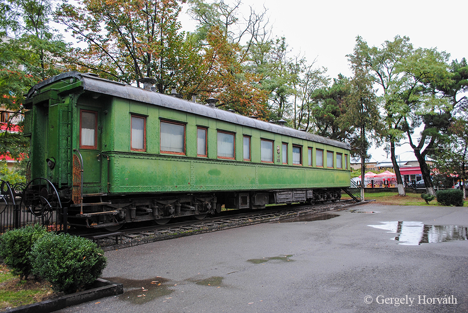
Sztálin személyes páncélvagonja is ki van állítva, melyet 1941-től használt rendszeresen, külföldi (ezzel érkezett például a Jaltai és Teheráni konferenciára) és belföldi utakra egyaránt. A repüléstől állítólag nagyon félt, autózni meg nem szeretett.
Stalin's personal armoured carriage. He travelled on this railway carriage from 1941 onwards to abroad (e.g Yalta and Tehran Conference) and inland. According to rumors he was frightened to flight and did not like cars.
Biztos akad olyan, akinek már csak a Sztálin Múzeum is elég a látványosságok közül, de van még legalább egy nevezetes hely, amit kár kihagyni. Igaz, hogy ez nem Goriban található, de a fél óra buszozás és pár perces gyaloglás szerintem senkinek sem lehet kifogás, úgyhogy ha Goriban jártok, akkor Upliszcikét mindenképp kötelező felkeresni.
I'm sure that for some people the Stalin Museum is more than enough must-see, however there is at least one more landmark what would be a pity to miss. Okay, it's not in Gori, you have to take a bus there, but it's only half an hour from your life and a short walk could not be an excuse either, so it is mandatory to visit Uplistsikhe.
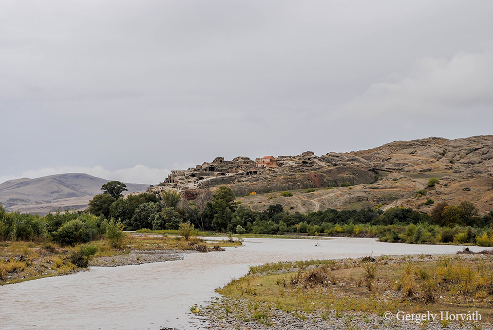
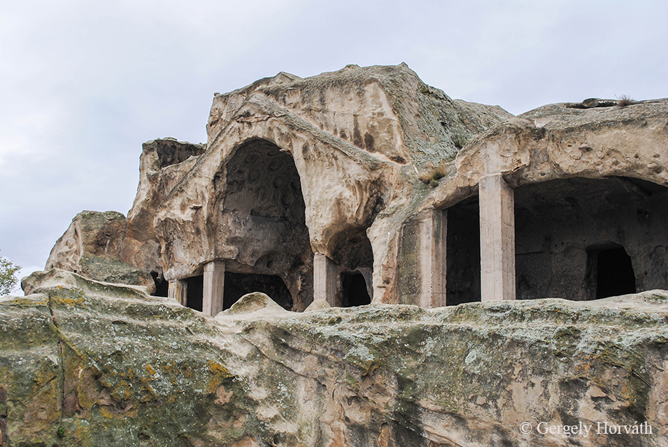
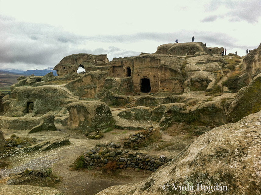
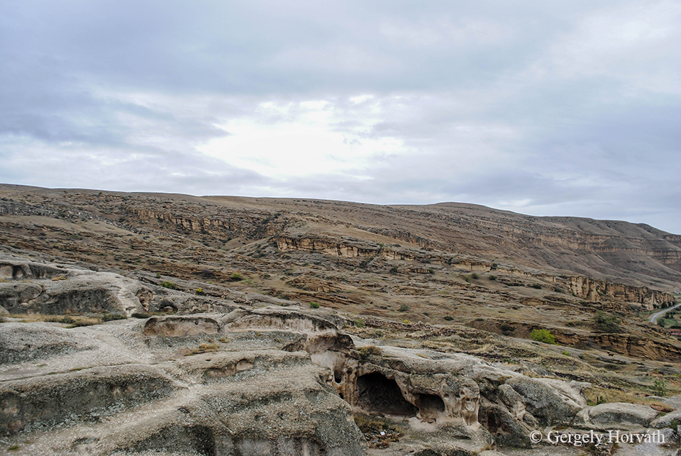
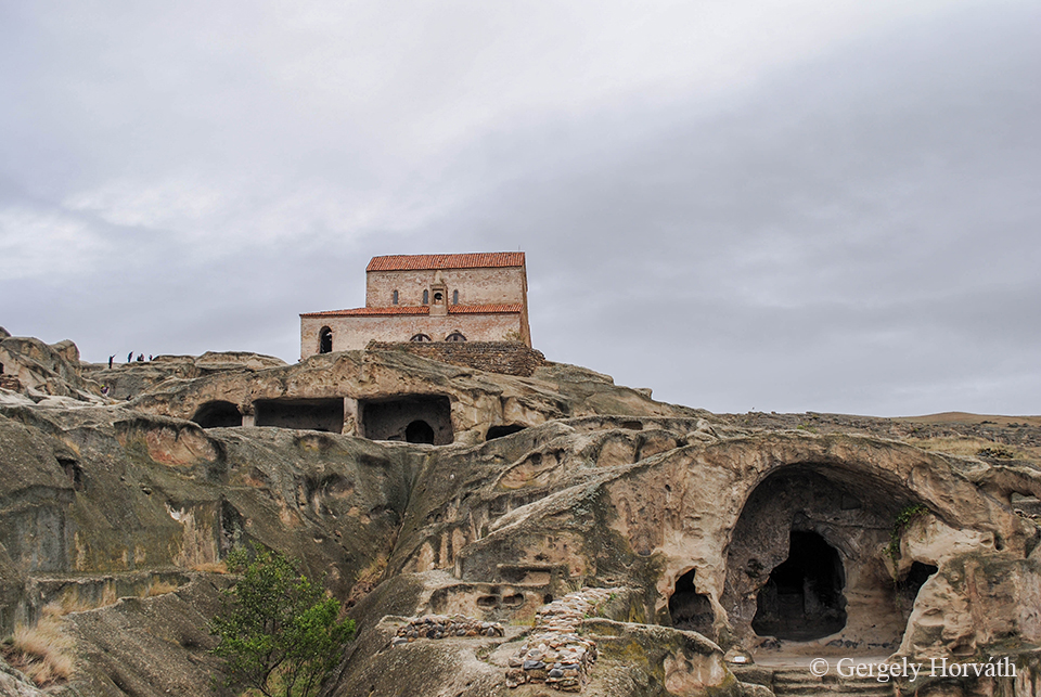
Upliszcike történelmi értékét az a tény adja, hogy ez Grúzia legősibb, huzamosabb ideig lakott települése. Ráadásként sziklavárosról van szó, melyet teljes egészében a Kura (Mtkvari) bal partján magasodó sziklákba vájt épületekből, termekből alakítottak ki.
The historical significance of Uplistsikhe comes from the fact that this is the oldest urban settlement in Georgia. Moreover it is a rock-hewn city built on the high-rocky left bank of the Kura (Mtkvari) River.
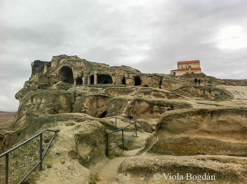
Az egykori város a kora vaskortól kezdve lakták és csak a középkor legvégén néptelenedett el. Mivel a valaha itt létezett ősi királyságok szívében található, hadászatilag fontos erődítményként szolgált az ókortól kezdve. Nagy Sándor biztosan megütközött a területet uraló "harcias törzsekkel" de a későbbi hódítók dolgát is nagyban megnehezítették a nehezen bevehető város lehetőségeit kihasználó, ide visszavonuló helyi hadak. Az évezredek folytán Upliszcikét folyamatosan új "épületekkel" egészítették ki, az egyes korokra jellemző építészeti struktúrák pedig jól elkülöníthetőek egymástól.
The onetime settlement was inhabitet from the Early Iron Age till the Late Medieval Period. It is located in the heartland of the ancient kingdoms once existed here (e.g. Kartli) and was a strategically important strongold for many occasions. Alexander the Great surely engaged a battle with the 'militant tribes' of this area but later conquerors had a hard time to overcome the defenders of the hardly pregnable city as well. During the millenias Uplistsikhe was expanded with new 'buildings' and the various structures of different eras are easily recognizeable.
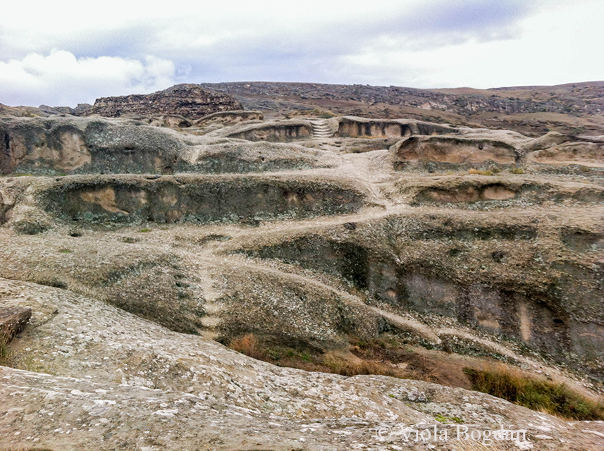
Upliszcike igen fontos vallási központ volt, ahol a rítusok főleg a szőlőhöz, borhoz és gabonához kötődtek. A kereszténység felvétele után jelentősége csökkent, de egyes források szerint a város elnéptelenedésig végeztek itt pogány szertartásokat.
Uplistsikhe was the main regional hub of ancient Georgia where worships involved mainly the gifts of nature: grapes, wine and grain. Its importance declined after adoptation of christianity, however, according to various sources pagan beliefs survived for a long time and sacrifices were presented till the very depopulation of the city.
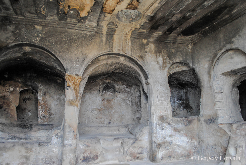
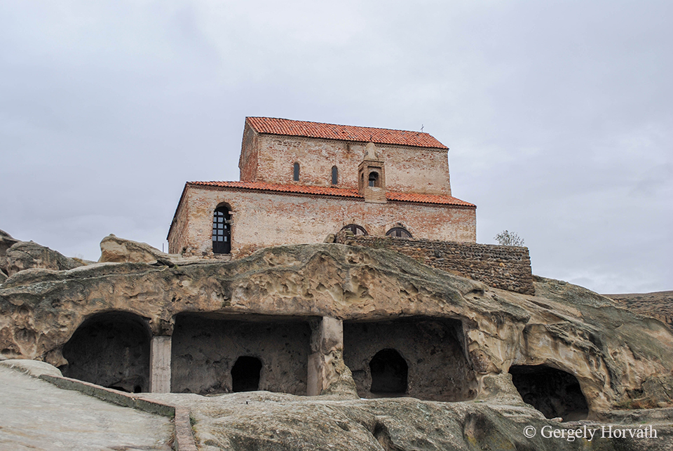
A város keresztény templomát a 9.-10. század fordulóján emelték a pogány templom fölé.
This christian church was built in the 9/10 century over the ancient temple.
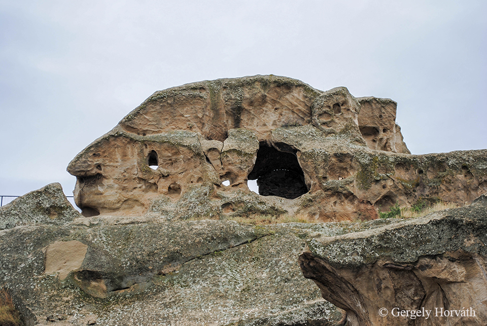
A híres "arc" szikla
The famous 'profile' rock
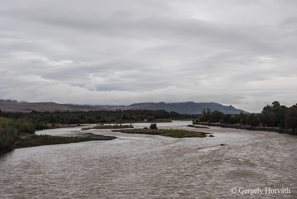
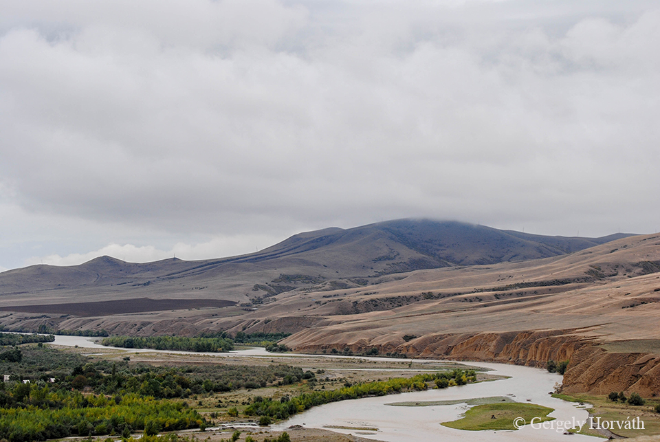
A Kura (Mtkvari) Tbilisziből már ismerős.
The Kura River (Mtkvari) is familiar from Tbilisi.
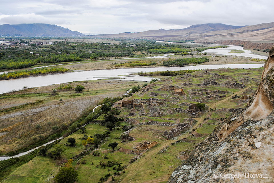
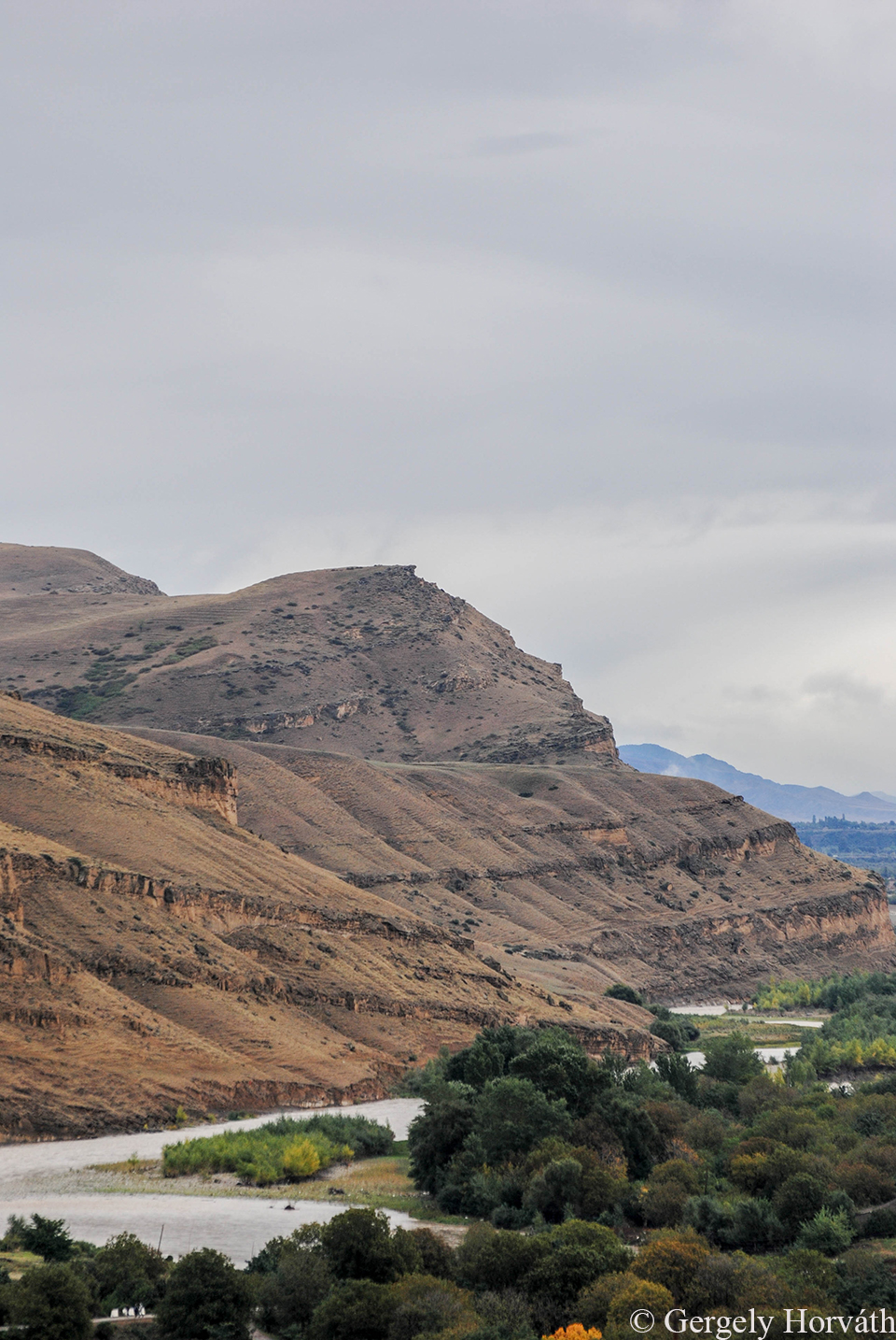
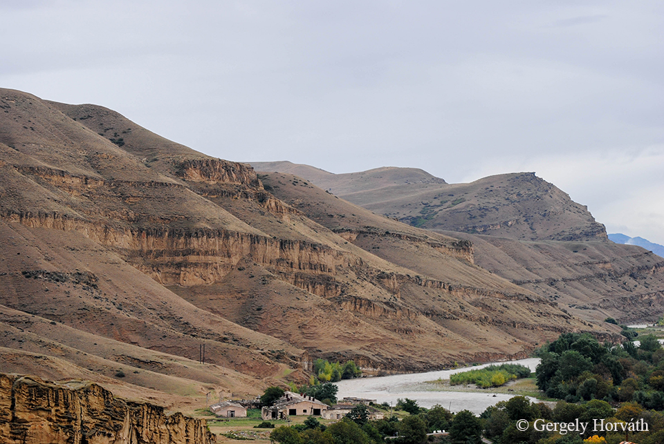
A táj természetesen festői.
The landscape is of course marvelous.
Gorit és Upliszcikét elhagyva utunk utolsó állomására, Batumiba indultunk tovább, ahová nem kevésbé kalandos módon sikerült eljutnunk, de erről majd a következő, záró bejegyzésben lesz szó.
After Gori and Uplistsikhe we travelled to our last destination Batumi, where we managed to get on a quite adventurous way. But this I will tell about in my next, closing post.
Aki a korai emberi történelem iránt érdeklődik, azt Sziszian környéke bőven elkényezteti látnivalókkal (lásd pl. Zorac Karer), ezek közül talán az Ugtazar hegy sziklarajzai a leghíresebbek, így mi sem hagyhattuk le őket a mindenképpen meglátogatandó helyek listájáról. De még mielőtt vezetőnkkel, Szaszun Bagdaszarjannal az ő elnyűhetetlen, 4x4 meghajtású UAZ terepjáróján nekivágtunk a szó szerint úttalan útnak, még felkerestük Örményország legmagasabb vízesését, ami történetesen szállásunktól egy rövid sétára volt fellelhető.
For those who are interested in ancient history of mankind the area of Sisian offers a large variety of landmarks (e.g. Zorats Karer), but maybe the most famous must-see is the Ughtasar mountain and the petroglyphs can be found here. Make a short trip to see these petroglyphs was on our list as well, but before we departed with our driver and guide Sasun Baghdasaryan taking his holeproof 4x4 UAZ jeep to a ride we went to see the highest waterfall of Armenia which was situated just a short walk from our lodging.
A Vorotan szurdok. A Saki vízesés ezen a folyón található, a várostól néhány km-re északra.
Vorotan gorge. The Shaki waterfall situated on this river just a few miles north of the town.
A vízeséssel kapcsolatban érdemes megemlíteni azt az érdekes és kissé illúzióromboló tényt, hogy a Vorotan vizét energiatermelés céljából elterelik, így a vízesés ebben az állapotban inkább csak csordogál. Azonban ha az ember kissé a zsebébe nyúl, az erőmű dolgozói hajlandóak a különbözet megfizetése ellenében "visszakapcsolni" a folyót, és az így lezúduló víztömeg már valóban tekintélyt parancsolóvá teszi a Shakit. Legalábbis 20 perc erejéig.
There is one interesting and maybe a bit disillusioning fact about Shaki: Most of the Vorotan is diverted to generate electricity and in this state the waterfall is just a trickling flow of water. Unless you are open to pay for the difference to the workers at the power plant, and they will turn the water on full blast for you! It is worth it's price and you can make nice pictures of the true Shaki waterfall for 20 minutes before they turn down the water again.
Előtte...
Before...
...Utána
...After
A sziklarajzokért a háttérben lévő hegyekhez kell eljutni. Ez pár órás utat jelent, amit kizárólag négy kerék meghajtású járművekkel lehet megtenni. Ez alatt pedig kizárólag UAZ dzsippet kell érteni.
For the petroglyphs we have to get to those mountains in the background. The trip takes a few hours and it's only possible with four-wheel drive vehicles, by which I mean UAZ jeep.
A feladathoz illő céljármű: UAZ 469. Ahogy a mondás tartja, karbantartásához nem kell más, csak kalap, kabát, kalapács.
The right vehicle for the task: UAZ 469. As they say only three things you'll ever need to keep this car in shape: hat, coat and hammer.
Vezetőnk, Szaszun Bagdaszarjan. Szaszun tíz éve szállít csoportokat az Ugtazarhoz és úgy ismeri a környéket, és annak történelmét mint a tenyerét. Az egykori mérnök jól beszél angolul, így a külföldi csoportok szinte mindig őt keresik ha sofőrre van szükségük. Előre szólok, hogy nagyon fürge, nehéz vele lépést tartani.
Our guide Sasun Baghdasaryan. Sasun leads trips to the Ughtasar for ten years and knows the history of this area like no one else. The former engineer speaks english very well so he is the best choice if you want to get to the petroglyphs. However, he is quite fast so it is sometimes hard to follow.
Kiépített utak, de még csak ösvények sincsenek a hegyekben, így vezető nélkül értelmetlen nekivágni.
There are no roads or paths around the mountains so there is no reason to setting out without a local guide.
Utunkat kialudt tűzhányók övezik.
Our way are surrounded by extinct volcanoes.
Vulkáni lanka és mögöttünk a már említett Zangezur hegység.
Volcanic mountainside and the Zangezur mountains in the background.
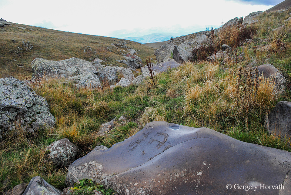
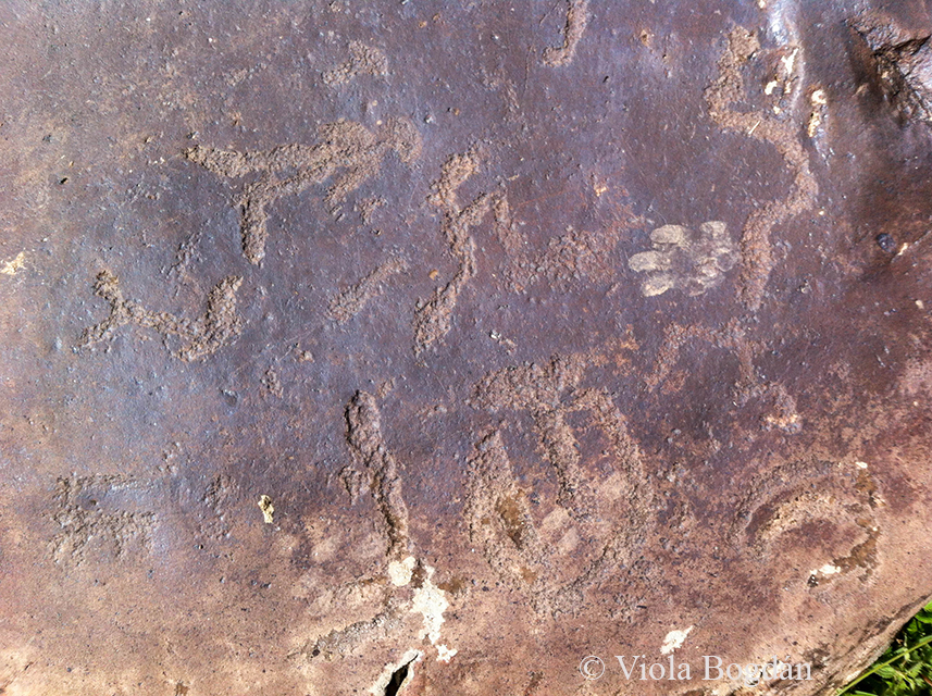
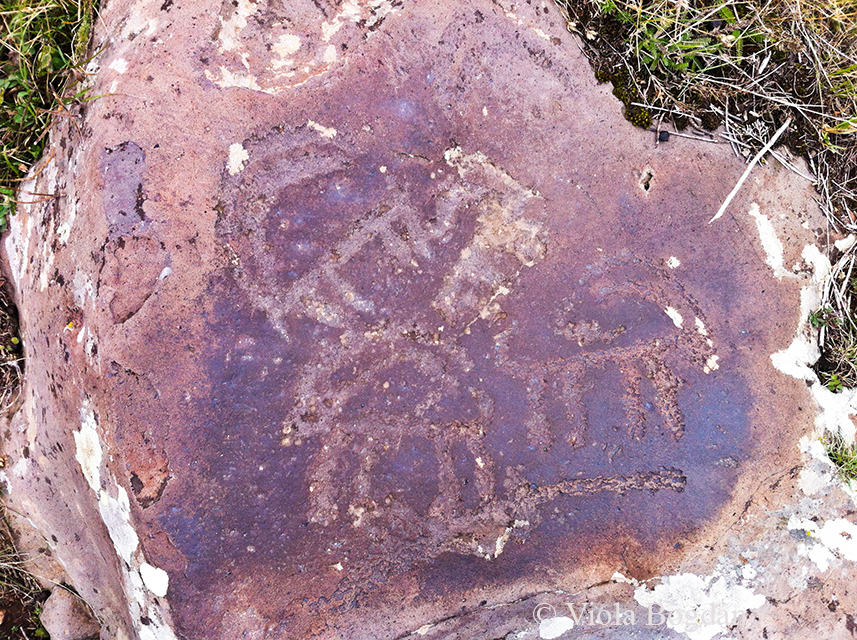
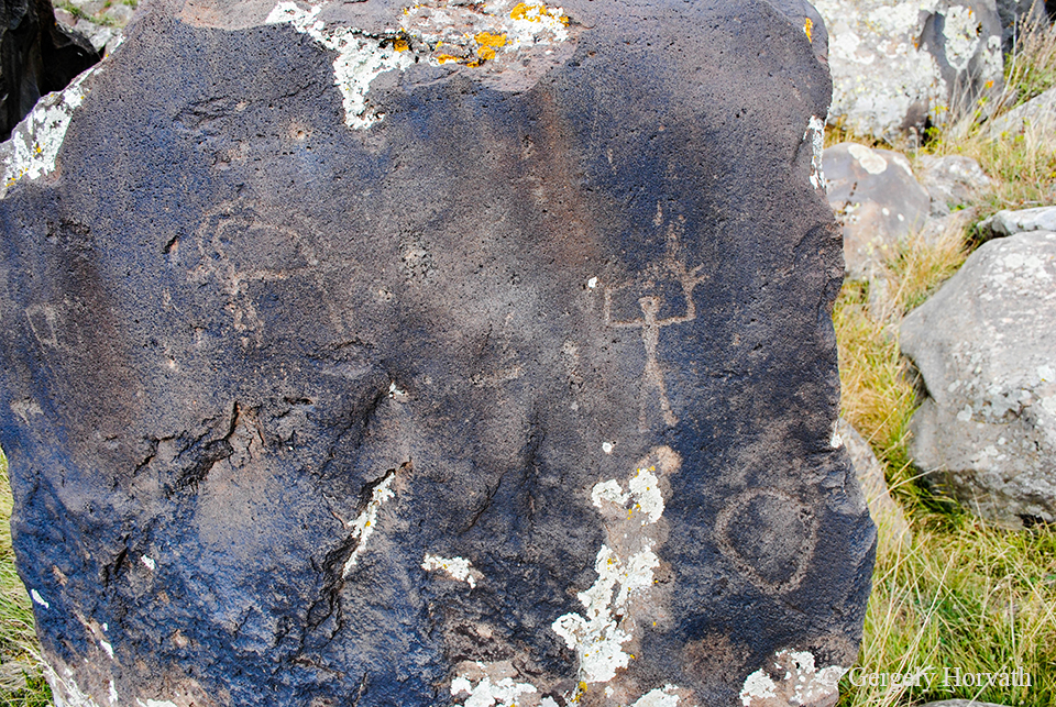
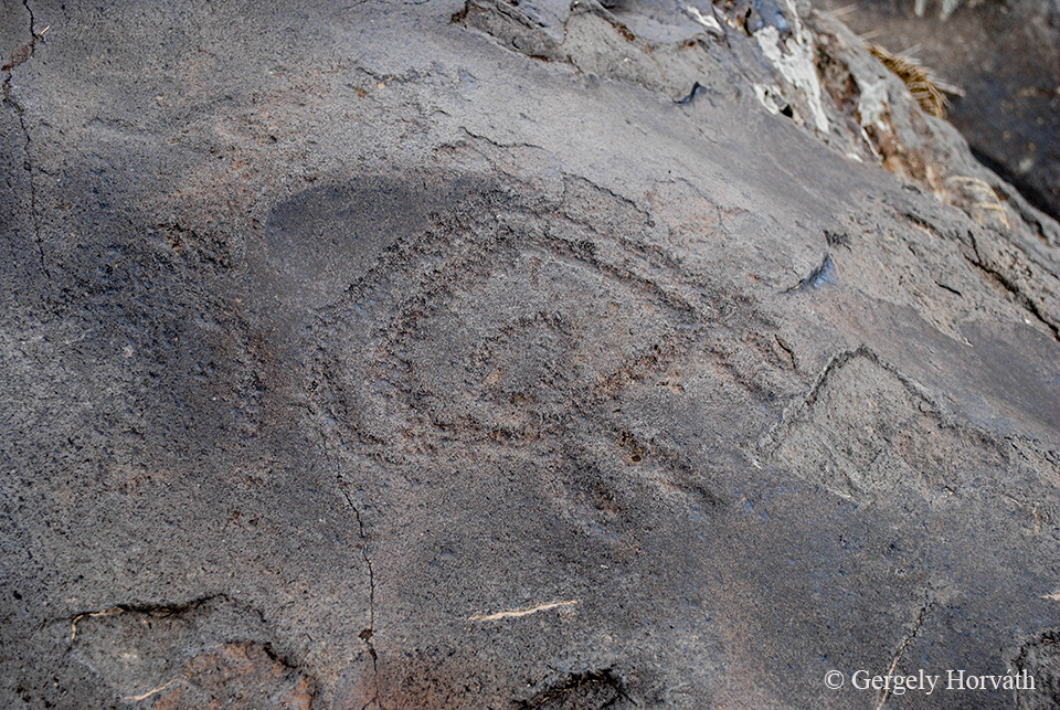
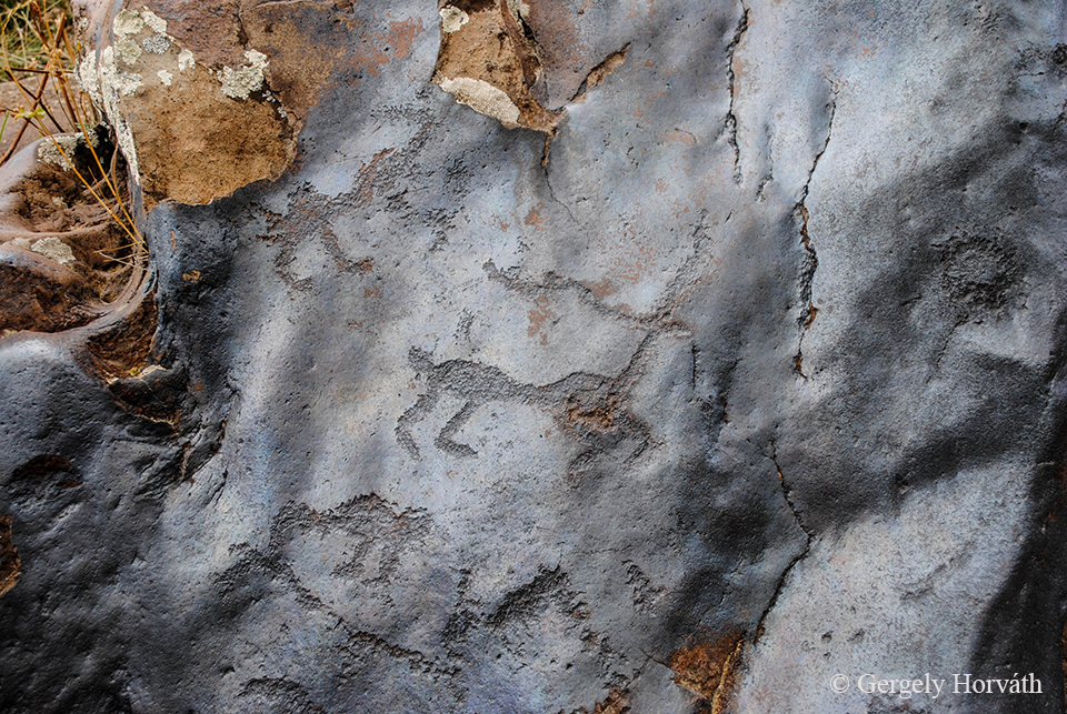
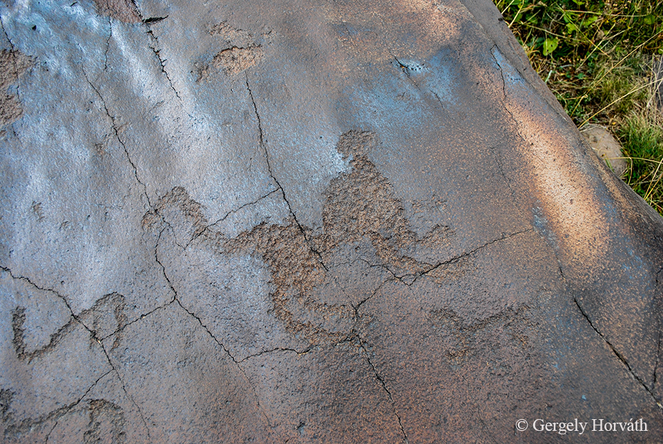
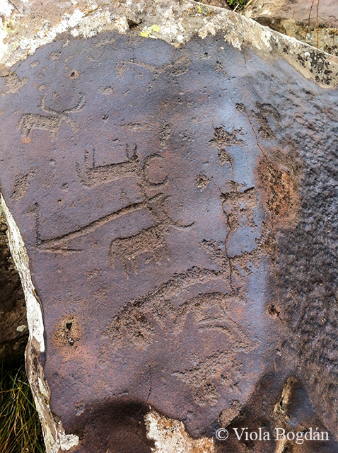
Kettőezer méter fölé érve kiszálltunk a kocsiból és nem is kellett sokat keresgélnünk, hogy az első rajzokra rábukkanjunk. Az őskőkorból származó több ezer rajz (Szaszun szerint több mint 10 ezer (!) van belőlük) nagy része haszonállatokat - főleg kecskéket - örökít meg, de találhatunk geometriai alakzatokat, emberábrázolásokat, vadászjeleneteket és az egykor itt előfordult megafauna tagjait is.
Above 2.000 meters we left the car and did not take much time to find the first petroglyphs. The several thousand carvings (According to Sasun's estimation there are more than 10.000 (!) of them) are dated back to the paleolythic era and depicts livestock, mostly goats. But we could find geometric shapes, human representations, huntung scenes and members of the megafauna once existed here.
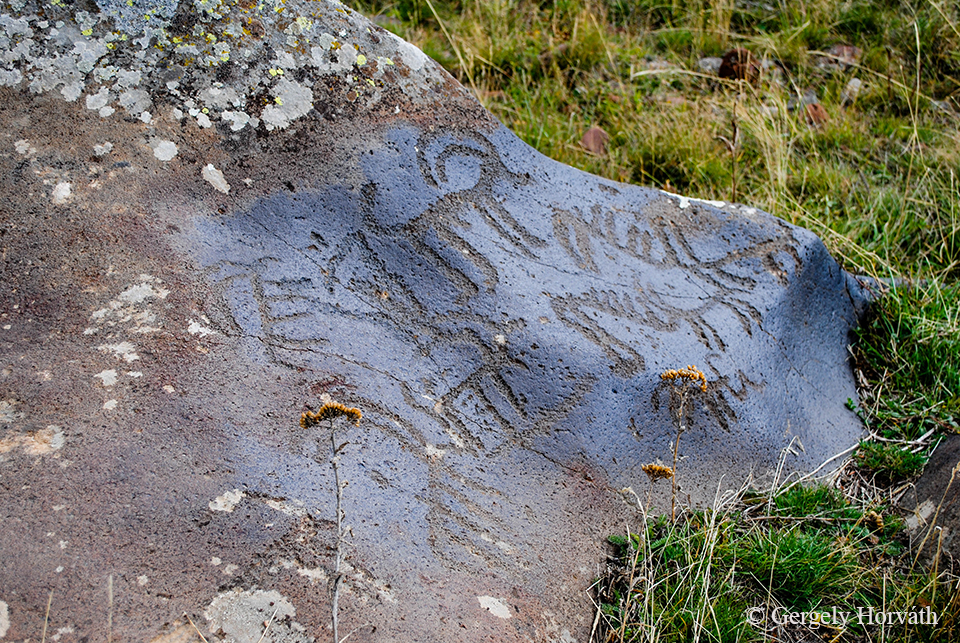
A rajzokat puha vulkáni kőzetbe vésték az egykor itt élt állattartó nomád népek tagjai és valószínűleg több száz éven keresztül használták ezt a területet, így sok rajzot kiegészíthettek az idők során.
The carvings were made by cattle-herding nomads onto the volcanic stones and since this area was used by people during several hundreds of years there are many engravings from different eras.
Kecskék mindenütt.
Goats everywhere.

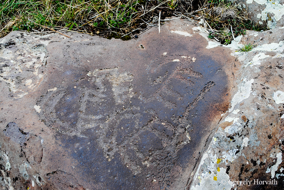
Bár a sziklarajzok létezéséről már több, mint száz éve tudnak, a kutatások nem túl intenzívek és még nem is sikerült teljes mértékben megérteni a funkciójukat. Egyesek úgy vélik, hogy egy kezdetleges írásrendszerrel van dolgunk, amire rájátszik, hogy az ősi örmény nyelvben a "kecske" és az "írás" szavak homonímák, azaz ugyanannak a szónak több jelentése is lehet, mint a magyarban pl. a "vár" szónak.
Although, the site is known for more than one hundred years, archeological studies are sporadic and we still not fully understand the role of the petroglyphs. One hypothesis suggests that these engravings are the representatives of an old writing system. This is suggested by many Armenian scholars because in ancient Armenian language the words meaning 'goat' and 'writing' were homonyms (i.e. the same word has different meanings like the word 'bow' in english).
Kecske és ember fúziója. Szaszun állította, hogy ezt a jelet most látja itt először.
Fusion of man and goat. Sasun said that this was the first time him seeing this picture here.
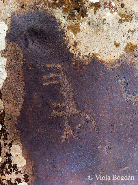
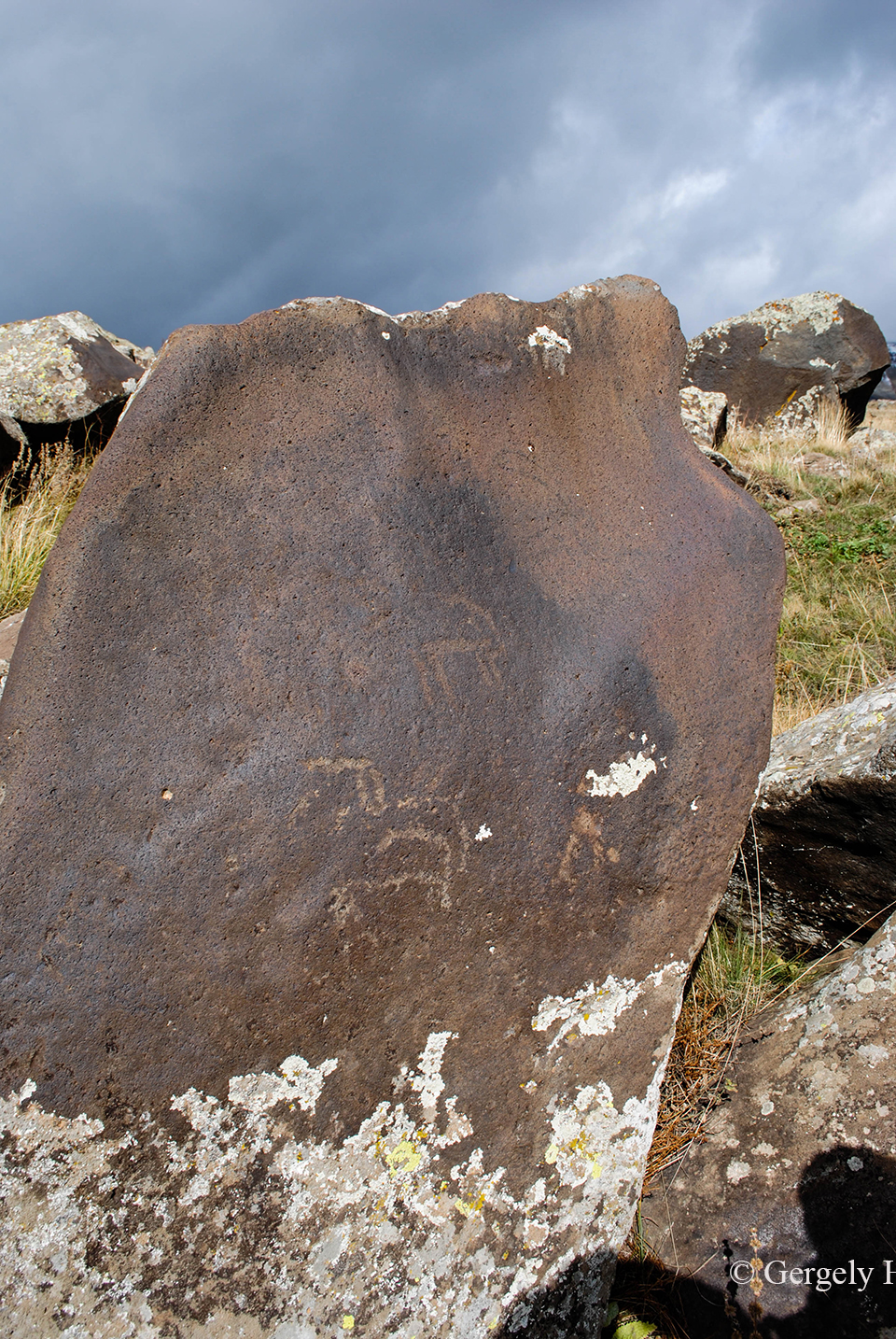
Szarvasok.
Deers.
Zseniális rajz egy nagymacskáról (oroszlán, párduc?).
Impressive depiction of a big cat (lion, panther?).
Ragadozó és bivaly (?) küzdelme.
Fight of a predator and a bison (?).
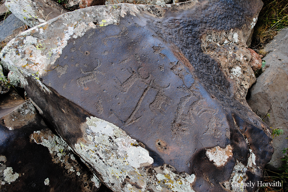
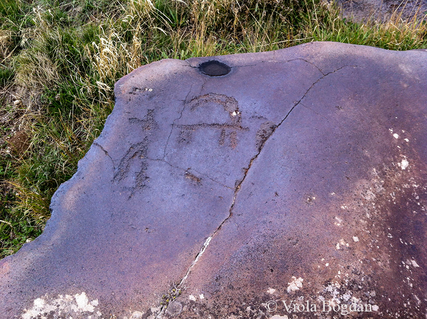
Személyes kedvencünk ez a jelenet: két, ekét húzó ökör.
Our personal favourite is this scene: two oxen pulls a plow.
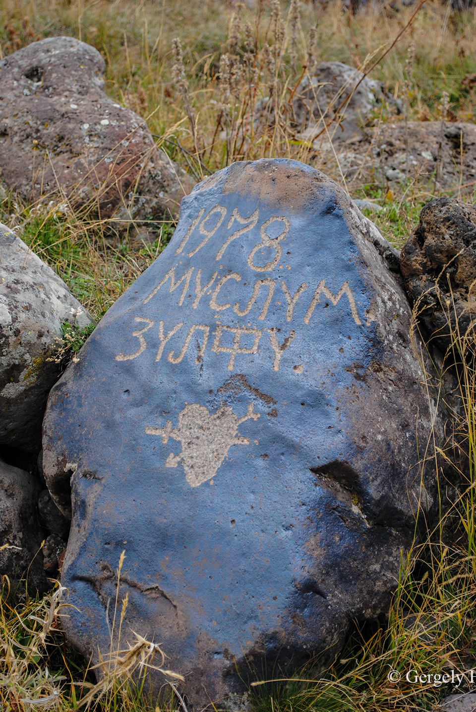
Korunkbeli sziklarajz egy azeri pásztortól, Muszlum és Zulfi szerelmét hirdetve.
A recent engraving from an azerbaijani shepherd: Muslum loves Zulfi.
Cicernakar.
Mt. Tzitzernakar.
Magára az Ugtazarra sajnos nem sikerült feljutnunk, mivel a baraátságtalan időjárás miatt szeptembertől már megközelíthetetlen. Azonban így is hálával tartozunk Szaszunnak és vendéglátóinknak, amiért két napos Szisziani tartózkodásunkat felejthetetlenné tették. Ez úton is köszönet nekik! մերսի!
Unfortunately, we could not reach the top of Ughtasar since it is mostly inaccessible from mid-September because of the unfriendly weather. Nontheless we are very thankful for Sasun and our hosting family for their kindness and help during our two day visit in Sisian. Thank you very much! մերսի!
Sziszian volt az utolsó állomásunk Örményországban, miután Jerevánon keresztül visszatértünk Grúziába. Következő posztomban Gori városát és Upliszcike romjait mutatom be.
Sisian was our last stop in Armenia, afterwards we returned to Georgia. In my next post I will present you the town of Gori and the ruins of Uplistsikhe.
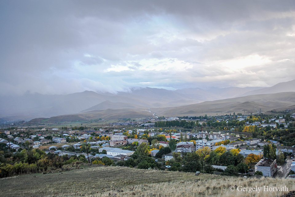
Sziszian egy közel 15 ezres városka Örményország déli részén, Szjunik tartományban. Bár a régió és a város történelme igen gazdag, ez önmagában nem predesztinálná arra, hogy kiemelt turisztikai célpont legyen. Ahhoz, hogy megértsük, miért keresik fel mégis rengetegen, nem a városban, hanem annak környékén kell válasz után keresgélnünk.
Sisian is a small town with 15.000 inhabitants in Syunik province, at the southern part of Armenia. Although, the history of this town is very rich this fact alone would not make this region a promoted tourist destination. To understand, why many people choose to travel here we should look not exactly in the town but it's surroundins.
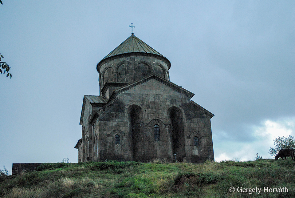
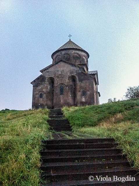
A Szent János (Szurb Hovhannes) templom, más néven Sziszavan, Sziszavank, Szjuni Vank vagy egyszerűen csak Fekete templom 691-ben épült.
The St. John (Surb Hovhannes) church was built in 691 AD. Known also as Sisavan, Sisavank or Black Church.
Bár több szempontból is erőltetett az összehasonlítás, de úgy gondolom, hogy Sziszian és Kazbegi között annyiban párhuzam vonható, hogy mindkét település turisztikai értékét a környező táj jelenti. Bár nálam Sziszian abszolút favorit, mégpedig az emberi kultúra itt megtalálható több ezer éves nyomai miatt. Mindazok a kézzelfogható emlékek, melyeket a régmúlt embere itt hagyott hátra, a lenyűgöző és első látásra fenyegetőnek tűnő hegyekkel együtt nagyon erőteljesen hozzájárulnak ahhoz, hogy egy rövid látogatás maradandó élményeket nyújtson annak, aki szán egy kis időt arra, hogy jobban körülnézzen és átjárja a környék hangulata. Nekem személy szerint Sziszian volt a kéthetes út csúcspontja, spirituális értelemben is.
Making a comparison between Kazbegi and Sisian is maybe far-teched, but both town's major turistical value is the landscape. But Sisian became my personal favourite because of the thousands of years old landmarks of human culture can be found around the town. All the memories left behind by the people of the past together with the breathtaking and menace-looking mountains creating a very unique athmosphere. I believe that if someone take the time to look around here the experience will last for a long time. For me the height of the two week journey was definetly the time we spent around Sisian.
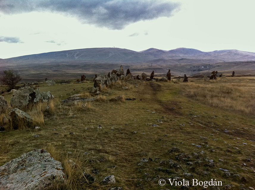
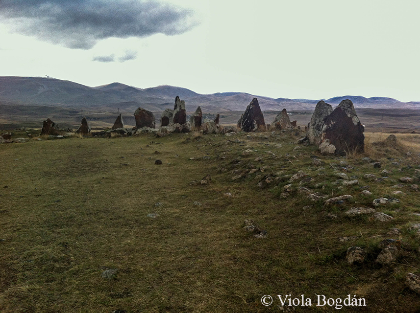
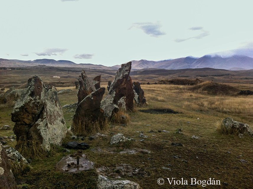
A környék fő látványosságainak egyike a Zorac Karer (más néven Karahundzs vagy Carahunge). A várostól néhány km-re északkeleti irányban, a Dar és a Vorotan folyók összefolyásánál, egy sziklaormon található bronz-vaskori kőköröket "Örmény Stonehenge"-nek is nevezik, habár angol párjánál jóval idősebb.
One of the main sights is the Zorats Karer (sometimes called as Karahunj or Carahunge) situated a few miles north-east from the town on a rocky promontory at the tributary of the rivers Dar and Vorotan. These menhirs are dated back to the Middle Bronz - Iron Age and sometimes called the 'Armenian Stonehenge' however, it's older than it's english counterpart.
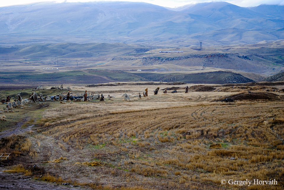
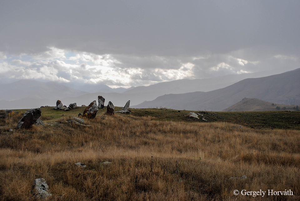
Az örmény Zorac Karer kifejezés "hadi kövek" jelentéssel bír, míg a Carahunge összetétel "beszélő kövek" értelmű, ami a szeles időben a kövek által adott fütyülő hangra utal. Ezt az okozza, hogy a kövek nagy részén egy, vagy több faragott lyuk található.
The Armenian name Zorats Karer means 'Army Stones' while the Carahunge refers to the words 'stone' and 'sound' ('Speaking Stones') since the stones making whistling sounds on a windy day because of the reach-trough holes can be found on many of them.
A lyukak miatt sokan úgy gondolják, hogy a hely csillagászati célokat szolgálhatott (2004 óta hivatalosan Karahundzs Obszervatóriumnak hívják a területet). A legnagyobb probléma ezzel, hogy az sem tudni biztosan, hogy a lyukak egyidősek-e a kövekkel. Sok tudós ezért inkább ősi településnek, nekropolisznak véli a Zorac Karert és katona-sírhelyek jelzőjét látja a kövekben.
Because the holes are bored under different angles the most popular view is that this are served as an observatory in ancient times (since 2004 the official name of the site is Karahunj Observatory). But since we do not know if the holes are prehitoric in origin, many scholars debates the purpose of the Zorats Karer for astronomical observation and claims that this place is more likely a necropolis and the stones signs tombs of soldiers.
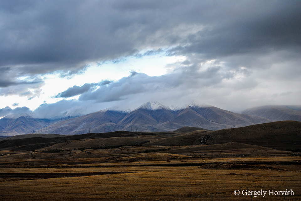
Háttérben a Zangezur-hegység. Azon túl már Nahicseván, Azerbajdzsán exklávéja és autonóm tartománya fekszik.
The Zangezur mountains in the background. Over this range lies the Nakhchivan Autonomous Republic, the exclave of Azerbaijan.
A következő bejegyzésben Sziszian másik két nevezetességéről, a Shaki vízesésről és az Ugtazar sziklarajzairól olvashattok.
In the next post you can read about the other two main landmarks around Sisian: The Shaki waterfall and the Ughtasar petroglyphs
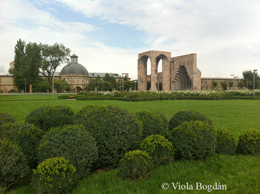
Ha Jerevánt már úgy-ahogy körbejártuk, kézenfekvő, hogy a város környékén is felfedezőútra indulunk. Temérdek lehetőség kínálkozik, nekünk sajnos sok időnk nem volt, választanunk kellett és így Ecsmiadzin mellett döntöttünk. Ez a Jerevántól mindössze negyed órára fekvő kisváros főleg azért érdekes, mert itt található az Örmény Apostoli Egyház (innentől ÖAE) központja.
If you explored most of the sights in Yerevan and you want to look outside the city there are many options to do so. Sadly our time was limited so we chose to go and take a look on Etchmiadzin. This town situated a 15 minutes’ drive from Yerevan and it’s significance come from being the centre of the Armenian Apostolic Church (from now on AAC).
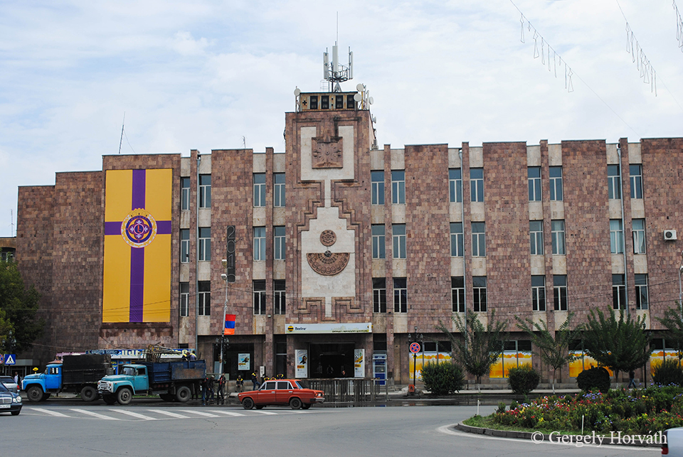
A város 1995 óta a Vagarsapat nevet viseli, de mindenki Ecsmiadzinként hivatkozik rá. A Kilikia buszállomáson (a Budapest utcában találunk meg) foghatunk kisbuszt, ami minden óra félkor indul ide. Lévén az ÖAE ebben a városban székel, rengeteg érdekességet lehet találni, amelyek még a hozzám hasonlóan vallás irányába kevésbé fogékony emberek érdeklődését is méltán felkelthetik.
The town officially known as Vagharshapat since 1995 but still everybody calls it Etchmiadzin. From the Kilikia bus station (located at the Budapest Street) minivans depart to Vagharshapat at every half past hour. Since the town is the religious centre of the AAC many interesting landmarks can be found which are worth a visit even if you are less enthusiastic about religious stuffs like I am.
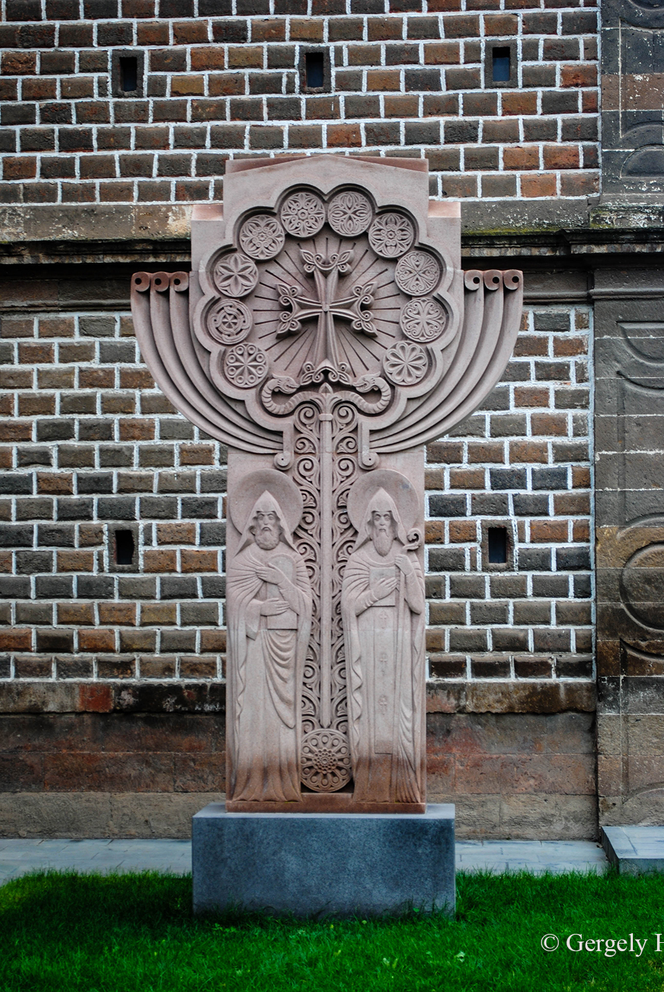
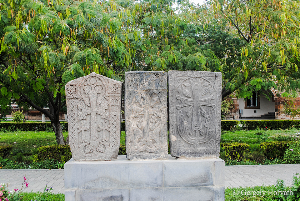
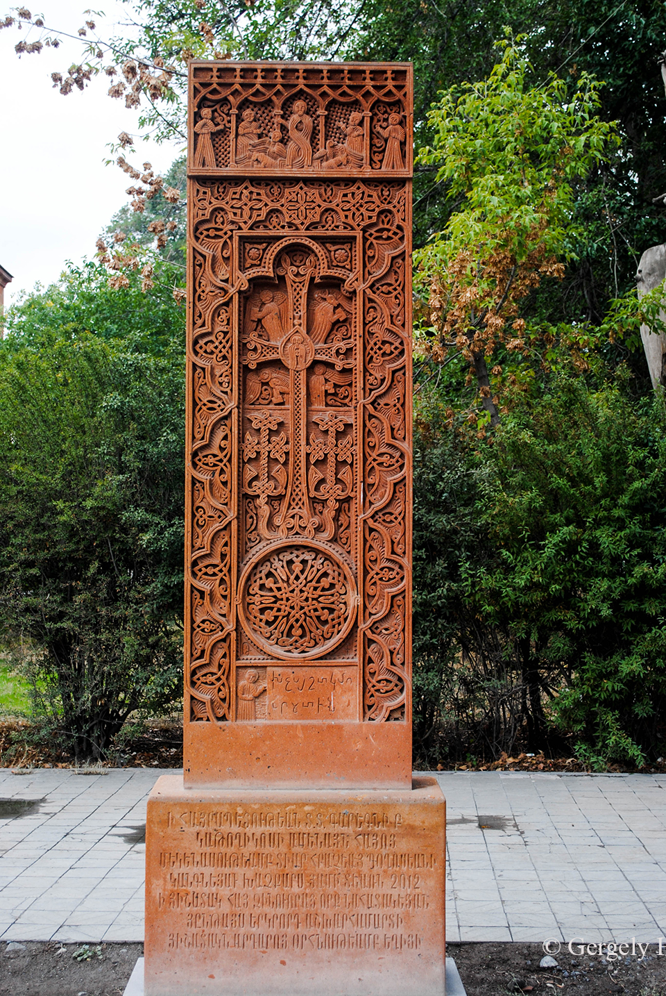
A hacskárok különösen érdekesek, ezek a rozettákkal és növényi motívumokkal gazdagon díszített kereszt-kövek nagyrészt középkori eredetűek és országszerte találkozhatunk velük.
Khachkars are quite interesting. These cross-stones are mainly made during medieval times and richly decorated with rosettes and botanical motifs.
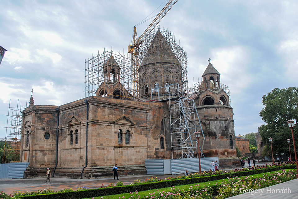
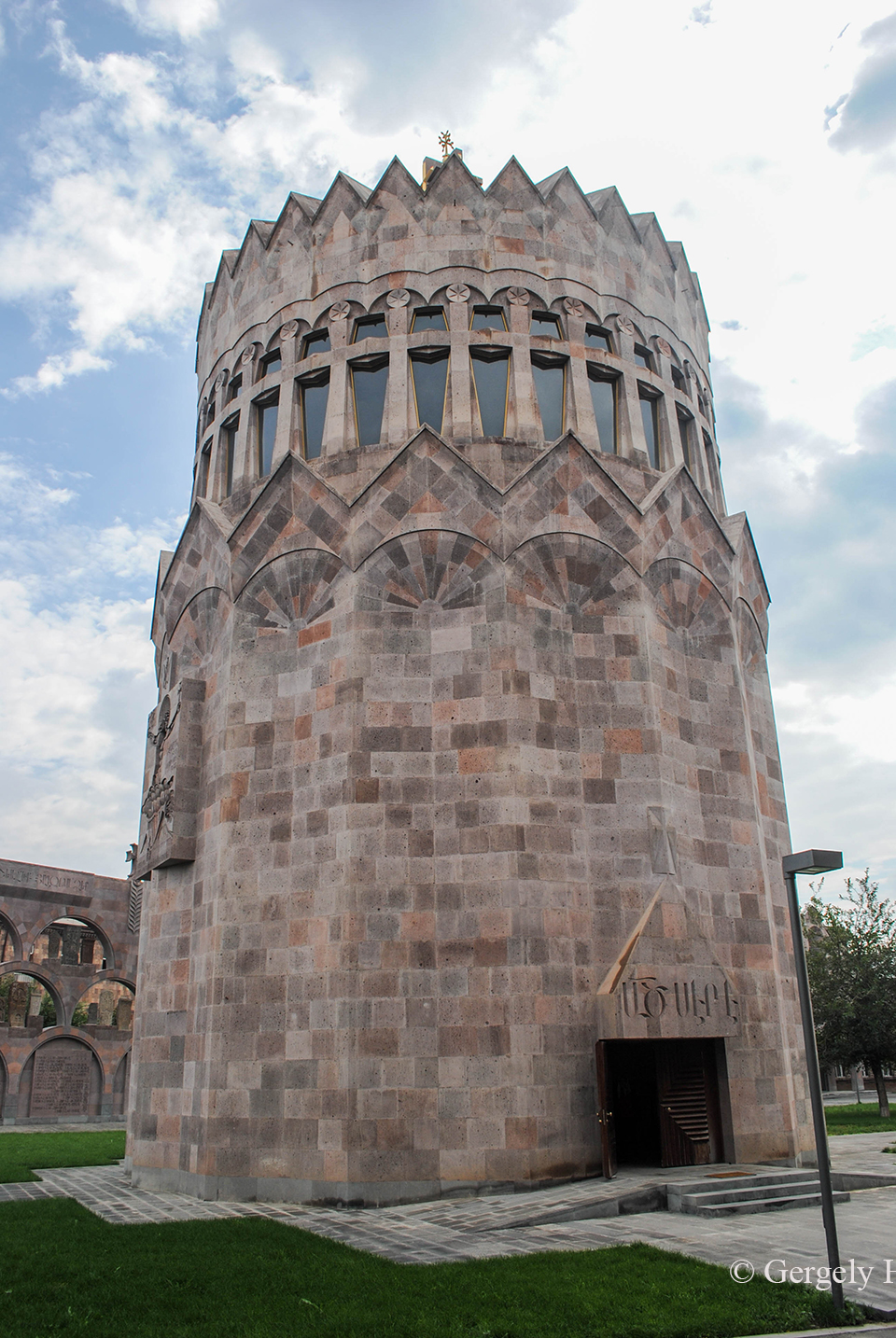
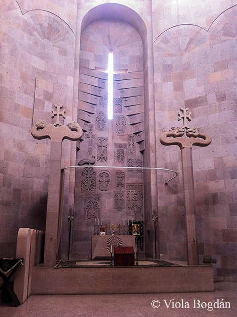
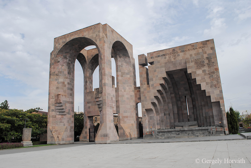
A fő látnivalót az ecsmiadzini katedrális képezi. A közvetlen elődjét képező épületet 301-ben kezdték el építeni és 303-ban a hagyomány szerint maga Világosító Szt. Gergely, Örményország védőszentje szentelte fel. A jelenlegi épület 483-4-ből származik. Ez nem csak Örményország első katedrálisává, de a világ legöregebb katedrálisává teszi és mondanom sem kell, hogy a világörökség része. Mondjuk azért itt már kezdtük azt érezni, hogy az összes templom-felújítást a mi tiszteletünkre időzítettek...
The main landmark is the Etchmiadzin Cathedral. The predecessor of this church started to build in 301 AD and it was sacred by the patron saint of Armenia himself, St. Gregory the Illuminator in 303 AD. The core of the current building dated back to 484/4 AD which makes it not only the first cathedral of Armenia but the oldest cathedral in the whole world. Do not need to say that it's on the UNESCO’s WHS list. However, we started to feel here that all reconstruction work was timed to our trip…
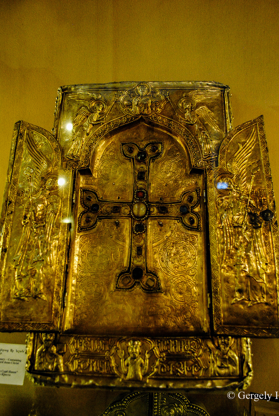
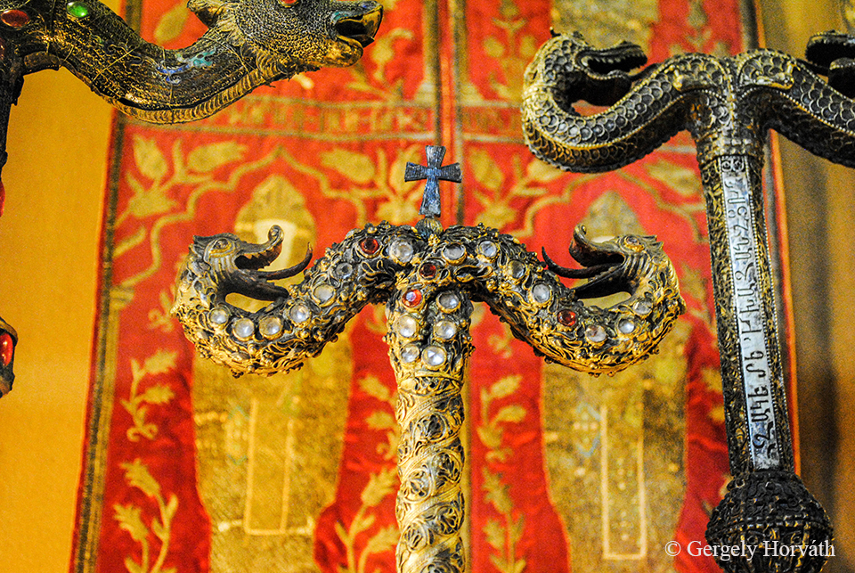
A katedrálisban egy múzeum található, ahol rengeteg kegytárgyat és ereklyét találhatunk, ráadásul nem csak olyan mondvacsináltakat, hanem azért van pár cucc, ami elég klasszisnak tűnik
Inside of the cathedral there is a museum with many religious items and relics. These are not just some kind of stuff but there can be found some big guns as well.
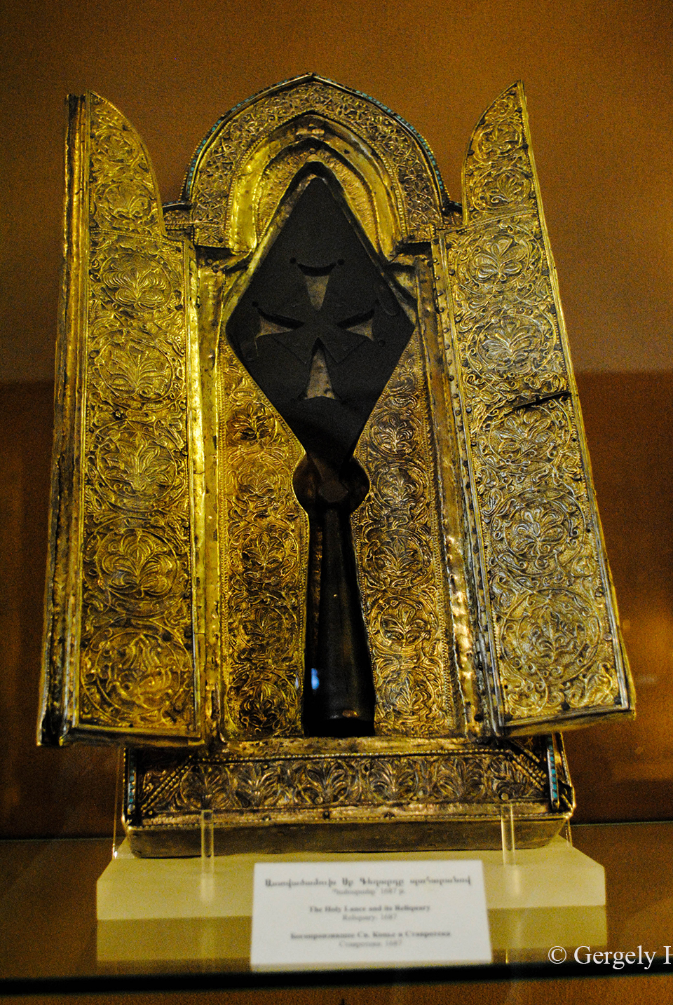
Példának okáért ez itt a Szent/ Longinusz Lándzsa, amivel a nevezett százados Krisztust átdöfte, meggyorsítva ezzel a feltámadást. Az áhítat elmúltával azért megjegyezném, hogy ilyen lándzsa található Bécsben és a Vatikánban is. Ha azonban abból a null-hipotézisből indulunk ki (csak úgy játszásból), hogy az egyiknek igazinak kell lennie, akkor azért mégis csak megvan az esélye az itt szereplő játékosnak is nyerni.
For example here is the Saint/ Longinus Lance, the weapon what the named roman captain used to make the suffering of Jesus easier and resurrection to happen. After the first shock I would like to point out that lances like this can be found in Vienna and the Vatican City as well. But, if our null model (why not?) is that one of these has to be the one, this item has a chance to win for sure.
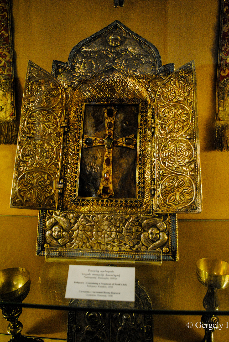
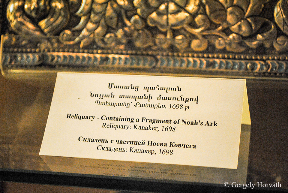
Vagy itt van mindjárt ez is, ami Noé bárkájából tartalmaz egy darabot.
Or this is an interesting one as well containing a piece from Noah’s Ark.
Ez itten pedig Jézus keresztjének egy darabját rejti.
And this is a reliquary of the piece from the cross Jesus was crucified on.
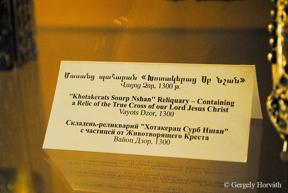
Szerintem ez a három tárgy a legérdekesebb, amit itt találhatunk, de azért vannak további nevezetességek is.
My opinion is that these three pieces are the most interesting items in the museum, but we can easily find other nice stuff as well.
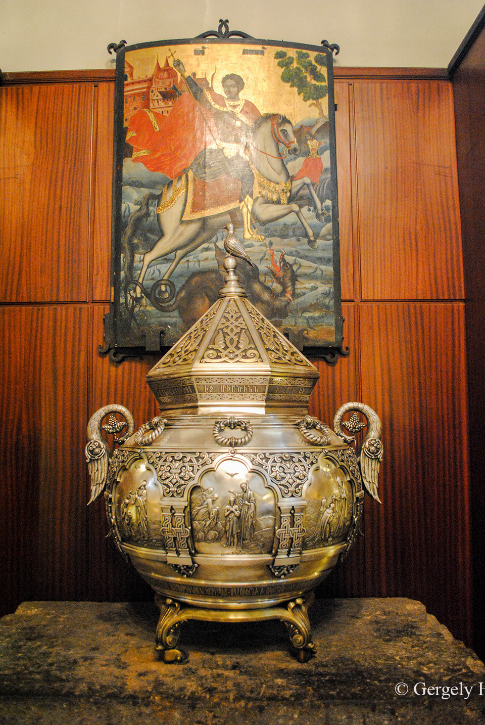
Tudomásom szerint ez az az üst, amiben húsvétkor a szentelt olajat főzik és nem is csak helyi felhasználásra, hanem minden (értsd: MINDEN) örmény templom és közösség ebből az olajból hozat magának legyen az található Örményországban, vagy a világ bármely pontján, az USA-tól Ausztráliáig.
As I know priests prepare the oil for Easter in this cauldron. And not just for themselves here in Etchmiadzin but for all (i.e. ALL) Armenian church and community, from the USA to Australia, gets the oil to the holiday from here.
Ecsmiadzinban képzik a papok eljövendő generációját is. Nekik húzták fel pár évvel ezelőtt ezt az összkomfortos szemináriumot.
The next generation of priest study in Etchmiadzin. This all inclusive seminar was built for them.
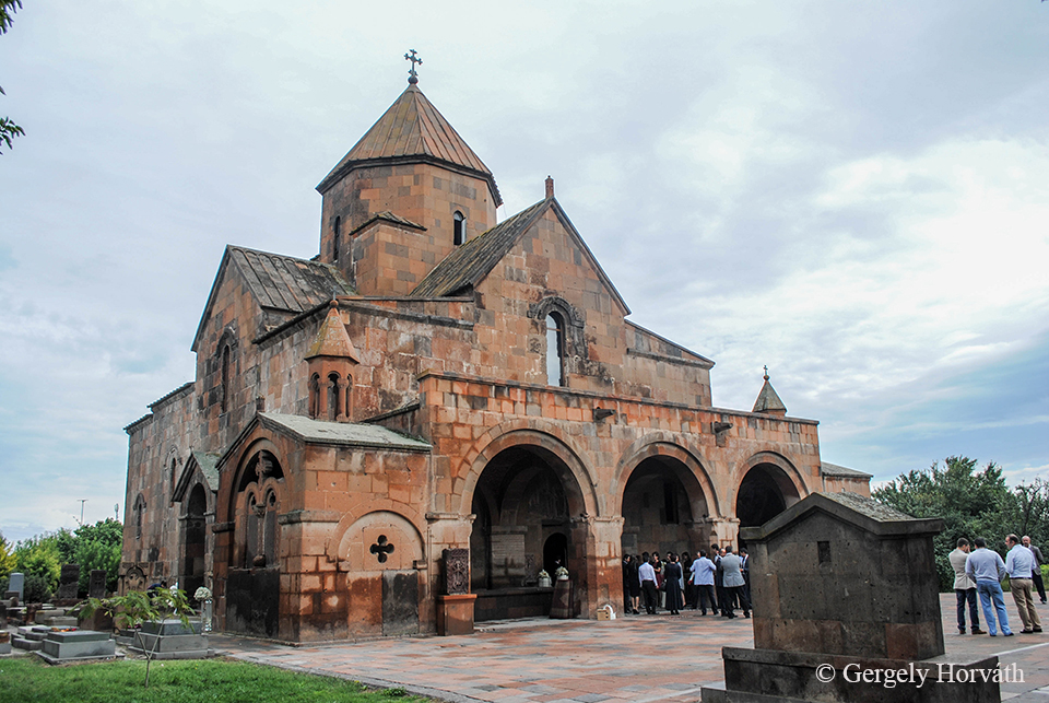
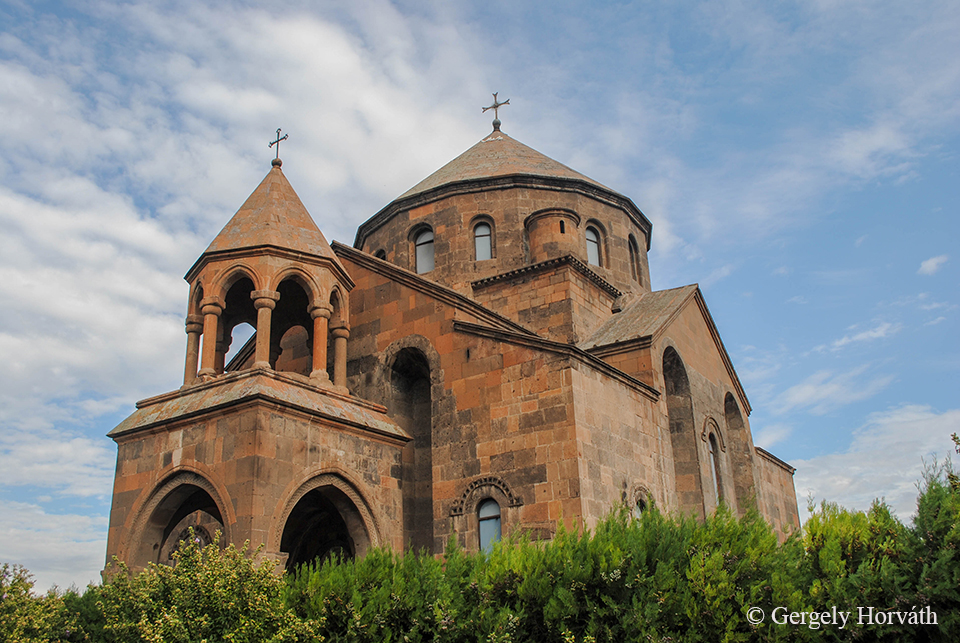
Ez itt a Szt. Gayene-ről elnevezett templom, amit 630-ban emeltek.
This is the St. Gayene church built in 630 AD.
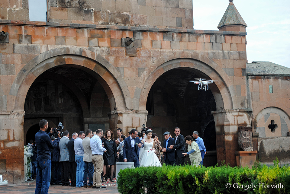
Ottjártunkkor épp esküvő volt.
We ran into a wedding.
Ez pedig az előbbi templom párja a Szt. Hripsziméről elnevezett, 618-ból. Mindketten az örmény kereszténység első mártírjai voltak.
And this is the pair of the former church named after St. Hripsime built in 618 AD. Gayene and Hripsime were the first martyrs of the AAC.
Utunk Jerevánból Dél Örményországba vezetett, ahol az örmény őskőkor és bronzkor emlékeit, az Ugtazar sziklarajzait és a Zorac Karert kerestük fel.
From Yerevan we travelled to the south to visit the meorials of Armenian Paleolithic Era and Bronze Age, the petroglyphs of Ughtasar and the Zorats Karer.
Jerevánba kissé feldúlt állapotban sikerült megérkeznünk, ami csak részben volt köszönhető a több, mint 6 órás buszozásnak. Ez, valljuk be, még akkor is nagy büntetés, ha az ember útitársait nem emelik ki a határon a sorból az egész csapatot másfél órás veszteglésre kényszerítve ezzel Grúzia és Örményország között. Viszont legalább alkalmunk volt kicsit kinyújtóztatni tagjainkat. Az ember naivan arra számítana ugyanis, hogy 300 km-es távon azért csak betervez a sofőr egy vagy optimális esetben kettő pihenőt, nem pedig lendületesen terjegetve, szigorú „Davaj, davaj!” kiáltásokkal igyekszik mindenki kedvét elvenni az anyagcsere-folyamatok folytatásának még csak gondolatától is. Gyanítom, ha nincs a határ, sofőrünk egyhuzamban letudta volna az egész utat, és a végén is csak nagy duzzogva kanyarodik be a Kilikia Buszállomásra. Mindezt betetézendő, szállásunkra egy óra keresgélés után találtunk rá, hála az internetes foglalás során (szerintem) helytelenül feltüntetett címnek. Szóval kicsit megtört bennünk valami, na.
We managed to arrive to Yerevan in a bit distressed state, what was just partly the outcome of the more than six hours of bus-ride. This, to be frank, a big punishment even if some of your co-travellers would not uphold by border guards forcing the whole group to wait one and a half hours at the Georgian-Armenian border. As it turned out though, this forced rest had some positive outcomes, as at least we had a chance to stretch our limbs. You’d think that the driver makes minimum one but optimally two stops during a 300 kms long travel rather than dynamically brandishing with his arms and yelling ’Davai, Davai!’discouraging everyone even thinking about to continuing metabolic processes. I suppose that if there were no border at all, our man would carry out the whole ride at once and at the very end stops pouting at the Kilikia Bus Station. On top of everything we found our hostel after one hour of intensive searching in the outskirts of the city, as the address was given wrong during the booking. So we lost our cool a bit.
Itt jegyezném meg, hogy a legendás Kaukázusi vendégszeretet és hihetetlen segítőkészség Örményországban csapott arcul minket igazán. Tényleg hihetetlen, de még közös nyelv teljes hiányában is mindenki a lehetőségeihez mért maximális mértékben megpróbált nekünk segíteni. Mikor magyarázza el Pesten kézzel-lábbal a pénzváltó, hogy melyik busszal kell eljutni oda, ahova akarsz? Vagy ajánlja fel a buszon utazó totál ismeretlen személy, hogy megfogja a táskádat, hogy ne kelljen görnyedezned, ha már egyszer nem jutott hely? Vagy szól hátra a buszsofőr, hogy itt kell leszállni? Ugye- hogy- ugye? Bárhova mentünk is az országban, csupa jó fej emberbe ütköztünk, akik mindent megtettek kényelmünk érdekében. Ez úton is köszönet és üdvözlet nekik! Örményországra is igaz egyébként, hogy oroszul gyakorlatilag mindenki tud, úgyhogy pár szó ismerete csodákat képes tenni, de rengetegen és kiválóan beszélnek angolul is, főleg a fiatalabb generáció tagjai.
However, I would like to note here that we experienced the legendary Caucasian hospitality in Armenia whit an overwhelming intensity from the very beginning. It’s truly amazing that everybody tried to help us as far as possible and in some cases even the lack of the common language wasn’t a problem at all. Just ask yourself, when would the guy at the exchange office tell you, mostly signing with his hands, which bus you need to take? Or when would a total stranger on the bus offer you that he/she will hold your bag, as you have no space left to hold your belongings comfortably? Or when would the bus driver call you from the back of the vehicle that we are at the exact stop you’re looking for? Honestly, I never met such a hospitality in Europe. Wherever did we go across the country, we met super nice and cool people, who did everything to make us feel comfortable. Many thanks and cheers to them! By the way, as in the whole region the most useful language in Armenia is Russian too. Literally everybody understands and speaks Russian on some level. Learning a few phrases will open many gates, however, many young people speaks very well English too.
A hat órás utat persze mivel mással lehetne elütni, mint fotózással, amire az Örmény-felföld rengeteg okot szolgáltat, lássunk is párat:
What could you do during a six hours bus-ride than taking pictures? The Armenian Highland offers perfect themes let’s see a few:
Az örmény népirtás emlékezete elevenebb, mint valaha és az áldozatoknak szentelt emlékhelyek szinte mindenhol megtalálhatóak.
The memory of Armenian genocide is more vivid than ever and memorials could occur anywhere.
Személyes benyomásom az, hogy az örmény főváros minden porcikájából modernség árad, bár kevésbé karakteres, mint Tbiliszi. A belvárosban járva – és eltekintve az örmény betűs feliratoktól – szinte már egy nyugat európai nagyvárosban érezhetjük magunkat. Ez azért is lehetséges, mert bár a Jereván közvetlen elődjét képező erődöt Kr.e. 782-ben alapították (Rómánál 29 évvel öregebb!) a szovjet időkig nem volt jelentős település, úgyhogy a 20. században fejlesztették fel igazán.
My personal impression is that Yerevan is a very modern and vibrating city, however, less characteristic than Tbilisi. Walking around the downtown you might even think that you are in a western European city, aside from the unique Armenian script of course. This mainly comes from the fact that Yerevan was a provincial town till the early 20th century and in its current form it was built mainly during the soviet era. This is a bit controversial though considering that Yerevan is a REALLY ancient city since the fortress which was the predecessor of the city was funded in 782 BC. This means that Yerevan is 29 years older than Rome. Quite impressive I think.
A város alapításának emlékére állított tábla.
Plaque commemorating the foundation of the city.
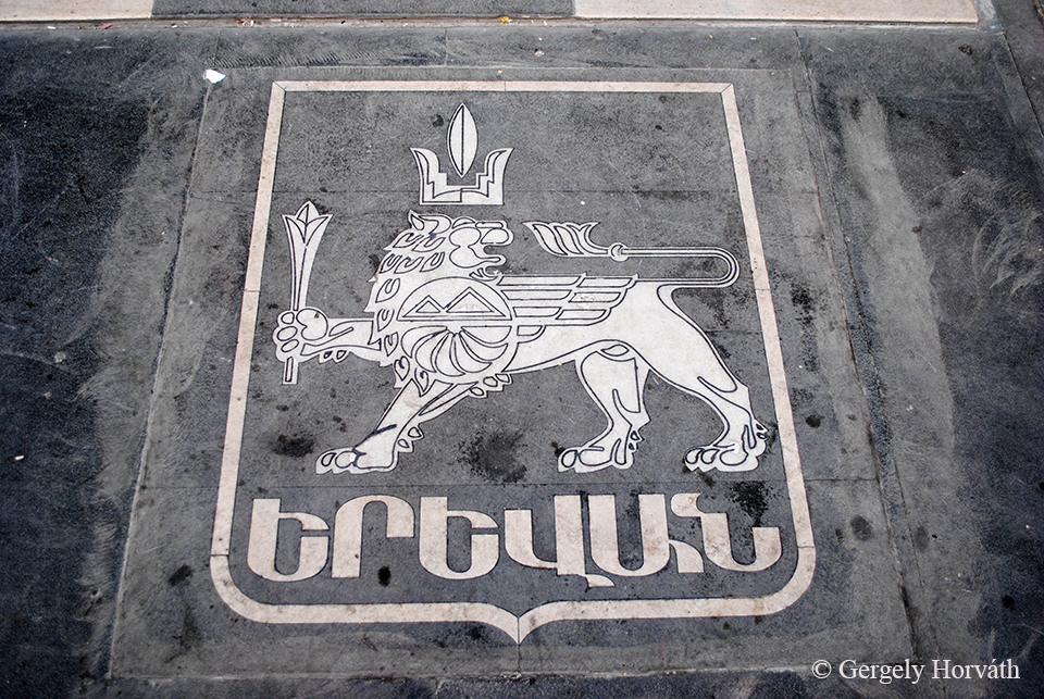
Jereván címere.
Coat of arms of Yerevan.
Nem csak Jereván, hanem Örményország és az örmény kultúra is igen ősi gyökerekkel rendelkezik. Ezt mi sem bizonyít jobban, mint hogy amikor 1918-ban Örményország elnyerte függetlenségét az Orosz Birodalomtól, a fővárossá kikiáltott Jereván immár 13. volt ebben a sorban. Az akkor 30 ezres kisváros a 20. sz. intenzív városfejlesztési munkálatainak köszönhetően ma már bő 1 millió lakossal rendelkezik. Ez Örményország lakosságának 1/3-a!
Not only Yerevan has ancient roots but Armenia and the Armenian culture as well. When the First Armenian Republic became independent from the Russian Empire in 1918 Yerevan was chosen to be the 13th capital of the Armenian nation. Back then the town had 30.000 inhabitants but through the intensive urbanization and development during the 20th century the city has now more than 1 million inhabitants. This is one-third of the population of Armenia!
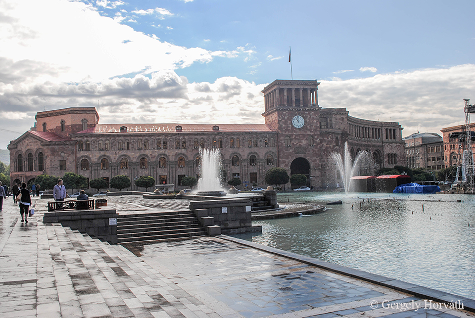
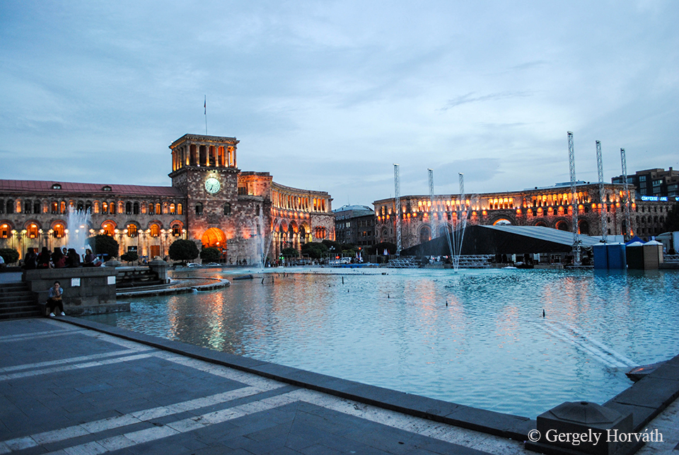
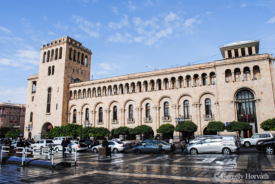
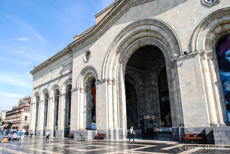
A köztársaság tere az 1920-as években épült a város szívében, de végső formáját csak 1958-ban nyerte el. Ma itt található többek között a Nemzeti Galéria, számos minisztériumi épület, és az Örmény Kormány Központi épülete (itt felül). Az épületeket, Örményország egész területére jellemző módon, vulkáni tufából faragott kövekből emelték. Fehéres-rózsás színűk miatt Jerevánt gyakran „Rózsás városnak” vagy „Rózsaszín városnak” becézik.
In the heart of the city the Republic Square was built in the 1920s but it was finished only in 1958. Here you find the National Gallery, buildings of many ministries and the Government House of Armenia (on the picture). The buildings, as you can notice all across the country, are built of volcanic tufa. The white-pink colour of these bricks gave Yerevan the nicknames ‘Rosy city’ or ‘Pink city’.
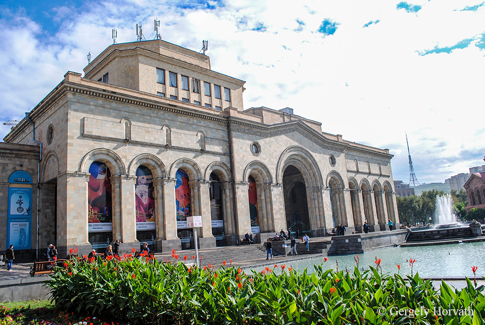
Nemzeti Galéria.
National Gallery.
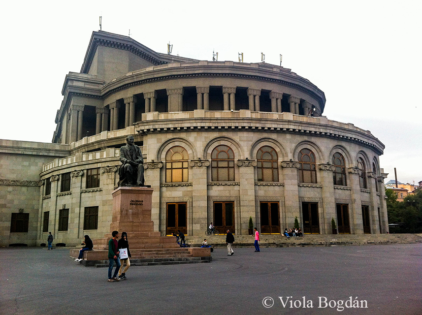
Az Örmény Opera épülete.
The Armenian Opera House.
Arno Babadzsanjan zongorista szobra.
Statue of pianist Arno Babajanian.
A város ottjártunkkor ünnepelhette 2797. születésnapját.
The city celebrated its 2797th birthday at the time we were there.
A Központi Piac bejárata.
Entrance of the Central Market/ Prospect Mall.
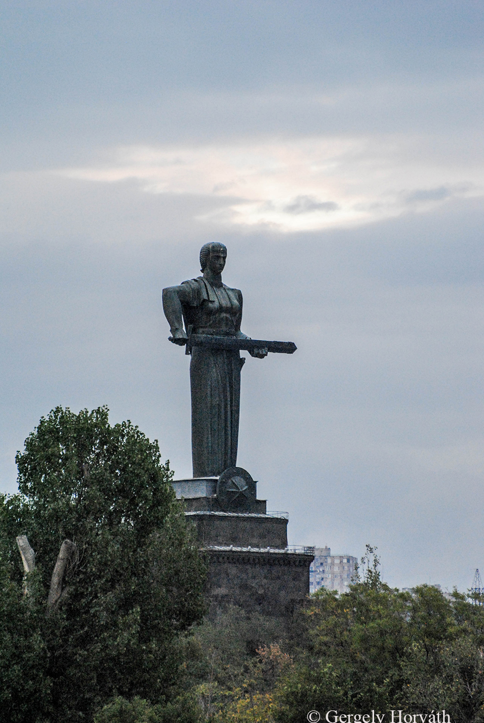
Majr Hajasztan (Örményország Anyácska) a város feletti dombon, a Győzelem Parkban található. Grúz párjához hasonlóan a nemzet megtestesítője, ám sokkal nagyobb, mivel talapzattal együtt 51 m magas. 1967-ben állították, a korábban itt található Sztálin szobor helyére. Ma itt található az Örmény Hadtörténeti Múzeum.
Mayr Hayastan (Mother Armenia) guards over the city at the Victory Park. Like its Georgian counterpart this statue is the female personalization of Armenia, however, it is much bigger as together with the pedestal it’s 51 m tall. This statue was erected in 1967 replacing the statue of Stalin formerly stood here. Now the Armenian Military Museum can be found in the pedestal.
Alexander Tamanian szobra. Az orosz születésű építész munkásságához köthető a modern városkép kialakulása.
Statue of Alexander Tamanian, the Russian born Armenian architect who designed most of the modern Yerevan.
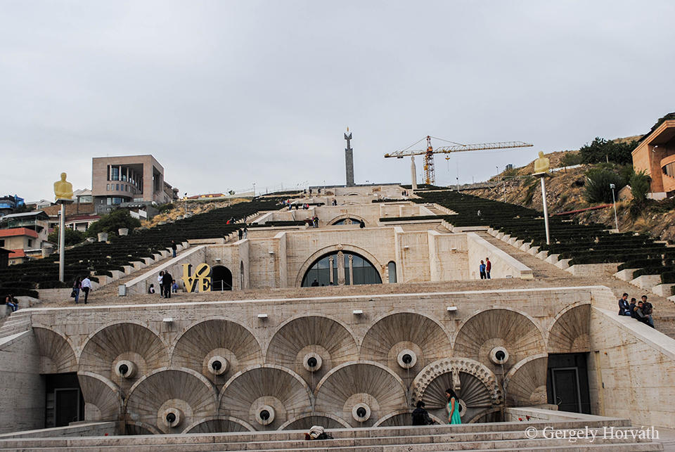
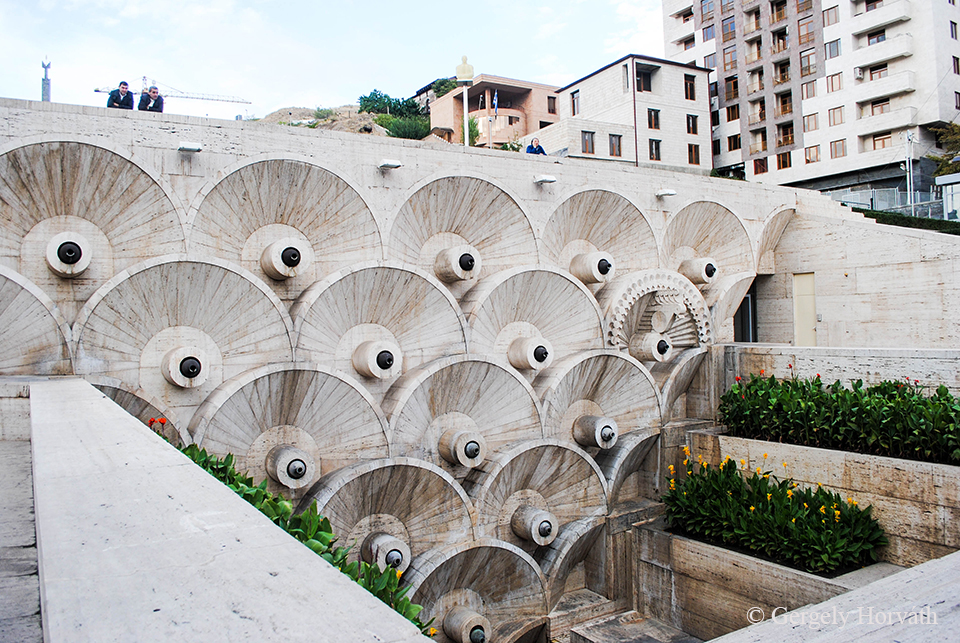
A város talán legnagyobb nevezetessége a Kaszkád. Ez a tulajdonképpeni lépcsősor 1971-80 között épült a város egy dombjának oldalába. A 2000-es évek során végzett felújítási munkálatok nyomán ma nyílt kiállítótér és múzeum. Az épület belsejében működik a Gerard Cafesjian Művészeti Központ, emléket állítva az örmény-amerikai üzletembernek, aki a felújtást finanszírozta.
Maybe the biggest landmark of the city is the Cascade. This stairway was built between 1971 and 1980 on one of the hillsides of the city. It was renovated and expanded during the 2000s so now it is an open museum and exhibition centre. Inside of the building the Cafesjian Centre of Arts is situated memorised to Gerard Cafesjian, an American-Armenian businessman who financed the reconstruction works.
A Kaszkád tetejéről jó kilátás nyílik a városra és környékére. Igaz, hogy a képen a légköri viszonyok nem igazán kedvezőek, de azért a háttérben felsejlik az örmény nemzeti büszkeség non plus ultrája, az örmény címerben is szereplő és számunkra a bibliából jól ismert hegy, az Ararát (örményül Maszisz).
From the top of the Cascade you have a good view on the city and it’s surroundings. The weather wasn’t the best here, but in the background you might see the mountain which is represented in the Armenian coat of arms and the Bible as well. The non plus ultra of the Armenian national pride and the most important symbol of the nation: Mt. Ararat (Masis in Armenian).
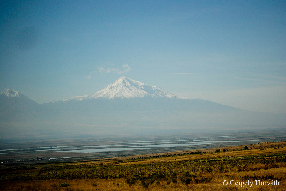
Itt már teljes valójában látható az 5137 m magas csúcs, ami az örmény hagyományok szerint az istenek lakhelye. Valójában egy vulkánról van szó, ami nem is olyan rég még aktivitás jeleit mutatta. Több kilométeres körzetben nincs olyan hely, ahonnan ne látnánk. Az már a kis népek történelemhez való viszonyát tükrözi, hogy a határ túloldalán, Törökországban található. Azt hiszem, ezzel együtt tudunk érezni.
Here you can see the 5.137 m high Ararat better. According to the Armenian legends, this is the home of the gods. In fact it is a stratovolcano with recent historic activity. You cannot find any spot in several miles radius where you can’t see it. Sadly, the history was never gentle or fair with small nations so today it is located in Turkish territory. We could feel sympathy about that I think.
Kilátás szállásunk ablakából.
View from our hostel window.
Végezetül egy fontos információ, amit Sopron lakóival szeretnék megosztani, mert valószínűleg őket is ugyanúgy marja a kíváncsiság, mint ahogy engem is kínzott: Van-e Sopronról elnevezett lakótelep az örmény fővárosban? Ha ezt nem is, de egy “Shopron” nevű utcát azért sikerült találnom a külvárosban. Azt hiszem, ezt elfogadhatjuk, nyugtázva, hogy a testvérvárosi viszony azért elhibázott politikai döntések ellenére valamilyen formában még mindig éldegél.
At the end I would like to share a very important finding with the people of my favourite Hungarian town, Sopron. I think they are as curios about this vital question as I was: Is there anything named after Sopron in the Armenian capital? Well, there is a ’Shopron’ street at the outskirts. I think it’s close enough. Despite all bad political decisions, the memories of the former partnership between the two settlements still can be found.
Egy röpke ecsmiadzini kitérő után Jerevánból utunk Dél-Örményországba, Szjunik tartományba vezetett, ahol a helyi kultúra legkorábbi hagyatékaival, az Ugtazar sziklarajzaival és az "örmény Stonehenge-dzsel", a Zorac Karerrel ismerkedtünk meg.
After a short visit to Etchmiadzin our travel continued to Syunik province in southern Armenia, where we found the oldest representers of local culture: the petroglyphs of Ughtasar and Zorats Karer the 'Armenian Stonehenge'
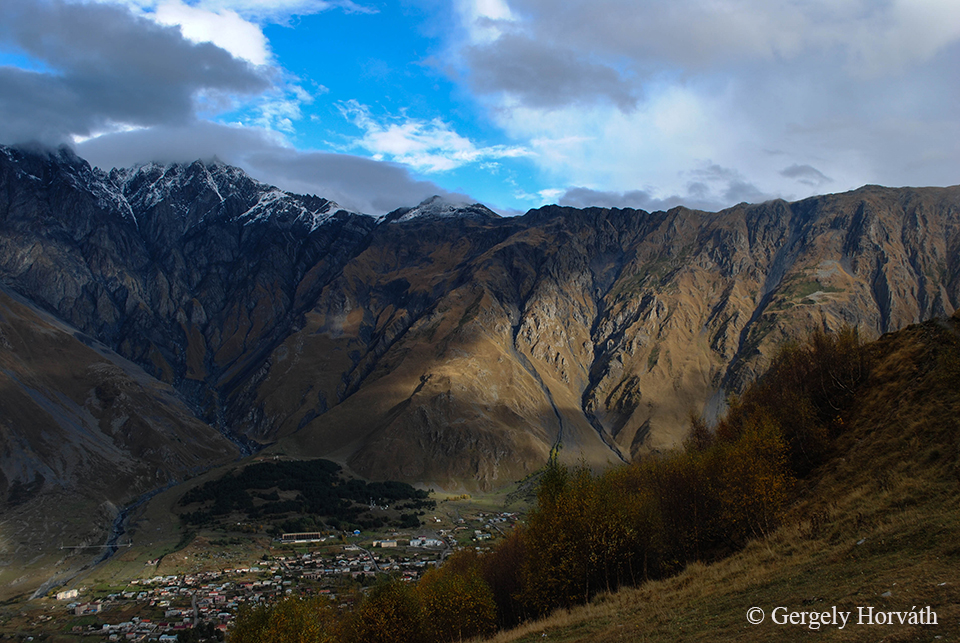
Azt hiszem nem túlzás kijelenteni, hogy ha valaki nem járt Kazbegiben, nem látta Grúziát igazán. Bár számtalan más hely is kínálkozik az országban annak, aki túrázásra, vagy hegymászásra vágyik, Kazbegi környékén mégis van valami, ami Grúzián belül is egyedivé teszi, ez pedig nem más, mint a grúz hadiúthoz való közelsége.
I think it's not an overstatement to say that if you haven't visit Kazbegi you haven't really saw Georgia at all. Sure one who looks for trekking or mountainclimbing oppurtuities could find other regions in the country to do that, but Kazbegi possess something what makes it's surroundins unique. And that is the fact that it lies at the Georgian Military Road.
Tbilisziből indulva a Didube buszállomáson tudunk marshrutkát szerezni az úthoz. Ez nem túl nehéz, mert bár maga az állomás elég kaotikus és inkább piac, mint tömegközlekedési csomópont (egy székely srác szavaival élve, akivel Tbilisziben találkoztunk: „Talán még halott embert is árulnak ott.”), az önjelölt sofőrök már a metróból kilépve ajánlják szolgáltatásaikat. Hivatalosan fejenként 10 grúz lari a viteldíj (jelen pillanatban ez 1202,15 HUF ill. 3.83 €), mi 15-ért mentünk de nem bántuk meg, mert sofőrünk olyan helyeken is megállt, ahol amúgy nem szokás, így volt lehetőségünk remek képeket készíteni útközben is.
The easiest way to get to Kazbegi is from the Didube bus station. This is not as hard as it looks first, however, the bus station itself looks more like a very-very chaotic market (I would like to quote here a Székely guy we met in Tbilisi: 'If you really want you can buy a goner there.') but as you step out from the subway many drivers will offer you a ride and you can easily find a guy who takes you to Kazbegi.Official fare should be 10 Lari per person (considering the current rate it means 3.83 €). We travelled for 15 but we did not regret to do so as our driver made several stops at locations where usally they don't so we had chance to make superb photographs during our way.
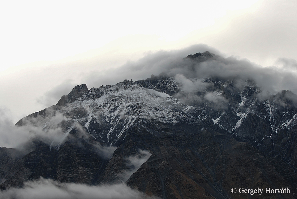
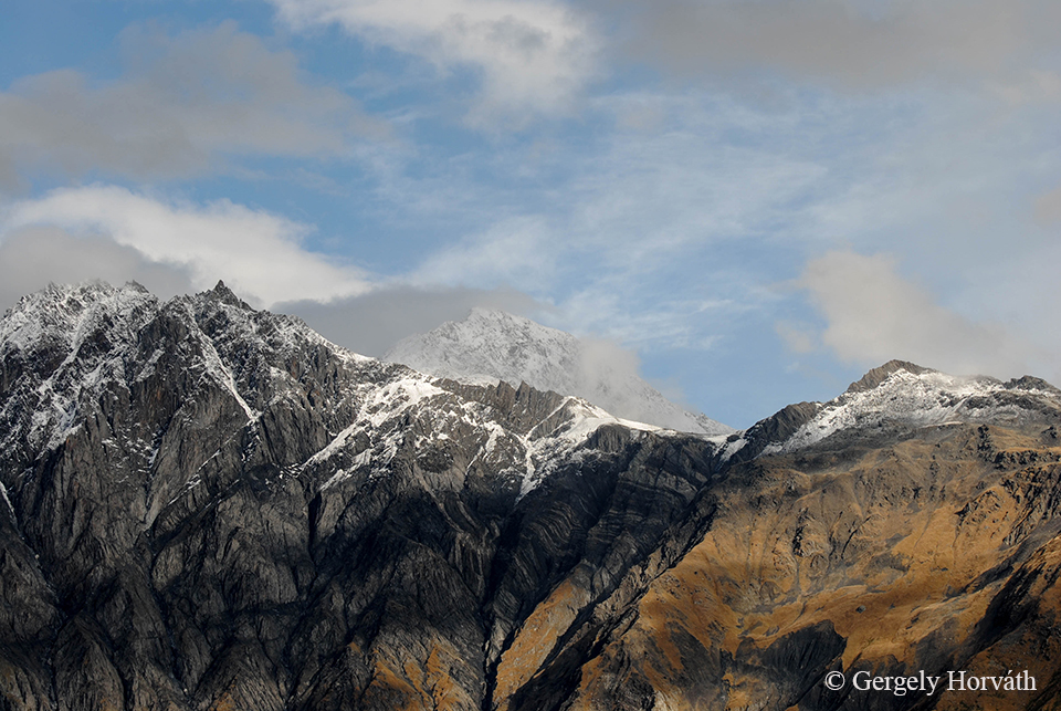
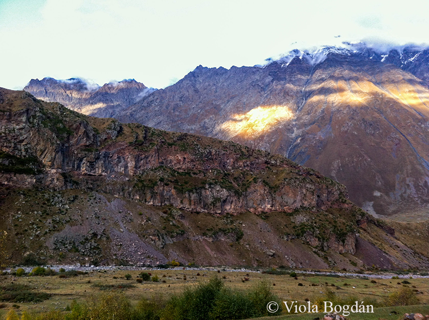
Maga a grúz hadiút Tbiliszi és Vladikavkaz között fut (Oroszország Észak-Oszétia nevű szövetségi köztársaságának fővárosa, a Kaukázus túloldalán) 212 km hosszan, részben a Terek folyó völgyében. Több ezer éve használják ezt az útvonalat kereskedők és főleg hódító szándékkal érkező hadseregek egyaránt. Mivel átszeli a Magas-Kaukázust, már a Kazbegibe való eljutás is páratlan élményt nyújt, de beszéljenek innentől inkább a képek:
The Military Road connects Tbilisi and Vladikavkaz (the capital of the Russian federal republic North Ossetia-Alania at the northern side of the Caucasus). The total length of the road is 212 km and it's partly follows the valley of the Terek River. It serves as route for traders and (mostly invading) armies for thousand of years and as it crosses trough the Greater Caucasus the scenery is spectacular. But I let the pictures speak for themself:
Első megállónk az Ananuri erődnél. A Tbiliszitől 45 km-re északra, az Aragvi folyó partján álló erődrendszert az Aragvi klán építtette a 13 században.
Our first stop was at the Ananuri fortress at the Aragvi River. This place situated 45 km north of Tbilisi and it was built by the Aragvi clan during the 13th century.
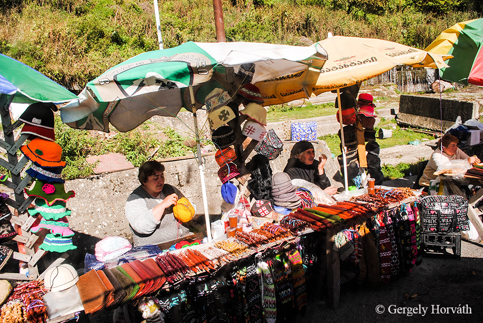
Egész Grúziában jellemző, hogy a forgalmasabb utak mentén és nagyobb megállóknál helyi termelők árulják portékájukat. A nénik előtt látható kolbász-szerű étel a csurcskelá, ami valójában zsinórra fűzött dióból vagy aszalt gyümölcsből készült, szőlőszirupba mártogatott édesség. Csak ajánlani tudom! A színes, zsírpapír szerű cucc is szárított szőlőszirup egyébként.
In whole Georgia you can see locals selling their products along the roads or at bigger resting stops. Here the ladies sell churchkhela which are the sausage like things on the table. In fact, these are sweets made from string of nuts or dried fruits dipped in grape juice. Highly recommended! The other differently coloured paper like sweets are made from grape juice as well.
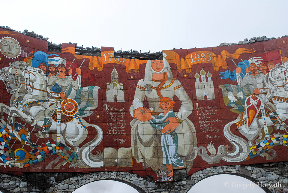
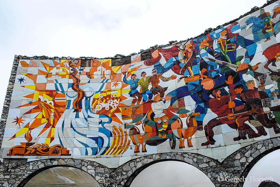
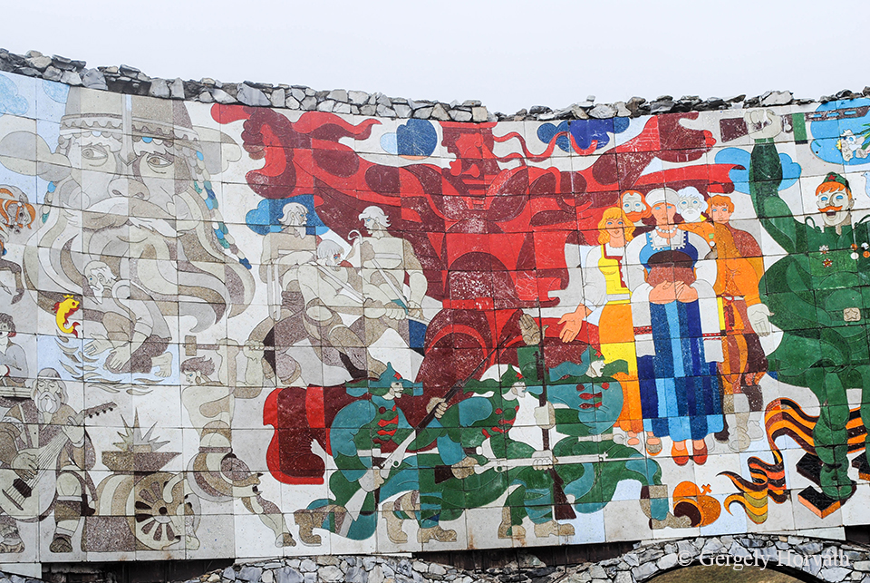
A második megálló Gudauri volt. Ez a város egy eléggé felkapott síparadicsom, de minket jobban érdekelt ez az "Orosz-Grúz Barátság Emlékműve" fedőnevet viselő, tulajdonképpeni kilátó.
The other stop was at Gudauri which is a quite popular ski resort. But we was more interested in this lookout tower called 'Russian Georgian Friendship Monument'.
A művészettörténeti kitérő után lássuk az igazi érdekességeket:
After Art History basics let's see the interesting stuff:
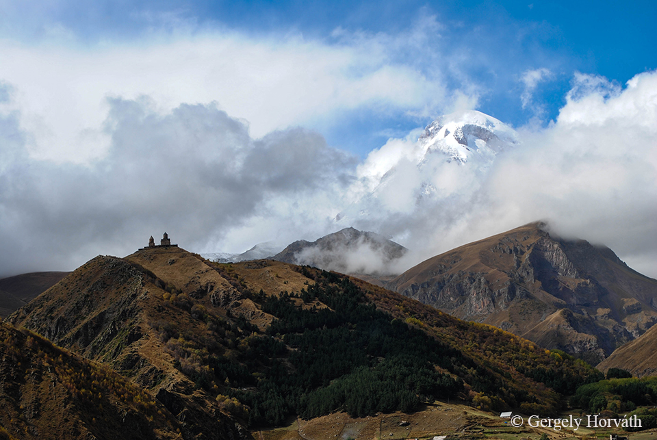
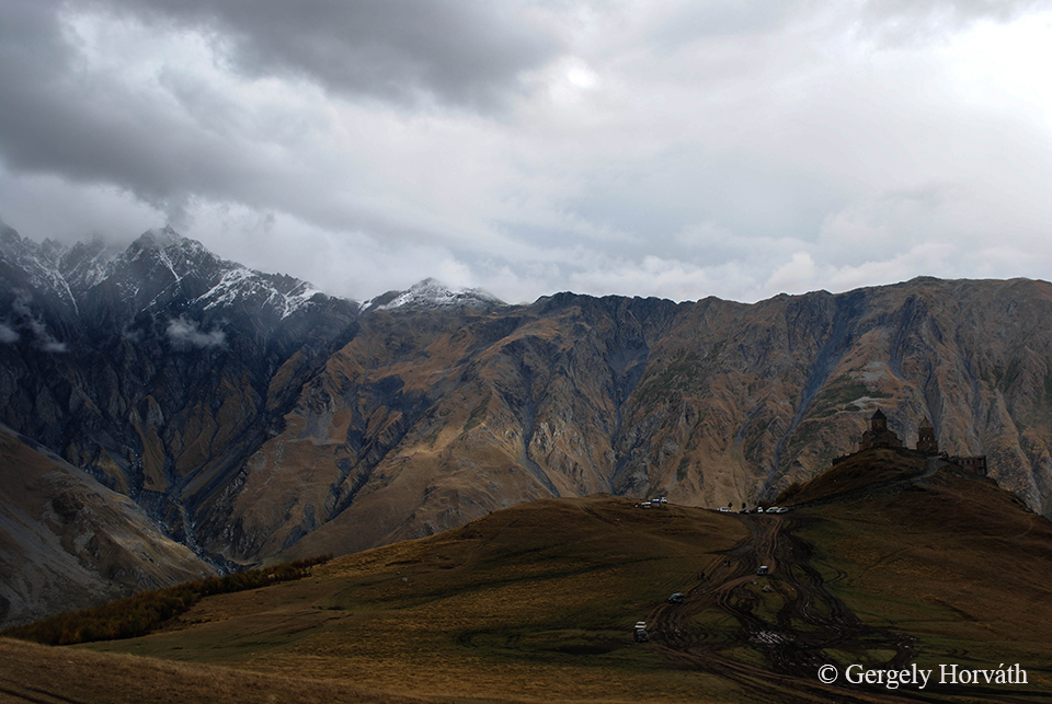
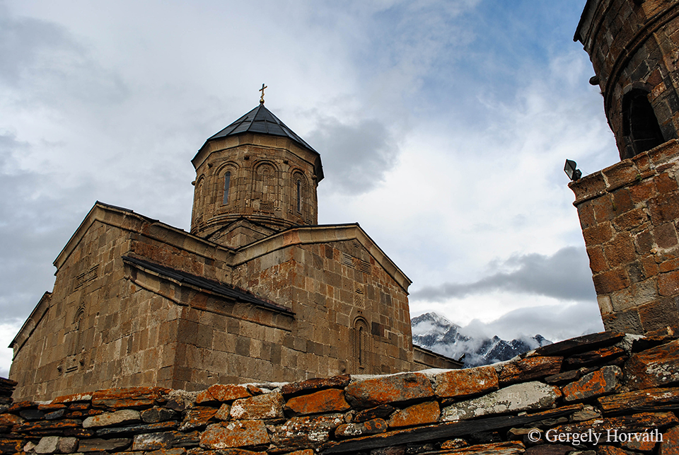
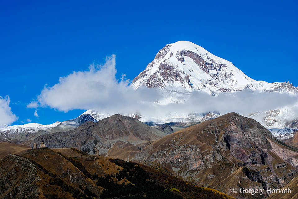
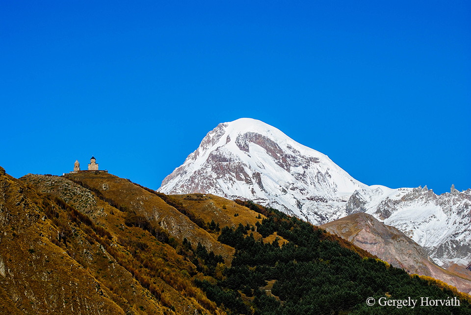
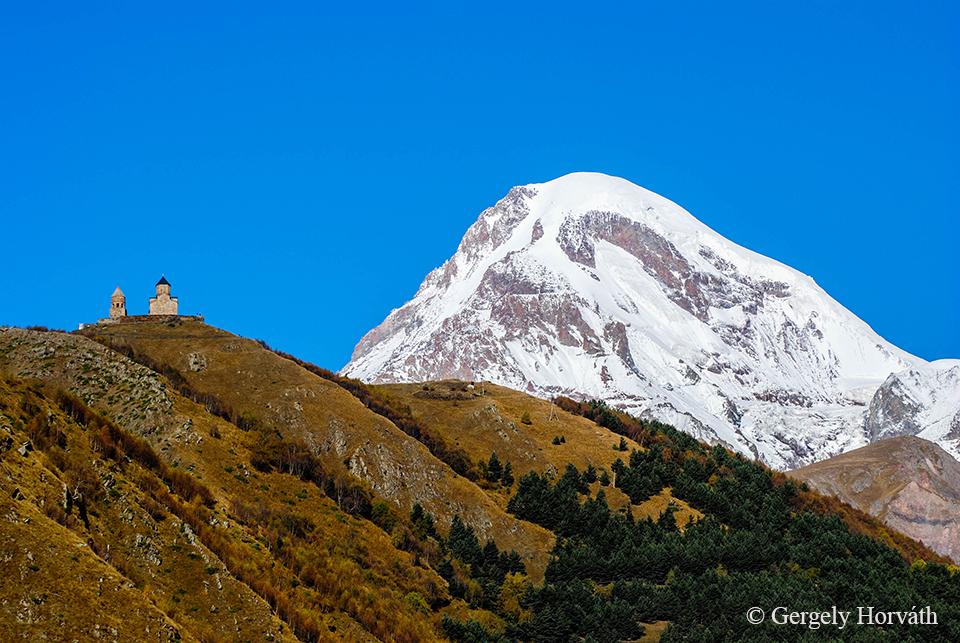
És végül ez az a látvány, amiért minden utazó Kazbegibe tart: A Kazbek-hegy, előtérben a Gergeti Szentháromság templommal. És itt most pár adat, az újabb képadag előtt. Kazbegit eredetileg, és hivatalosan ma is Stepantsmindának (egy István nevű, szent életű szerzetes után) nevezik, de mindenki az ismertebb nevén hivatkozik rá. Mtskheta-Mtianeti tartományban található, egy köpésre az orosz határtól. A gyakran felhőbe burkolózó Kazbek-hegy 5047 m magas, potenciálisan aktív vulkán. A legenda szerint Prométeusz grúz megfelelőjét, Amiramit az istenek ennek a hegynek a tetején láncolták le, büntetésül a tűz ellopásáért.
And finally, the view every traveller goes for: Mt. Kazbek and the Gergeti Trinity Church. Before the new set of pics I would like to share some facts: Kazbegi's original and official name is Stepantsminda after a monk called Stephen. The town located in Mtskheta-Mtianeti region just a few miles from the Georgian-Russian border. The 5.047 m high Mt. Kazbek is a potentially active vulcano and mostly covered with clouds. According legends the Georgian variant of Prometheus, Amirami was chained on the top of this mountain as a punishment for steeling the fire from the gods.
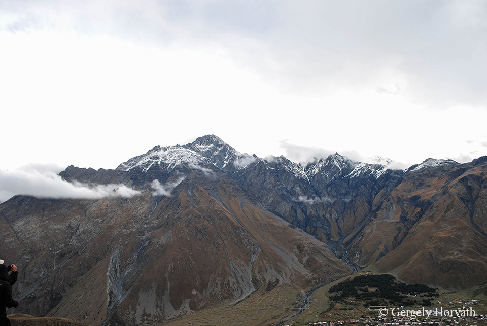
A Shani-hegy (lásd a bevezető írást).
Mt. Shani (see the introduction post).
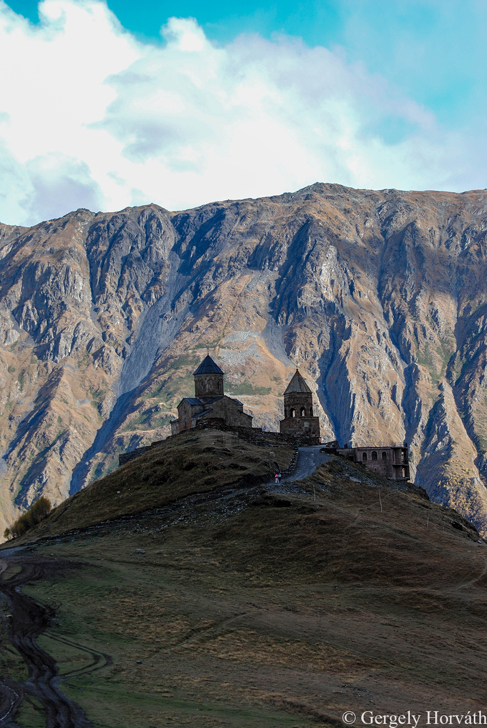
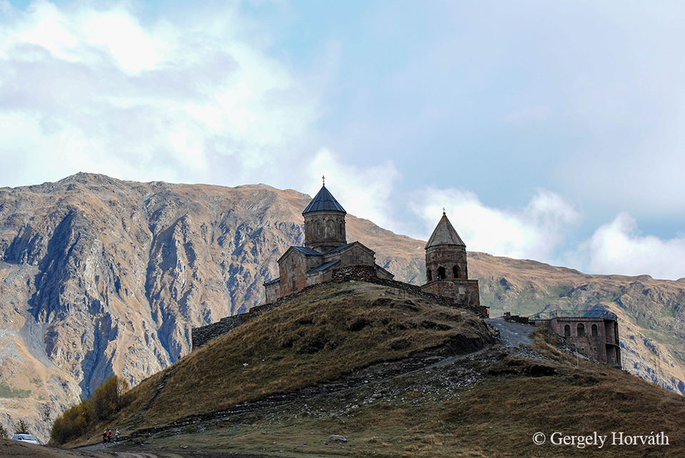
A Gergeti templom 2170 m magasan található. A városból dzsippel is fel lehet jönni ide, de mivel mi kemények vagyunk, a gyaloglást választottuk.
The Gergeti church at 2.170 m. One option tho get here is by taking a jeep from the town, but as we felt tough we chose to walk.
Mielőtt elhagytuk volna a várost, a Kazbek csúcsa kegyeskedett előbújni a felhők közül.
Just before we left the town, Mt. Kazbek showed how majestic it looks like without the clouds.
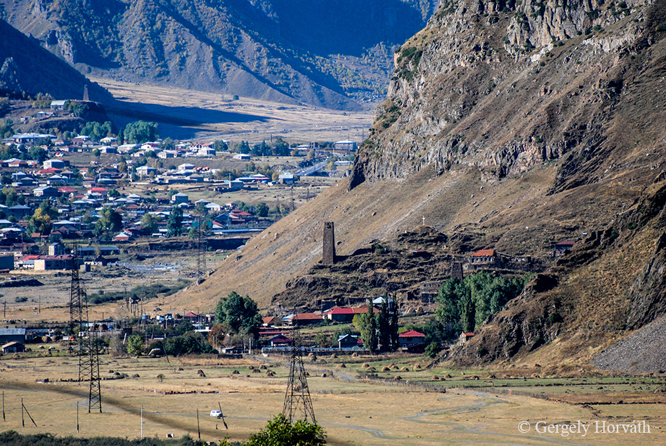
A kép közepén és a bal felső sarokban látható építmények őrtornyok, melyek évszázadokon keresztül a kereskedelmi útvonalat voltak hivatott védeni.
In the centre and the left corner you can see old watchtowers which protected the trade route for centuries.
Kazbegi után visszatértünk Tbiliszibe, majd innen indultunk tovább Örményországba. A következő posztban Jerevánt fogom bemutatni.
After visiting Kazbegi we returned to Tbilisi and then travelled further to Armenia. In the next post I will present the Armenian capital Yerevan.
Kutaisziből Tbiliszibe nagyjából 3 óra alatt jutottunk el. Az út nagy része szó szerint hegyen-völgyön keresztül vezet, szerpentinszerűen kanyargó meredek kaptatókkal. Mint ahogy lenni szokott, ezt az utunkat is a táj, és a grúz vezetési stílus tette igazán emlékezetessé, bár nem ez a szakasz volt a legijesztőbb a két hét alatt.
To get to Tbilisi we took a marshrutka from Kutaisi. The ride takes circa 3 hours literally over hill and dale, steep slopes and serpentine roads. The Georgian driving style makes every travel unforgettable as our driver was a bit crazy in this case too but not this trip was the scariest at all.
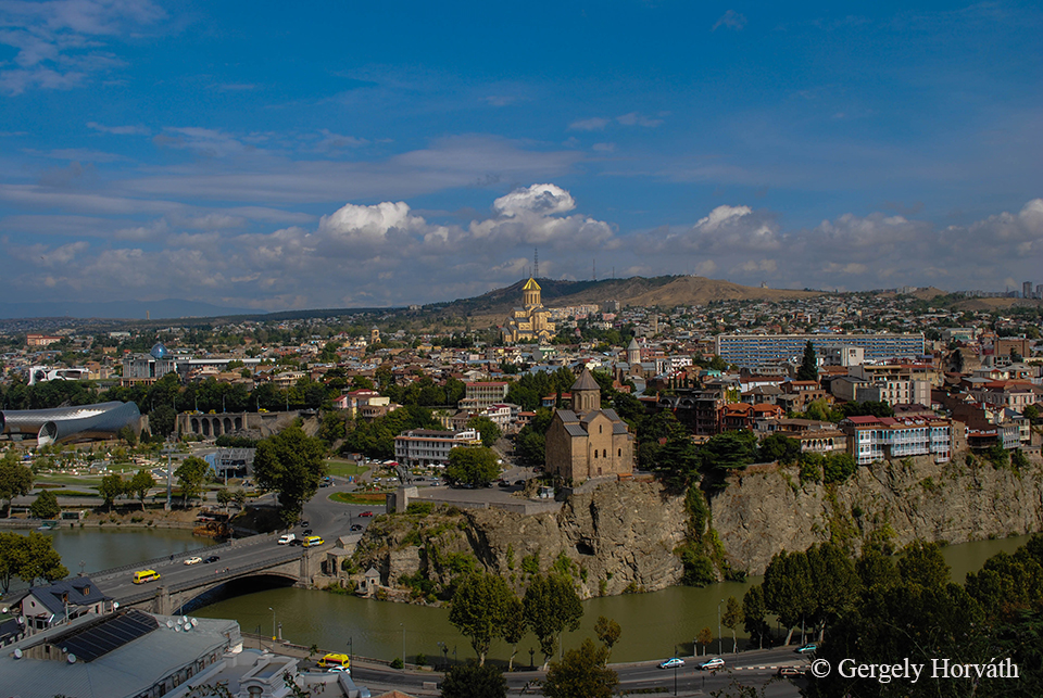
Tbiliszi története ugyan nem datálható olyan régre, mint Kutaiszié – „mindössze” 1550 éves településről van szó –, de mivel a térségen áthaladó Európát Ázsiával összekötő kereskedelem úgymond ütőerén fekszik, nem csoda, hogy már a kora középkorban jelentős várossá nőtte ki magát. Tbiliszi volt a középkori Ibéria és Kartli királyságok, majd az egyesített Grúz Királyság székhelye, vezető szerepét pedig az orosz hódítást követően, Transzkaukázia székhelyeként is képes volt megtartani, lokális kereskedelmi központként pedig jelentős török, örmény és azeri hatás is érte. A maga közel 1,5 millió lakosával ma is Grúzia legnagyobb városa és minden decentralizációra irányuló törekvés ellenére (emlékezzünk csak a Kutaiszibe helyezett országgyűlésre) központi szerepet tölt be az ország kormányzásában.
History of Tbilis could not date back as far as Kutaisi’s, as the capital is ‘only’ 1550 years old, but since it lies at the artery of east-west trade roads between Asia and Europe it quickly became a very important commercial hub. In the early medieval times Tbilisi was the capital of the kingdoms of Iberia and Kartli and later became the centre of the unified Georgian Kingdom. The city kept its leading position after the Russian occupation of Transcaucasia and as the seat of the province it was influenced by Turkish, Armenian and Azerbaijani culture. With almost 1.5 million inhabitants Tbilisi is the largest city in Georgia and despite all efforts of decentralization (remember moving the parliament to Kutaisi) it is still the economic and political centre of the country.
Tbiliszi óvárosa a Narikala erődből nézve. A történelem nem bánt kesztyűs kézzel a térség országaival, így Grúziával sem. Nagy birodalmak közé ékelődve Tbiliszi felett is gyakrabban lengett idegen zászló (perzsa, szeldzsuk, oszmán és persze orosz, csak hogy párat említsek), mint grúz, de minden hódító és idegen kultúra otthagyta a keze nyomát a város arculatán nagyon is egyedi karaktert alakítva ki ezzel. Manapság a grúz építészet hipermodern és esetenként a történelmi városképtől nagyon elütő építményekkel igyekszik „európaivá” tenni a várost.
The view of Tbilisi’s downtown from the Narikala Fortress. History did not treat Georgia with kid gloves, as it was the same with every country in the area. Wedged between empires wind waved foreign flags (Persian, Seljuk, Ottoman and of course Russian) over Tbilisi more often than Georgian, but all conqueror left its cultural fingerprint on the city creating a unique character. Nowadays Georgian architects build hypermodern buildings in the historical city centre creating bigger and bigger contrast between past and present times.
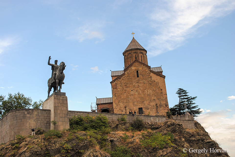
A város egyik ikonikus pontján, a Kura folyó (grúzul Mtkvari) felett magasodó Meteki sziklán álló templom és a várost megalapító Vaktang Gorgaszali (becenevén Farkasfejű Vaktang [egyébként már a "Vaktang" név is „farkastestűt” jelent az akkoriban tetőző farkaskultusz nyomán]) lovas szobra. Vakhtang Építő Dávidhoz hasonlóan a grúz történelem egyik legjelentősebb figurája.
Over the Kura river (Mtkvari in Georgian) on the top of the Metheki cliff stands a medieval church together with the equestrian statue of the city founder Vakhtang Gorgasali (or Vakhtang the Wolf Head [interestingly the name 'Vakhtang' means ‘wolf bodied’ so the king is very good example of the early medieval Georgian wolf cult]). Along with David the Builder Vakhtang Gorgasali is an iconic figure of Georgian history.
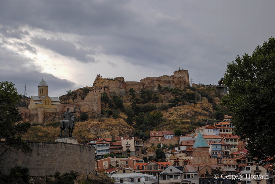
Átellenben a Narikala erőd magasodik a város fölé. A késő ókorban (4. sz.) épült erődrendszer látogatható, de elég romos állapotban van. Neve egyébként mongol eredetű, (ők is jártak erre), „kis erőd” jelentésű.
At the other side of the river, on a steep hill lies the Narikala Fortress. The fortress dated back to the late antiquity (4th century AD). It’s open for tourists, but it’s partly ruined. The name ‘Narikala’ comes from Mongolian (they also ruled Tbilisi for a short time) meaning ‘little fortress’.
Az egy főre eső templomok száma Grúziában elég magas, így a Narikala falai között is találunk egyet. A Szt. Miklós templom eredeti, 13. sz.-ban épült épülete egy tűzvész során semmisült meg, 1996-97-ben építették újjá.
The number of per capita churches is quite big in Georgia, so it’s no wonder that inside the fortress’ walls the St. Nicholas church can be found. The original building dates back to the 13th century and later destroyed in a fire. It was rebuilt between 1996-1997.
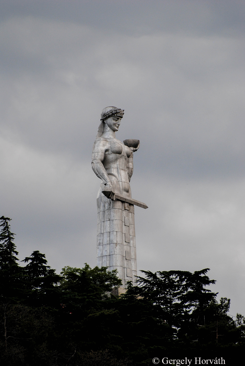
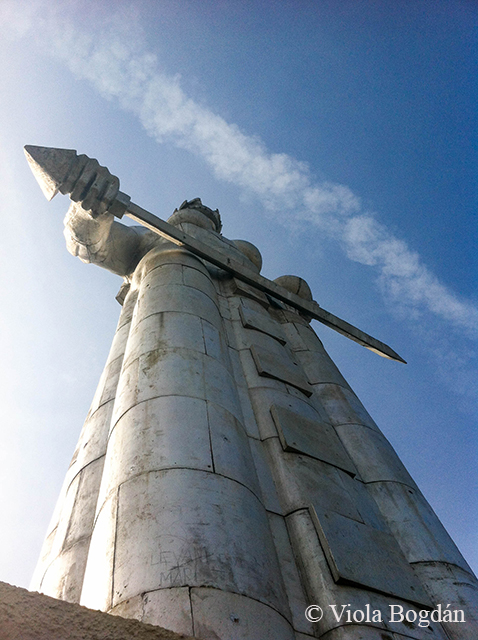
Az erődtől nem messze, a Szololaki dombon trónol egy újkori szobor is, a Kartvlisz Deda (Grúzia Anyácska). 1958-ban avatták fel, a város megalapításának 1500. évfordulója alkalmából. A női alak a grúz néplelket hivatott megjeleníteni: Bal kezében bort kínál a baráti szándékkal közeledőknek, míg jobbjában karddal várja ellenségeit.
Not very far from the fortress a modern statue was erected on the Sololaki Hill. Kartvlis Deda (Mother Georgia) was built in 1958 commemorating the 1500th anniversary of the city. The statue represents the true Georgian character: The female figure offers a bowl of wine with her left hand for friends, while holding a sword in her right hand against enemies.
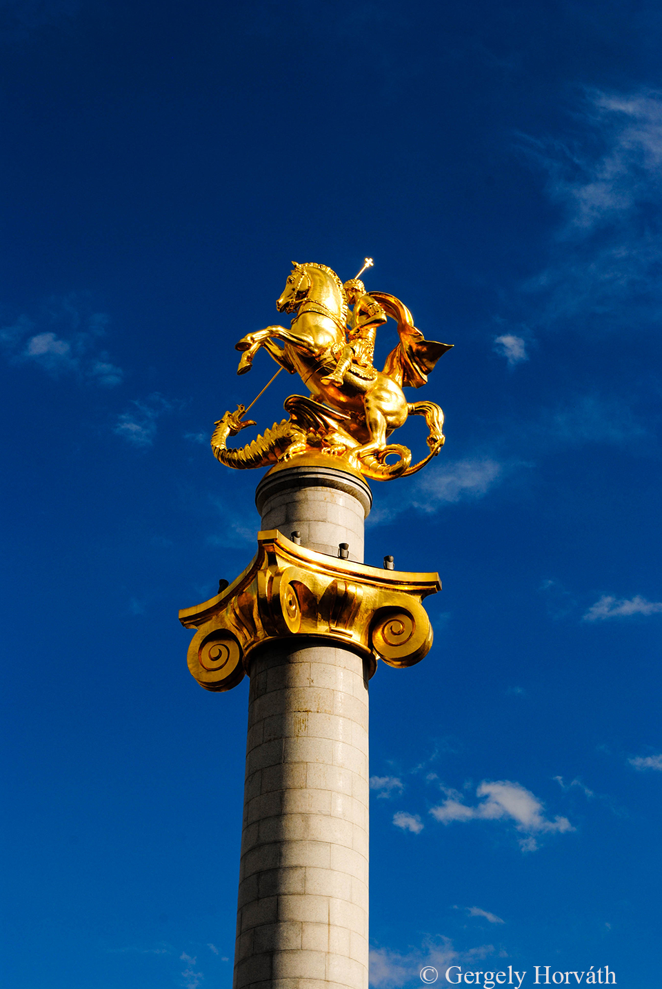
Szintén újkori, de a város központjában, a Szabadság téren emelkedik Grúzia védőszentjének, Szent Györgynek szobra. Az ország angol neve is tőle származik.
Statue of St. George (patron saint of the Georgia and he is whom the country’s English name comes from) erected a few years ago in the modern centre of the city at the Freedom Square.
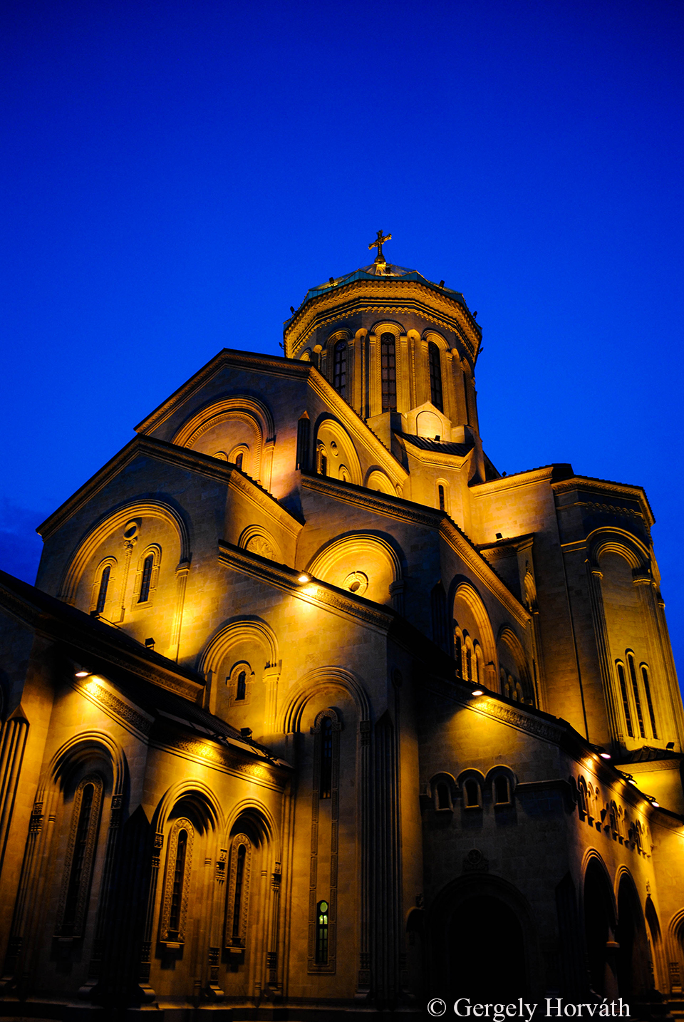
A Szameba katedrálisról a bevezető posztban már volt szó. A katedrális a legnagyobb templomnak számít a Kaukázus térségében (a jereváni Világosító Szt. Gergely katedrálissal egyetemben), valamint a világ 3. legmagasabb ortodox temploma. Építéséhez egy elég termetes botrány kötődik: Mikor 1995-ben megkezdték a katedrális és a hozzá tartozó (amúgy elég impozáns, itt a második képen) park építését, elég hamar belebotlottak Tbiliszi korábban ott elterülő legrégebbi ismert örmény temetőjébe. A Bagrati katedrálisnál már láthattuk, hogy a nemzetközi nyomás nem mindig hatja meg a grúz döntéshozókat, akkoriban meg tényleg más szelek fújtak errefelé, így a sírokat is minden lelkiismereti megingás nélkül, Örményország heves tiltakozása közepette eldózeroltatták.
I already mentioned Sameba Cathedral in my first post. This church is the biggest in the Caucasus area (along with the Cathedral of St. Gregory the Illuminator in Yerevan) and the 3rd tallest orthodox church in the world. Also, there is a quite huge scandal attached to its building. Back in 1995 when they started to construct the cathedrals’s park (which looks quite fascinating by the way, second pic) workers found Tbilisi’s oldest known Armenian cemetery. You may remember from the story of Bagrati Cathedral that Georgian authorities not always pay attention to international pressure, not to mention that political system was a bit different back then, so they simply destroyed the graves despite of huge protest in Armenia.
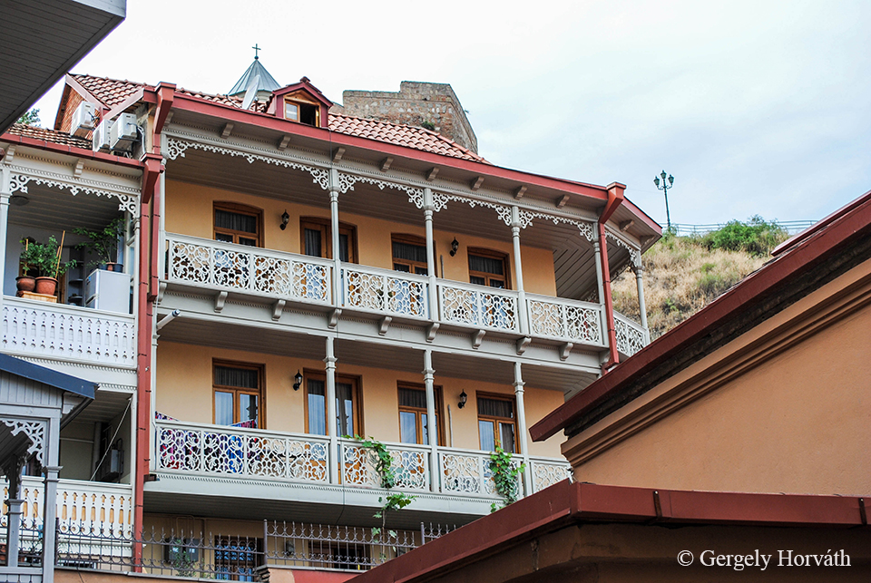
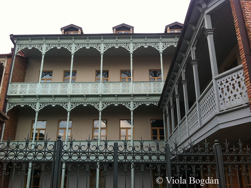
Az óváros lakóházai főleg török stílusban épültek.
The houses of the old town are built in somewhat Turkish style
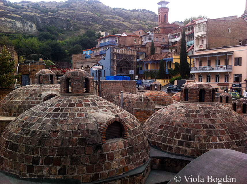
A török hódítás emlékei a kénfürdők is. Tbilisziben egyébként jelentős muzulmán vallású kisebbség is él, főleg a kénfürdők közvetlen közelében található török negyedben, melynek központjában a háttérben látható tornyos mecset áll.
Sulphur baths are another memento of Turkish occupation. Significant Muslim minority still lives in Tbilisi, mainly in the Turkish district where you can found the city’s Jami (tower in the back).
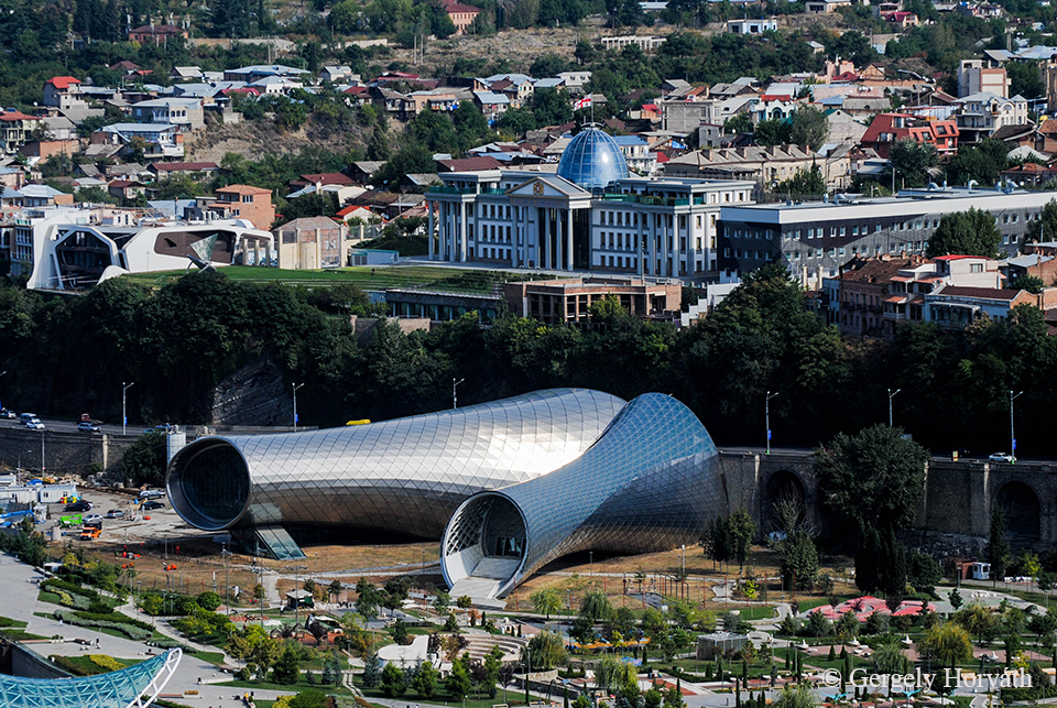
A már említett posztmodern épületek egyike a Rike parkban nemrég felépített Színház és Kiállítócsarnok. A fémcsöveket formázó épület felett az Elnöki Palota látható. A park már elrendezésében is számos, szokatlan tájépítészeti megoldás használtak, mivel Grúzia stilizált térképét jeleníti meg. Az egyes tartományokat mintázó gyepfoltokat gyalogutak választják el egymástól.
One of the already mentioned postmodern buildings is the newly built Theatre and Exhibition Hall in Rike Park. Above these metal tubes you can see the President’s Residence. Rike Park also counts as a postmodern construction since its shape represents the map of Georgia. Plantations form the countries provinces and roads connect them with each other.
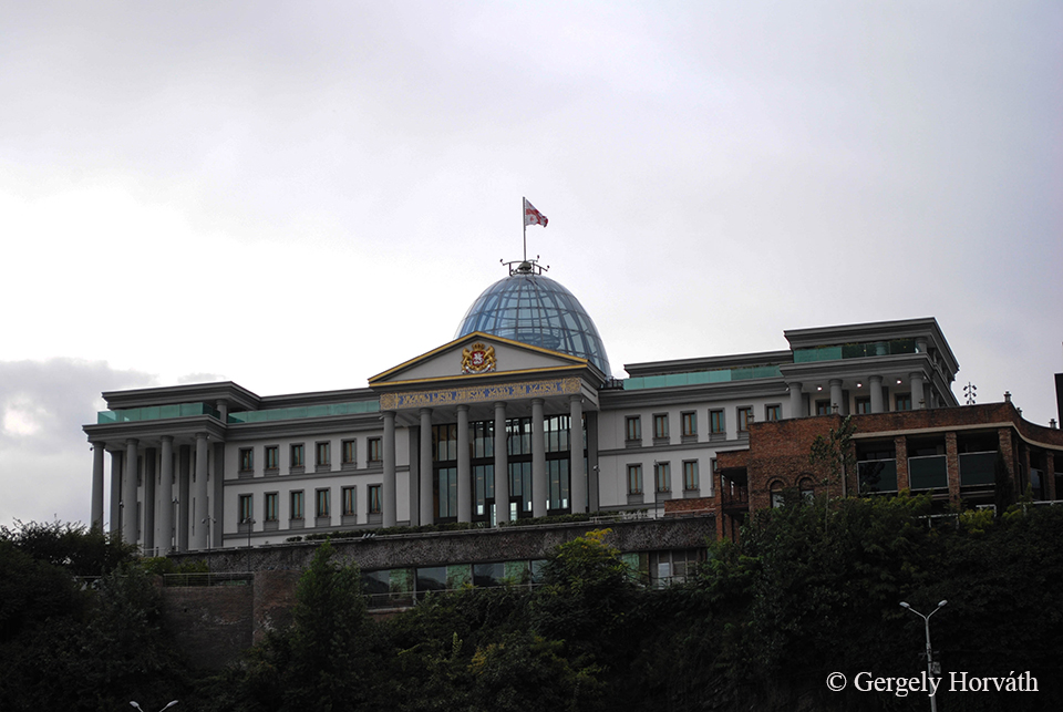
Elnöki palota
Presidential palace
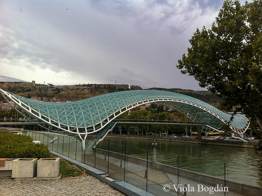
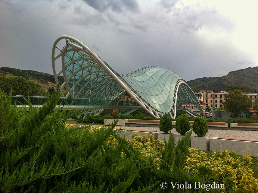
Végül, de főleg nem utolsó sorban, a modern építmények talán legemblematikusabbja a Kura folyó felett átívelő Béke hídja. A 2010-ben átadott gyalogoshíd Michele De Lucci tervei alapján készült (ő tervezte az elnöki palotát is 1991-ben). Az eredetei elgondolás szerint tengeri állatot formáz, de a népnyelv hamar elnevezte ’Always Ultra’-nak. Talán mondani sem kell, miért.
Last but definitely not least the most emblematic postmodern building: the Bridge of Peace. This pedestrian bridge was opened in 2010 and connects the left and right banks of the Kura River. It was built by the Italian architect Michele De Lucci (he designed the President’s Residence in 1991) and planned to represent a marine animal. However, locals nicknamed it ‘Always Ultra’. Do not need to mention why.
Tbilisziben összesen két és fél napot volt szerencsénk eltölteni, igaz két részletben. Ennek oka, hogy egy napot Kazbegi hegyi városkában töltöttünk, ahová a legegyszerűbben Tbilisziből indulva lehet eljutni. Kazbegiben szerzett élményeinkről a következő posztban számolok be.
We spent altogether two and a half days in Tbilis but not continuously. The reason of this that we spent one day in the mountain resort town Kazbegi and the easiest way to get there is trough Tbilisi. I will present our experience and impressions about Kazbegi in the next post.
Körutazásunk első állomása Kutaiszi volt, elsődlegesen azért, mert Budapest ennek a városnak a repterével áll közvetlen légi-összeköttetésben (nem mellékes apróság, hogy a Budapest-Kutaiszi járat közép-európai idő szerint 23.50 körül indul, ami 3 órás repüléssel plusz 2 óra időeltolódással számolva hajnali 5 órás érkezést jelent). A Kutaiszi reptérről lehetőség van ugyan marshrutkával, vagy taxival továbbindulni Tbiliszi felé (újabb 3 óra…), de mi úgy döntöttünk, hogy egy napot eltöltünk a városban (pihenés okán is), ugyanis látványosság mind Kutaisziben, mind a környéken szép számmal akad.
The first stop of our journey was in the town of Kutaisi, mainly because this is the destination of the only direct flight from Budapest to Georgia (also worth to mention the not so negligible fact that the plane departs around 11.50 pm CET and counting with 3 h of flight and 2 h of time difference it arrives around 5 am local time). Direct transport to Tbilisi is available from the airport (another 3 hours…), however, not so surprisingly we decided to rest and spend one day in Kutaisi, since must-sees are represented with high number in and around the town.
Először is pár alapvető adat Kutaisziről, melyet (Batumi mellett) Grúzia második fővárosaként is emlegetnek. Kutaiszi 200 ezer lakosával az ország második legnépesebb városa és már a kora ókortól kezdve jelentős település, hiszen számos államalakulat fővárosa volt a történelem során, melyek közül talán Kolkhisz (Kr. e. 13. sz - Kr. e. 164) volt a legjelentősebb (ide hajóztak el az Argonauták az aranygyapjút keresve). Ma Imereti tartomány székhelye és érdekes módon 2012 óta a grúz parlament is itt székel Tbiliszi helyett.
First a few facts about the town, which is often referred (together with Batumi) as the second capital of Georgia. With 200.000 inhabitants Kutaisi is the second most populous settlement in the country. Kutaisi was a significant town already during the ancient times as it was the capital of many states. The most famous and strongest of these was Colchis (13 th cent. BC - 164 BC), known as the legendary destination of the Argonauts during their search for the Golden Fleece. Nowadays Kutaisi is the seet of Imereti province and since 2012 the home of the Georgian parliament.
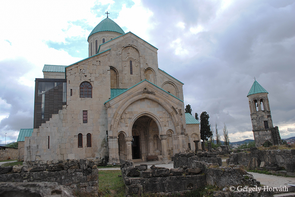
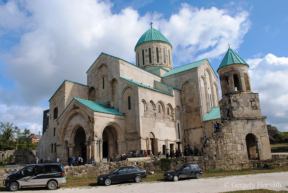
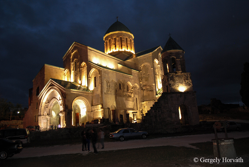
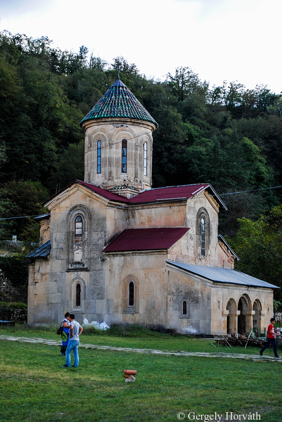
A város talán leghíresebb műemléke a Bagrati katedrális (hivatalos nevén Nagyboldogasszony Katedrális [teológiai ismereteim eléggé limitáltak, de az angol dormition kifejezést én így ültetném át magyarra, ez ugyanis általában Szűz Mária mennybemenetelét jelenti]), mely a 11. században épült, III. Bagrat király uralkodása alatt. A katedrális többször is megrongálódott a történelem folyamán - ebben a muszlim hódítóknak elég mélyen benne volt a kezük - és a 20. századot már elég romos állapotban érte meg. A feltárással egybekötött (ekkor még ráérős) rekonstrukciós munkálatok 1952-ben kezdődtek el. 1994-ben az UNESCO felvette a világörökségi listára, érdekes módon ellenezve a felújítást, a szervezet ajánlása szerint a katedrálisnak romos állapotban kell(ett volna) fennmaradnia az utókor számára. A grúz illetékeseket ez nem igazán hatotta meg így a már egyre nagyobb elánnal folyó felújítás (igazándiból újjáépítés) folytatódott tovább. Mai formájában 2012. szeptember 16.-án adták át. További érdekesség, hogy 2001 óta már nem igazán miséznek a katedrálisban, manapság szinte teljes egészében turistalátványosságként funkcionál.
The most important architectural landmark and main tourist attraction in the town is the Bagrati Cathedral (oficially Cathedral of the Dormition) built in the 11th century under the rule of Bagrat III. The cathedral was dameged and destroyed many times mostly as an outcome of constant wars fought against muslim invaders. By the 20th century only ruins of the original building remaind. Archeological excavations and reconstruction works began in 1952. In 1994 the ruins of the Cathedral was added to the UNESCO's World Heritage Site list with the recommendation that the site should kept in the form as a ruin and not to rebuild (which was in progress at the time). However, Georgian authorities continued the process and the cathedral was opened in it's current form on the 16th September 2012. Worth to mention that since 2001 the cathedral is owned by the Church but it's now of limited use of worship and functioning mainly as a tourist attraction.
Szállásunkat olyan szerencsésen sikerült kiválasztanunk, hogy pontosan átellenben esett a katedrálistól, szóval sokat nem kellett gyalogolnunk.
We were lucky since the cathedral was only a few steps away from our hostel.
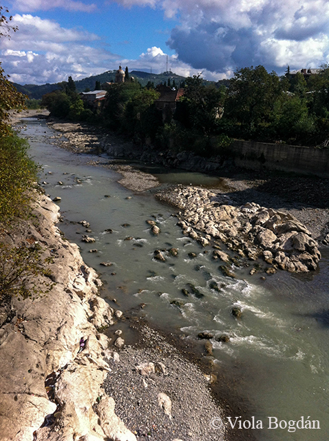
Kutaiszi folyója, a Rioni két részre osztja a történelmi belvárost.
The Rioni river divides the historical centre of Kutaisi.
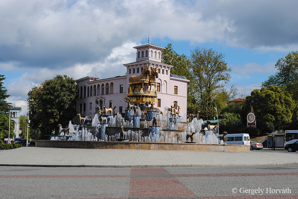
A grúz építészeti stílus eléggé szokatlannak hat európai szemmel. Ennek első példája ez a belvárosban található, bibliai elemekkel díszített szökőkút volt. A szökőkutak egyébként minden grúz város elmaradhatatlan tartozékai, általában prominens helyen felállítva.
Georgian architecture (style, no offence) might be a bit strange with a European standard. The first example of this fact was this fountain, depicting biblical motifs, from the centre of the town. Fountains are usually inevitable accessories of every Georgian town.
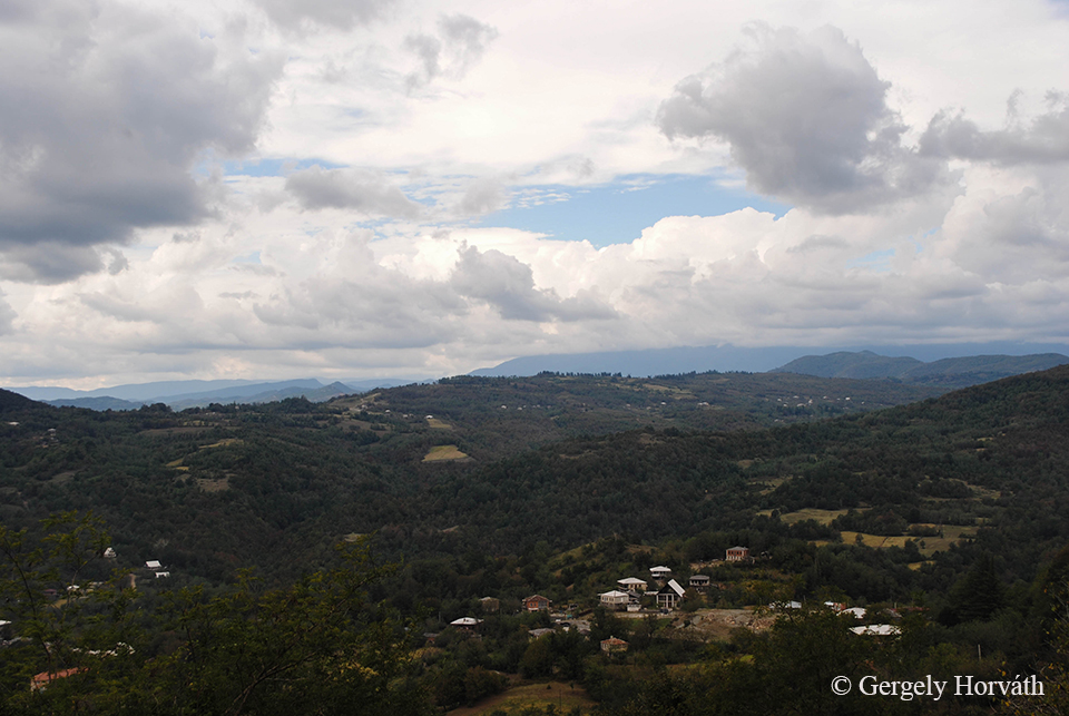
A város domborzatilag határzónában található, hiszen míg északról, északkeletről hegyek (Szamgurali hegyhát, Észak-Imereti dombvidék) délről és nyugatról a Kolkhiszi-síkság fogja közre.
The town located in a geographical boundary zone since Samgurali Range and North Imereti Foothils borders it from the North and North East, while the Colchis Plain from the West and South.
A környék másik fontos turistalátványossága a Kutaiszitől néhány kilométerre északra található Gelati kolostor, mely a 12. században, IV. Dávid (ismertebb nevén Építő Dávid) király uralkodása alatt épült. Hamar a királyság egyik legjelentősebb szakrális és kulturális központjává nőtte ki magát, hiszen az itt lakó szerzetesek egy akadémiát is fenntartottak ahol nem csak teológiát, hanem többek között filozófiát is magas szinten tanítottak (és persze bort is termeltek, mert az errefelé alapvető életműködésnek számít). A kolostor ma is Grúzia egyik legfontosabb vallási központja...
An other must see is the Gelati Monastery which situated from a few miles north from Kutaisi in the mountains. The monastery was built by the order of David IV. (known also David the Builder) and soon became one of the most important theological and cultural hubs of the kingdom. The monastery had a famous Academy where the most important scientists, theologists and philosphers of the age were employed (also, they produced wine since this is vital in this territory). The Gelati Monastery remaind the one of the most important religious centre of Georgia...
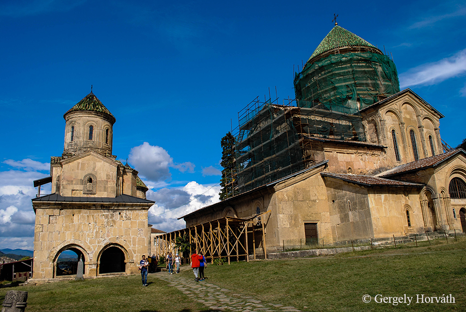
...ami sajnos ottjártunkkor épp felújítás alatt állt.
...which was unfortunately under reconstruction at the time of our visit.
Az alapító, Építő Dávid sírja a kolostor területén található. Építő Dávid a grúz történelem egyik legfontosabb alakja, akinek uralkodása alatt az egyesített Grúz Királyság a térség vezető állama volt, határait két tenger mosta (jó, az egyik gyakorlatilag tó, de azért mégiscsak nagyobb, mint a Balaton). Alakját a grúz egyház kanonizálta, így a hívők ottjártukkor szentekkel szemben tanúsított ortodox szokás szerint csókkal illetik a király sírját.
The tomb of David the Builder can be found in the monastery. David was one of the most prominent Georgian kings since under his rule the unified Georgian Kingdom became the strongest state in the area reached from the Black Sea to the Caspien Sea. He was canonized by the Georgian Church so believers kiss their grave as they do portraits of other orthodox saints as well.
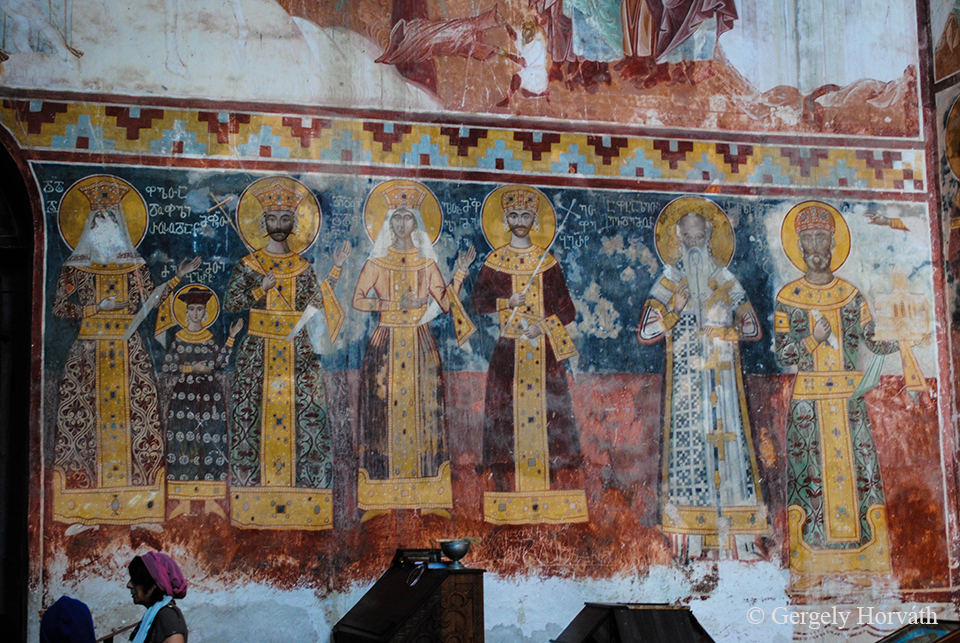
A grúz királyok mindig is bőkezűek voltak, ha Gelati fejlesztéséről volt szó. A jótevők portréját a templom freskói is megörökítik. Jobb szélen Építő Dávid.
Georgian kings were always generous to Gelati and the portraits of the benefactors was immortalize on the murals of the Gelati church. On the right, David the Builder.
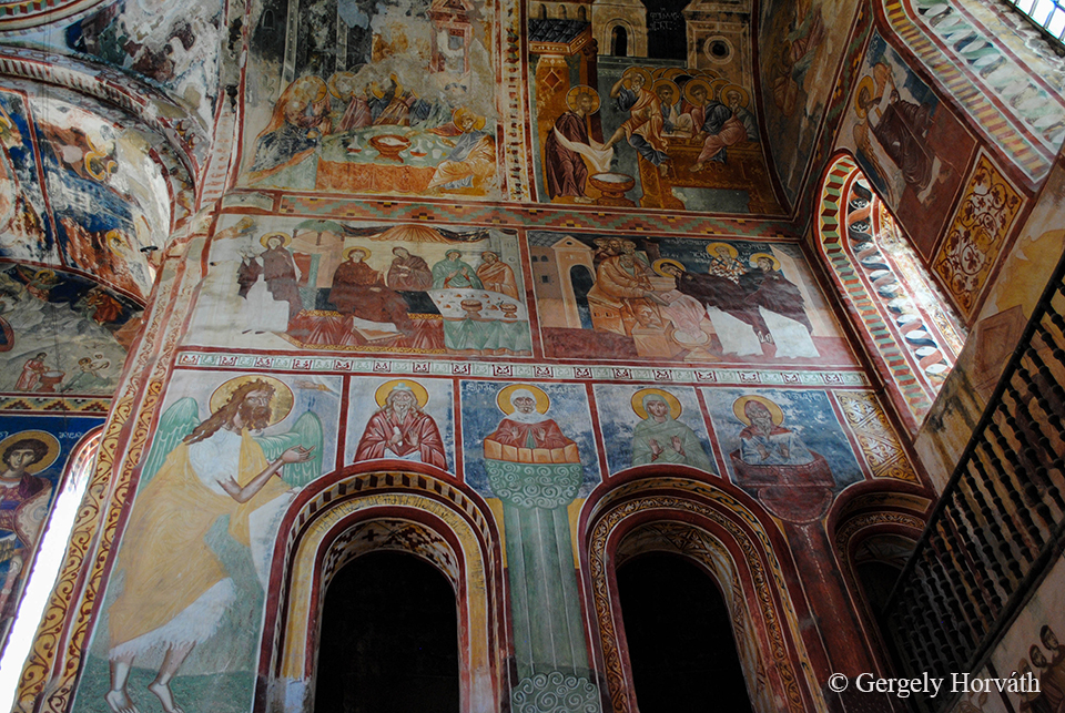
A templom belső tere, gazdagon díszített, a freskók Jézus életének történéseit, szenteket, mártírokat és bibliai részleteket örökítenek meg.
The inner walls of the church are richly decorated with scenes from the life of Jesus, portraits of saints, martyrs and events from the Bible.
Utazásunk következő szakaszában elhagytuk Kutaiszit és a főváros, Tbiliszi felé vettük az irányt.
In the next phase of our journey we lefts Kutaisi and travelled to the capital of Georgia, Tbilisi.